2025 Update: A rockslide has dammed the river about 1.75 miles from the trailhead. The rest of this trail is inaccessible without swimming through the pool created by the dam. The Forest Service has been notified, but it’s unclear if they will attempt to blast out the dam with explosives, or leave the new trail end as is. It’s still worth hiking – the most scenic parts are between the trailhead and rockslide. The new pool is a great swimming and fishing spot too!
If asked about hiking along the Boise River, most Idahoans would probably think of walking along the Greenbelt somewhere between Lucky Peak Dam and Eagle. Some Boiseans might not even know that the eponymous river is formed by three forks – the North, Middle, and South. Near the headwaters of the North Fork, in the mountains on the boundary of the Boise and Sawtooth Ranges, hikers will be rewarded with near complete solitude – something you might not assume could be found along the Boise’s banks.
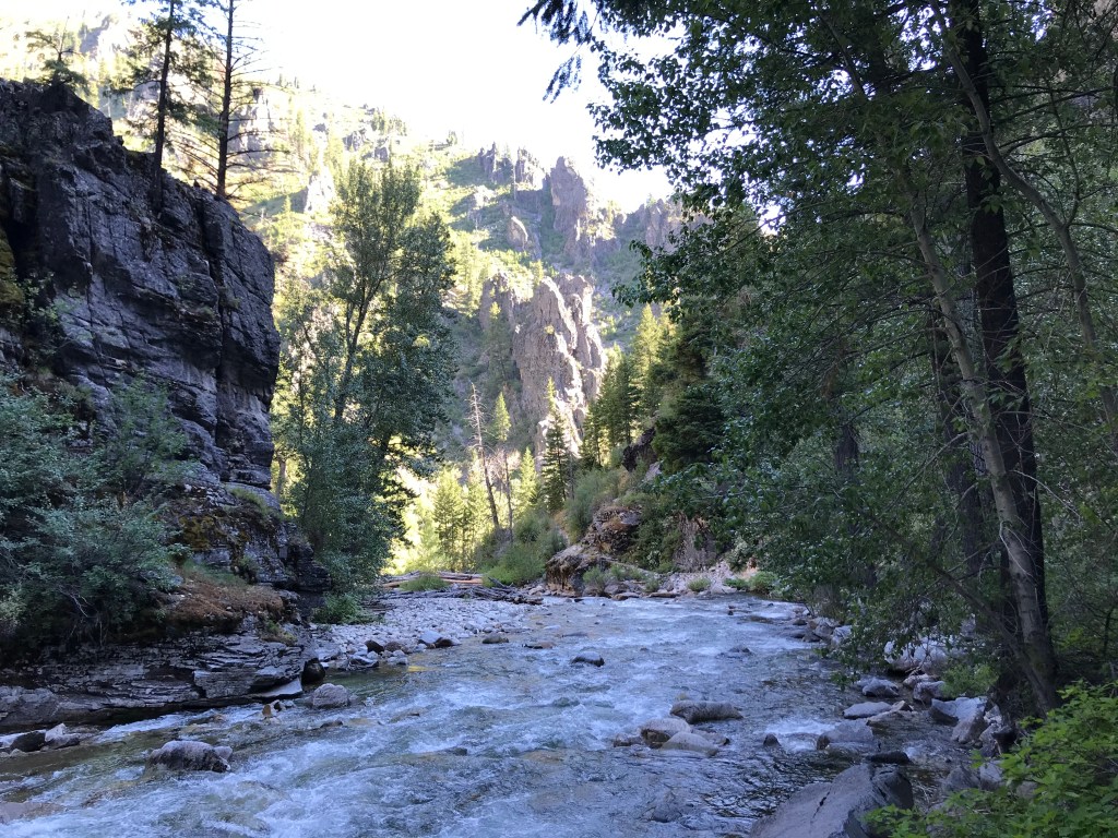
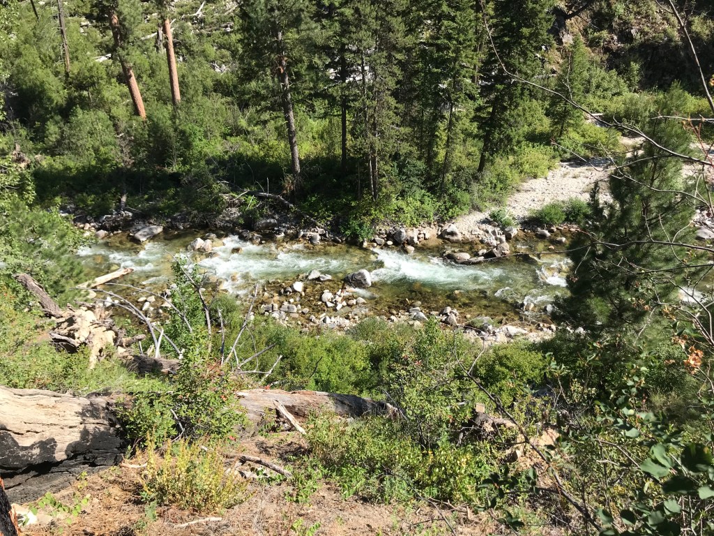
One of my favorite hikes in Idaho, the North Fork Boise River Trail travels through the 1,000+ foot deep gorge pictured above only a half-mile into the trail, which meanders along the north side of the river for about five miles. Located deep within the Boise National Forest, the seldom-traveled trail highlights all the best features you’d expect in a Gem State hike: no crowds, vibrant wildlife, and unexpected natural beauty
On the Trail
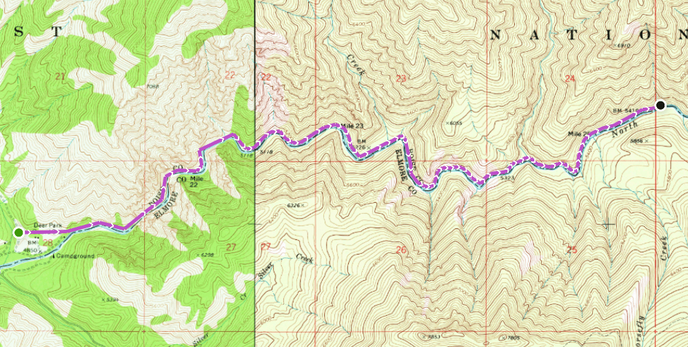
The unassuming trailhead is located just off of NF 327/N Fork Boise River Road, a stone’s throw away from Deer Park Guard Station Rental Cabin, a deactivated forest service outpost built in the 1930s that can now be rented for $35/night from Recreation.gov. For those interested in tent camping, Deer Park Campground is next to the cabin.
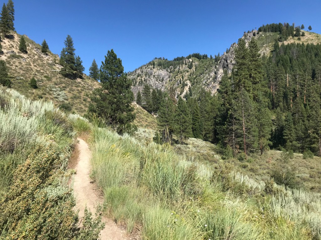
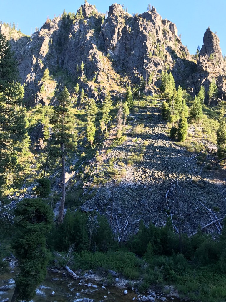
The trail begins with a gentle ascent along the north hillside with the mouth of the steeper canyon in view. The single-track dirt path is lined with pine stands, tall grasses, and wildflowers. In the three-plus hours I spent here, I saw no other hikers, and judging by my AllTrails submission, it doesn’t see much regular traffic.
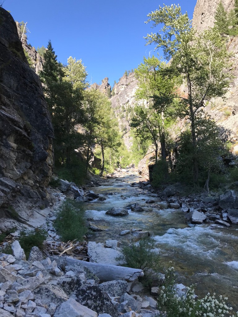
Within a half-mile, the trail approaches the river bank and parallels it into a deep canyon, changing from dirt to an uneven, rocky surface. In a few places, you’ll have to channel your inner mountain goat as you hop from boulder to boulder. There are deep pools and fast whitewater sections in the gorge, and hikers should take caution navigating the talus and scree among them.
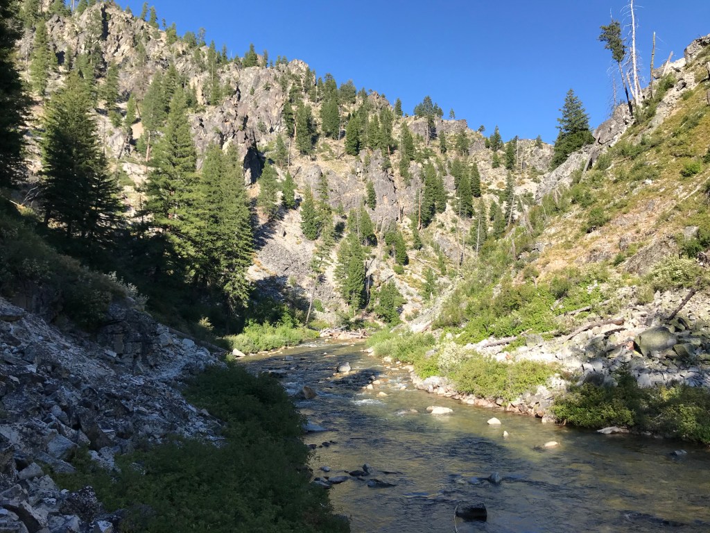
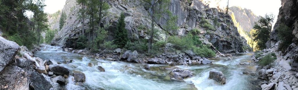
The canyon and river widen once you hike out of the gorge, with plenty of calm stretches to drop a line into if you’re interested in angling for a variety of trout. Similarly, those looking to cool off will have plenty of opportunities to dip their feet in or swim. The trail and banks remain rocky, making for slow hiking regardless of experience level.
The North Fork Trail travels about five one and three-quarter miles up the canyon before disappearing into a pool formed by a rockslide (see the update at the top of post). It previously continued on to an intersection with Horse Heaven Trail near National Forest Road (NF) 312, but it has not been regularly maintained by the Forest Service and the upper reaches have been surrendered to mother nature.
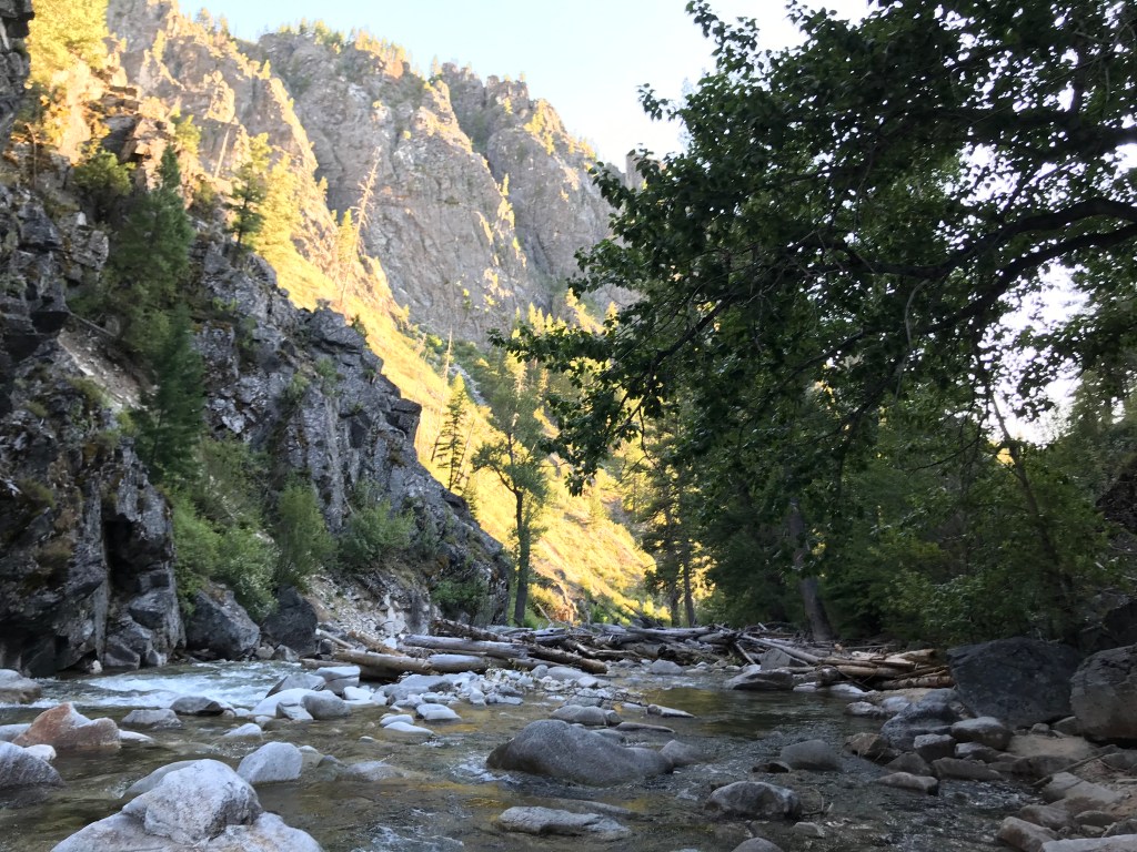
I hiked about two and a half miles up and back in the canyon in the late afternoon, with the setting sun providing excellent lighting as I made my way back through the gorge to the trailhead. On a day where the temperature brushed 90° in Boise, the shade and cool mountain waters of the North Fork was a rejuvenating relief.
I cannot recommend this trail enough! Between May and December 2020, I hiked 538 miles and never repeated a trail, and this was one of my absolute favorites. Rather than post more pictures, I’ll leave it at that – I don’t want to spoil too much of it for first timers. I’m looking forward to returning this summer to camp and hike it again.
Trail Stats
- Season: June to late October
- Difficulty: Easy to moderate due to uneven, rocky trail surface
- Type: Out-and-back
- Surface: Single track dirt, rock
- Distance: 6 miles (you can hike farther at your own risk, the trail starts to deteriorate and disappear around 3 miles in)
- Starting elevation: 4,864 feet
- Elevation gain: 700 feet
My Rating
Easy five stars, I’ll definitely be back again.
How to Get There
Google Maps says that driving from Boise will take 2 hours and 20 minutes, but my trip in 2020 only took about an hour and a half. The dirt roads after leaving Highway 21 are generally two lanes wide and well-graded, allowing for higher speeds than normal. Vehicles with high clearance and AWD/4WD are not necessary. Here is the step-by-step navigation from the intersection of Warm Springs Avenue and Highway 21 in Boise, or use these steps:
- Continue east/northeast on Highway 21 for approximately 48 miles to a signed turnoff on the right for NF 384 and Edna Creek Campground
- Turn right and continue on NF 384/Crooked River Road, passing several campgrounds and trailheads along the way
- Continue 4.3 miles and take the right fork to stay on NF 384
- Continue 1.9 miles and take the slight right fork to stay on NF 384
- Continue 7.6 miles as NF 384 curves down into the North Fork drainage along Little Owl Creek
- Turn left onto NF 327/N Fork Boise River Road
- Continue 5.5 miles to the Deer Park Cabin/Campground area
- Turn left onto NF 348/Hunter Creek Road and park in a small dirt lot about 150 yards up on the left – the trailhead is on the right
Preparation
Boise National Forest
Idaho City Ranger District
(208) 392-6681
Interactive Map of Road, Trail, and Area Closures
Here are the need-to-know details for hiking the North Fork:
- This is black bear country – carry personal protection and know what to do in an encounter (here is a handy guide from the Humane Society of the United States)
- The trail is rocky and uneven – wear sturdy hiking shoes or boots – I wore good Merrell trail running shoes and still came away with a blister
- When I visited in July, the water level was normal and did not interfere with the trail, but I’ve read that high water earlier in the summer or spring can submerge some stretches
- Route-finding is not necessary, but there is a stretch of trail that is covered by a small rockslide that is tricky to navigate
- Dogs (especially small breeds) may not do well on the upper stretches of the trail because it requires rock-hopping on firm and sometimes slippery ground
- Likewise for young children – they’ll love the short stretch into the gorge and back, but beyond that may be too difficult
- Much of the trail is well-shaded by pine trees and canyon walls, lowering the risk of sun exposure – protect yourself as needed
- Be respectful to other trail users and leave no trace!
Other Useful Resources
- Downloadable GPX track via AllTrails
- The Hiker’s Guide: Best Easy Hikes of Greater Boise by Scott Marchant
- Topographical map via Natural Atlas
