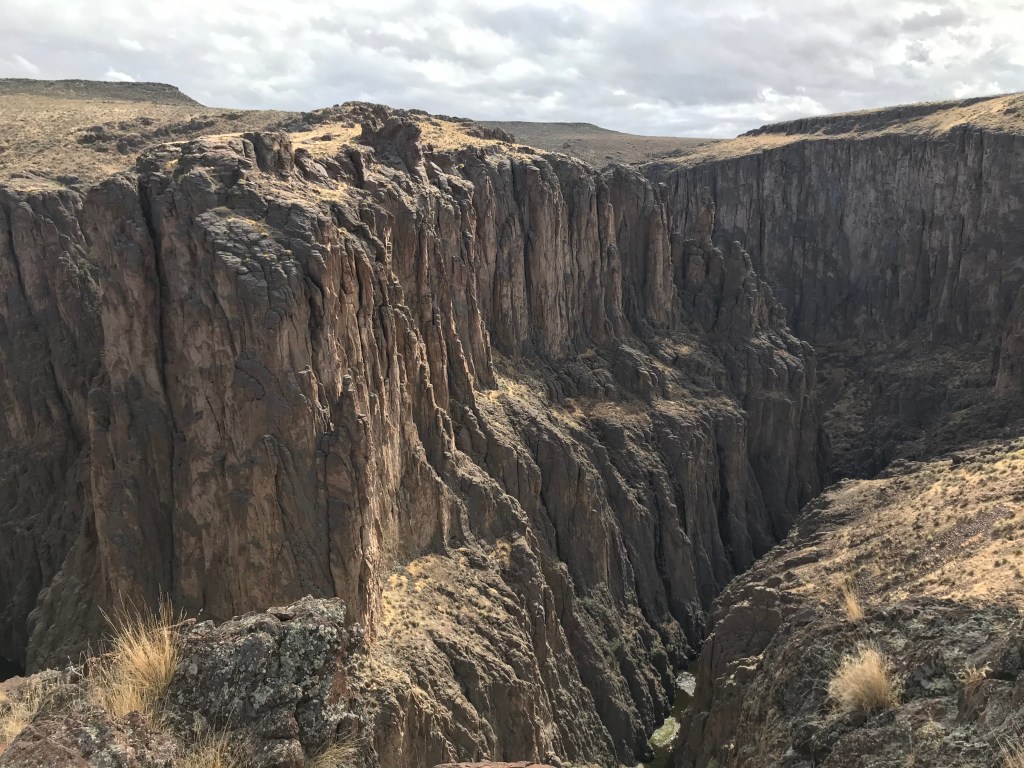
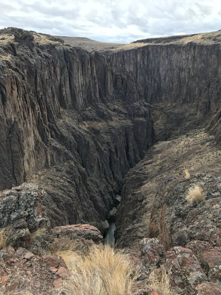
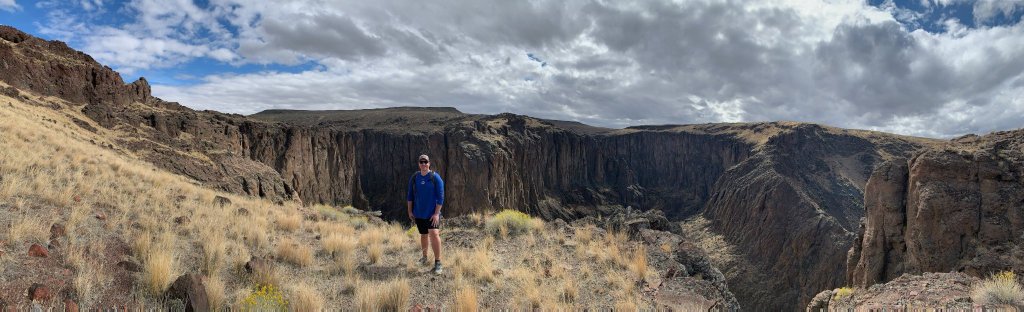
If you drive an AWD/4WD vehicle with ground clearance and enjoy desolation and the borderline feeling of vertigo when standing on the edge of a gorge and looking down, you’ll love the Big Bend of Sheep Creek. This waterway flows north through a deep canyon from Nevada down the Owyhee Plateau before turning east at Big Bend a few miles from its confluence with the Bruneau River. There is no trail here, but those looking for adventure will enjoy hiking cross-country along the canyon rim and gazing nearly 750 feet down into it. I brought my parents here late in the summer of 2020 after hiking the nearby Parker Trail in the Big Jack’s Creek Wilderness, and while they weren’t fans of the drive, they loved the scenery and remoteness.
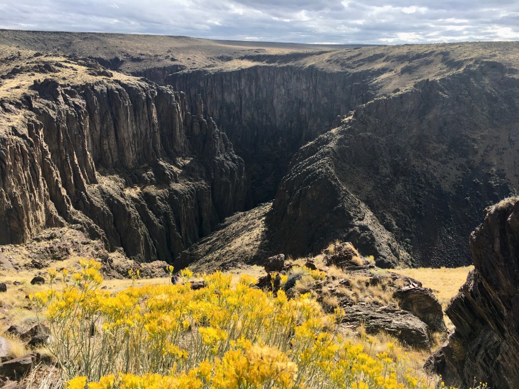
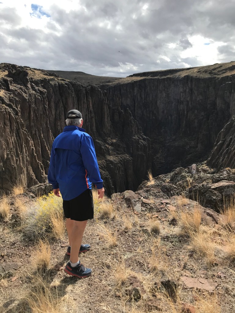
Sheep Creek is a nationally protected Wild and Scenic River that can be kayaked after heavy rainfall, but is typically dried up in the summer months. Over the millennia, it has carved out an impressive rhyolite canyon whose rock pillars are reminiscent of a gothic cathedral or Roman temple. Big Bend offers the unique perspective of seeing the near-vertical canyon walls from several angles as the creek bed changes direction unpredictably – a reminder of the absolute power and chaos that mother nature harnesses regularly.

On the Trail
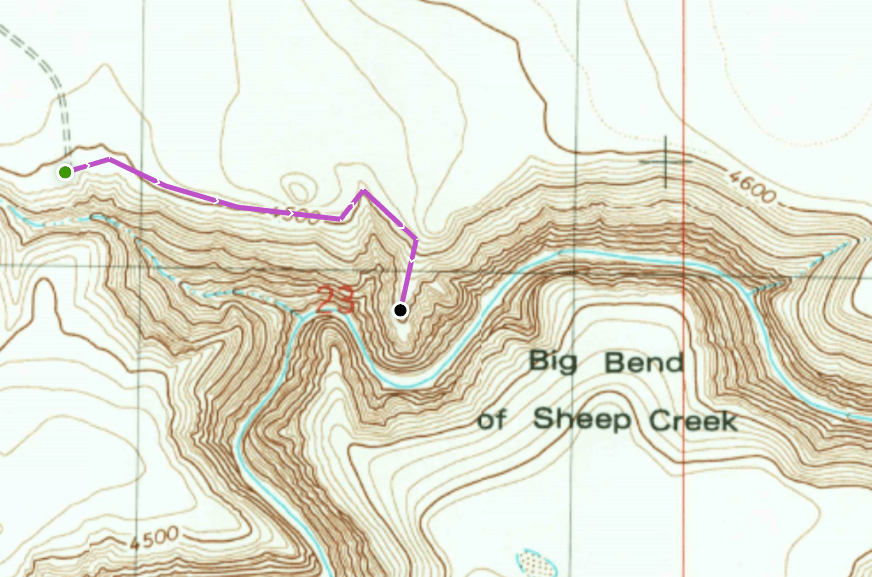
There is no trail – just relatively easy cross-country hiking on the grassy plain with the occasional volcanic rock and loose, sandy patch to navigate. I’d highly recommend walking east along the rim, then south and down to an obvious promontory point where you can peer down to the narrow strip of riparian habitat along the creek in either direction.
I have no fear of heights, but standing on the edge and facing the abrupt chasm made me feel uncomfortable – not to mention small. My mom wouldn’t get within 500 feet of it. Places like this provide an immense sense of gratitude that we live in a world that has so much natural beauty – especially in Idaho, where we have so many distinct types of landscapes. The canyons of Owyhee County are some of the much less-visited geological wonders of southern Idaho (the hidden gems of the Gem State, if you will), and that makes them all the more special to me. I’ll be sharing several of them in future blog posts, and I’d encourage Boiseans and non-local explorers alike to give them a chance.
I’m planning on returning to Sheep Creek Canyon to traverse a section upstream called “Bighorn Country,” where you can scramble down to the bottom of the gorge and hike along the creek. I’ve read and prepared for both of these off-trail trips using Steve Stuebner’s excellent handbook, The Owyhee Canyonlands: An Outdoor Adventure Guide, which I would highly recommend for anyone looking for more to do in Idaho’s high desert and Owyhee Range.
As said above, I propose that all Boiseans should take a break from the mountains and head in the opposite direction for a change of pace and scenery. The lower elevation regions of the Owyhee Wilderness are especially appealing in late winter and early spring, when the snow has melted and the daytime temperatures are reasonable for hiking, whereas other regions of Idaho are still snow-covered and inaccessible. While the roads are typically bad, the more rigorous journey makes the destination all the more worthwhile.
Trail Stats
- Season: Year-round, except after heavy rain or snowfall due to road accessibility
- Difficulty: Moderate
- Type: Out-and-back, meandering
- Surface: Off trail, rock
- Distance: As long as you like
- Starting elevation: 4,513 feet
- Elevation gain: Depends on route
My Rating
I subtracted a half star only because the drive out here is brutal. Those who make the arduous trip will be glad they did.
How to Get There
Caution! Do not attempt to drive here without an AWD/4WD vehicle with medium to high clearance! Do not attempt to drive in this area after even a half-inch of rain!
A Jeep or Subaru Forester/Outback or better is necessary to access the Big Bend area via an unmaintained dirt two-track across the rocky sagebrush steppe. Dirt bikers or ATV/UTV riders will thrive! There is not currently a route on Google or Apple Maps to this location, so bring paper maps as backups and use the below guide from the intersection of Highways 51/78 and Hot Springs Road in the town of Bruneau, Idaho:
- Continue west for 2 miles to the fork of Highways 51 and 78, continuing slight left to stay on Highway 51
- Continue south on Highway 51 for 33 miles to well-graded gravel road on the left (east)
- Turn left onto the unsigned road, which leads towards Blackstone Reservoir
- Continue 4.9 miles to a sharp left (northeast) onto an unsigned dirt road in poor condition – this is Blackstone-Grasmere Road (if you start going downhill towards the Blackstone Reservoir Dam, you’ve gone too far)
- Continue 1.7 miles to an unsigned four-way intersection
- Turn right (east) onto anther poor quality dirt road – this continually-deteriorating dirt two-track is the final approach to the Big Bend and doesn’t allow speeds more than 10mph for most of it
- Continue 3.4 miles as the two-track turns south and gradually disappears near the canyon rim
I cannot emphasize how poor the last five miles of this “road” are. The two-track is barely defined, rocky, and totally ungraded. The brush between the tracks will scrape your undercarriage the whole way. My dad had to get out of the car and throw large rocks out of the way so we could pass through. There is a downhill section where it will feel like you might tip over. Savvy off-roaders with big tires will love it, everyone else will hate it. It’s still worth it.
Preparation
Bureau of Land Management
Bruneau Field Office
(208) 384-3300
Here are the need-to-know details for hiking the Big Bend of Sheep Creek:
- This area is home to coyotes, bighorn sheep, pronghorn antelope, birds of prey, and more – be respectful to local flora and fauna
- Wear sturdy hiking shoes or boots for the off-trail walking where the ground can be uneven, rocky, and unstable
- Bring your own water, there is no reliable water source in the area
- Route-finding is not necessary, but be cautious around the canyon and make a plan before you go
- There is no shade – protect yourself from the sun as needed and expect warm temperatures to feel hotter in the direct sunlight
- Be respectful to other trail users and leave no trace!
Other Useful Resources
- Downloadable GPX track via AllTrails
- Driving route from Highway 51 to the trailhead via AllTrails
- The Owyhee Canyonlands: An Outdoor Adventure Guide by Steve Stuebner
- Topographical map via Natural Atlas
