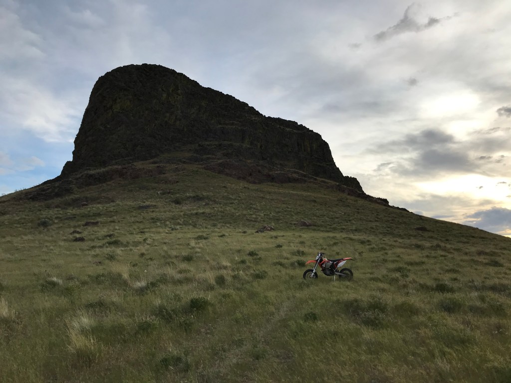
Three Fingers Rock sits just a few miles over the state border in Oregon, one of the most prominent features of the northern Owyhee Range, whose geology forms the western boundary of the Treasure Valley. Named for it’s three distinct skyward-jutting “knuckles”, the rock is a relatively easy hike and scramble that rewards explorers with incredible vistas from the Owyhee Canyonlands to the Boise Mountains.
On the Trail
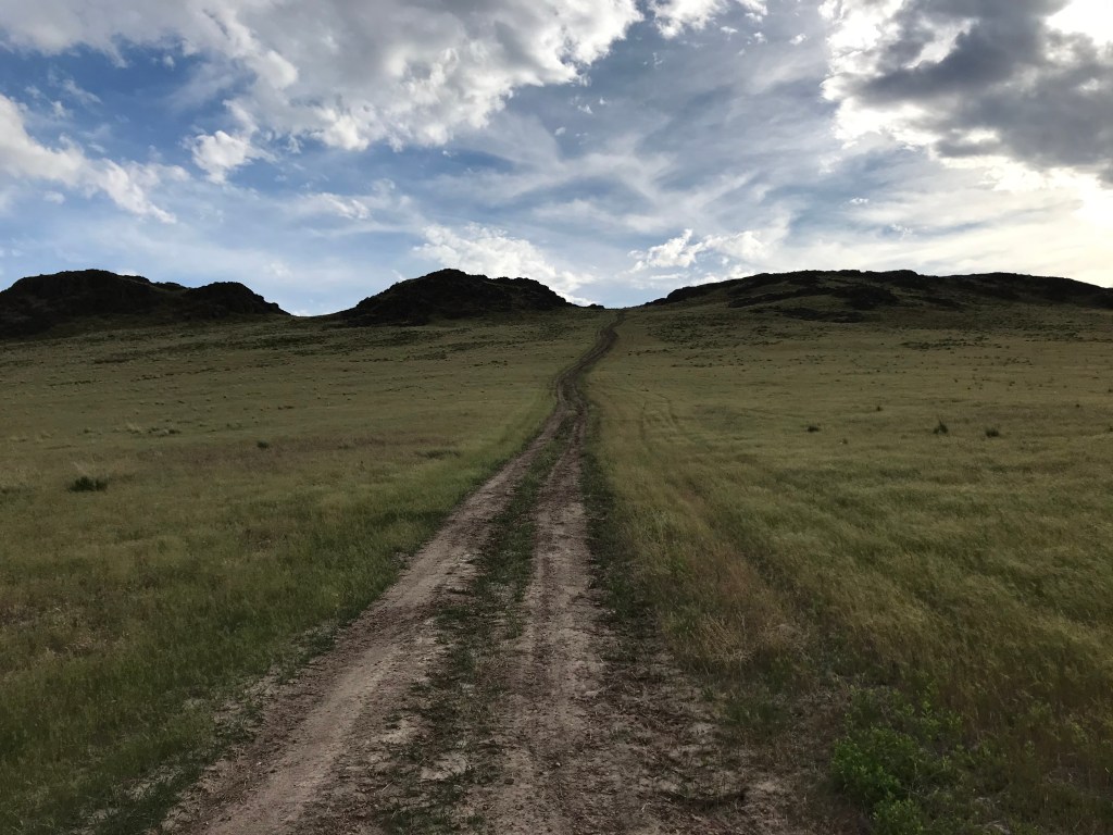
“Trail” is a somewhat generous term, as the approach to Three Fingers Rock is on an old, overgrown two-track, followed by an off-trail section through tall grass, a scree field, and a scrambling ascent up the formation to the east knuckle. Despite this, it’s straightforward and fun to follow the route and find your way.
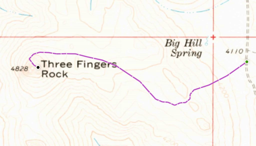
From the de facto trailhead on McIntyre Spring Road, the trail ascends 0.3 miles west-southwest to gain a ridge approximately 260 feet above the road. The tracks then turn northwest and ride the top of the ridge for a little under a mile before fading away near the base of the rock.
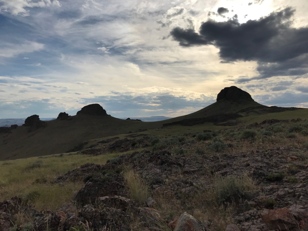
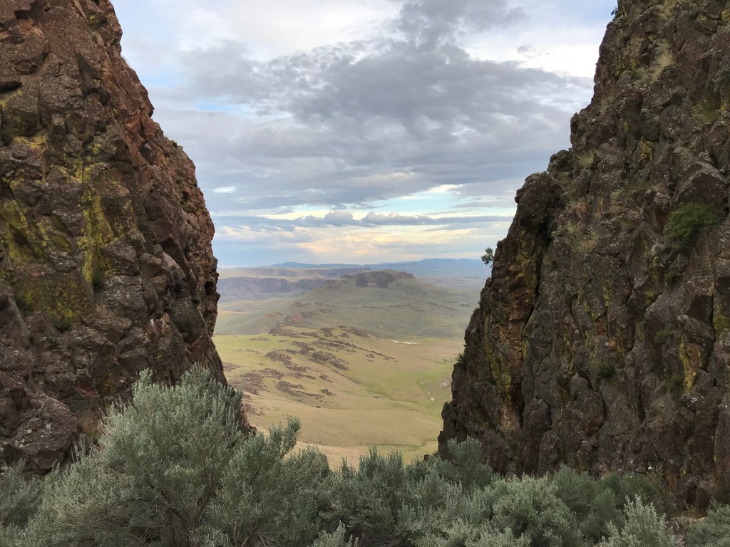
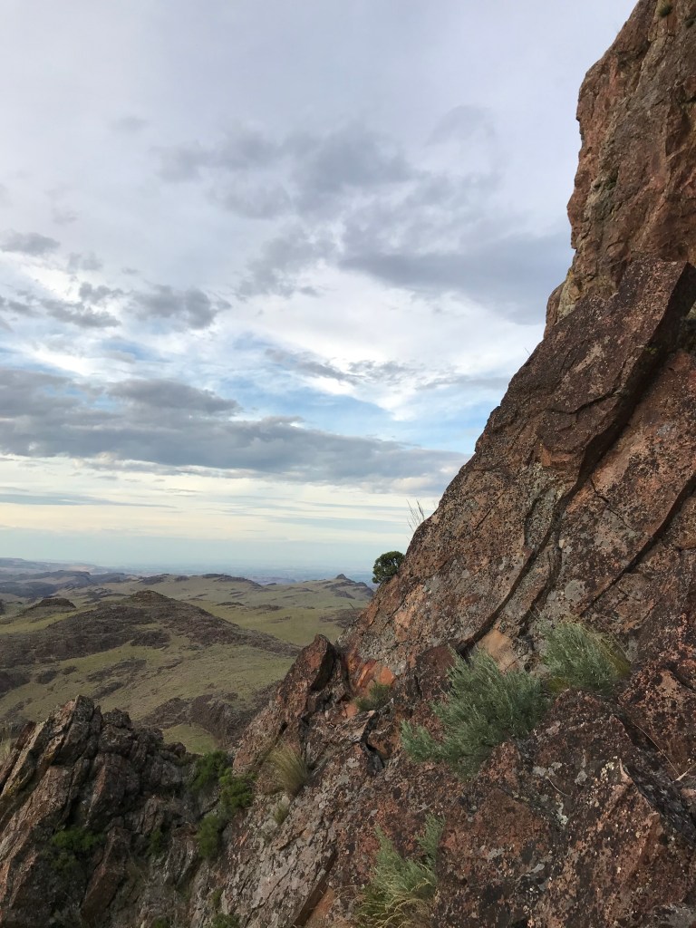
The easiest way to get into the east notch is skirting the north side of the rock and ascending carefully through alternating patches of tall grass and loose scree. The entrance to the notch becomes apparent as you turn southward and climb between the two knuckles. Looking west, the scarred badlands of the Owyhee River ripple all the way to the horizon.
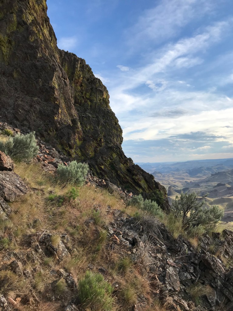
The saddle of the notch is flat and dotted with sagebrush, offering a good resting place before the scramble. Depending on where the sun is, this will be the only shade on the trail. Enjoy the cool breeze and rehydrate before following an obvious route up the east knuckle. I have no climbing experience and had no issues going up or down, but young children and unathletic dog breeds might struggle on the larger steps.
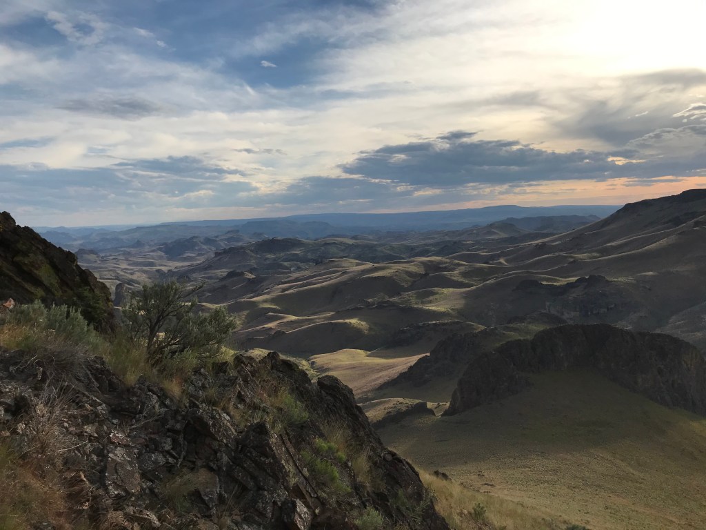
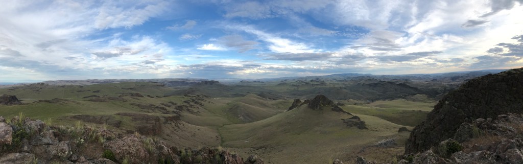
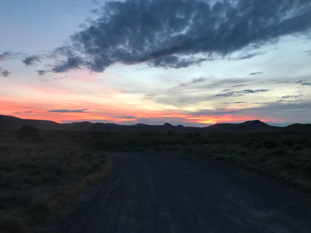
Standing over 300 feet above the crest of the ridge, the east knuckle sits relatively flat once you reach the top. While enjoying the panoramic views, look for a summit register that you can sign. I was here on summer solstice in June of 2020 and stayed until just before sunset at 9:30pm. The odd division of time zones in Idaho and Oregon allows for daylight hiking very late in the evening in the longest days of summer, as long as you don’t mind driving home in the dark.
I was surprised to meet two other hikers at the top who had ridden a dirt bike up the trail from the nearby Succor Creek Campground. We exchanged stories of exploring the Owyhees for a half hour or so before I departed. I could’ve sworn that when I looked back as I descended the trail below the rock, I saw the silhouette of a man on one knee proposing. If that was the case, I hope the couple wasn’t annoyed by my presence, but rather grateful that I was there to take a photo of them together.
I’d highly recommend visiting Three Fingers Rock shortly after rainfall or early in the spring when the Owyhee Canyonlands are lush with soft grasses and wildflowers. There is a stark contrast between the verdant day I was there and dryer times, as evidenced by Steve Stuebner’s post in his outdoor journal. If you’re looking for a physical guide to bring with you, his book The Owyhee Canyonlands: An Outdoor Adventure Guide is an excellent source that I’ve used many times.
Trail Stats
- Season: March to November
- Difficulty: Moderate
- Type: Out-and-back
- Surface: Two track dirt, off-trail, rock
- Distance: 2.5 miles
- Starting elevation: 4,134 feet
- Elevation gain: 719 feet
My Rating
When planning hikes, I like to cycle through a variety of terrain, from Boise’s foothills, into the forested mountains, and out to the high desert and sagebrush steppe. This is one of the absolute best in the third category, and I will return. It’s relatively easy to get to, quick, fun, and doesn’t have the crowds of Jump Creek Falls or Leslie Gulch.
How to Get There
Those who have visited Leslie Gulch or Succor Creek State Natural Area before will be familiar with the route to Three Fingers Rock, which can be accessed easily in any vehicle from Marsing or Homedale. Here is the step-by-step navigation from the intersection of Highways 95 and 55 in Marsing, and here is the step-by-step navigation from the intersection of Highways 95 and 19 in Homedale, or use these steps:
From US-95 west of Marsing:
- Proceed south on US-95 for 19.1 miles to a dirt turnoff on the right
- Turn right onto McBride Creek Road, a good-quality dirt road that leads to Rockville, Leslie Gulch, and the Slocum Creek Campground at Lake Owyhee
- At 2.4 miles, continue as the road turns left (west), avoiding a lesser branch to the right
- Continue 6.3 miles to a T-intersection at private ranch
- Turn right onto Succor Creek Road and cross the ranchland for 0.3 miles
- Turn right again to stay on Succor Creek Road
- Continue north for 6.6 miles to an intersection with a lesser road directly in front of you
- Proceed straight onto McIntyre Spring Road, which is slightly rougher but suitable for all vehicles
- In 3.8 miles, the “trailhead” is on your left (west) where the two-track road ascends the hillside – pull off the road and park anywhere
From SH-19 in Homedale:
- Proceed west on SH-19 through the center of Homedale
- At 5.2 miles, cross the state border into Oregon and proceed on OR-201
- At 7.0 miles, turn left onto Succor Creek Road, which quickly turns to rocky gravel
- Continue for 20.1 miles, passing through Succor Creek State Natural Area, a great place to camp and hike more if you want to make this a weekend trip
- Turn sharp right onto McIntyre Spring Road, which is slightly rougher but suitable for all vehicles
- In 3.8 miles, the “trailhead” is on your left (west) where the two-track road ascends the hillside – pull off the road and park anywhere
Preparation
Bureau of Land Management
Malheur Field Office
(541) 473-3144
Here are the need-to-know details for hiking Three Fingers Rock:
- This area is home to coyotes, bighorn sheep, pronghorn antelope, birds of prey, and more – be respectful to local flora and fauna
- Wear sturdy hiking shoes or boots for the off-trail hiking and scrambling where the ground is uneven, rocky, and unstable
- Bring your own water, there is no reliable water source in the area
- Be cautious around the sheer drops on top of the rock
- There is no shade – protect yourself from the sun as needed and expect warm temperatures to feel hotter in the direct sunlight
- Be respectful to other trail users and leave no trace!
Other Useful Resources
- Downloadable GPX track via AllTrails
- The Owyhee Canyonlands: An Outdoor Adventure Guide by Steve Stuebner
- Topographical map via Natural Atlas
