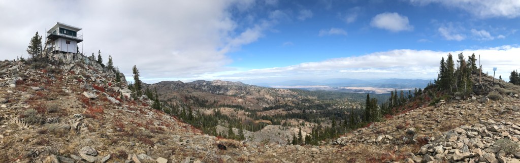
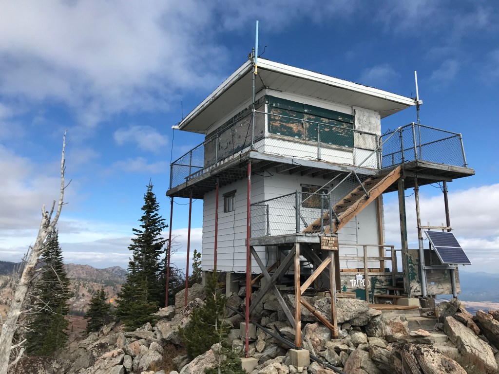
There are hundreds of fire lookout towers on the high peaks of Idaho’s forests, many of which are still manned in the summer as the first line of defense against wildfires. One of them sits precariously atop Tripod Peak, which looms over Round Valley, Long Valley, and Cascade Reservoir, with expansive views north to the Seven Devils and east to the Salmon River Mountains. Established in 1921, the lookout tower is a beautiful half-day hike along the West Range from the trailhead on top of Granite Peak.
On the Trail
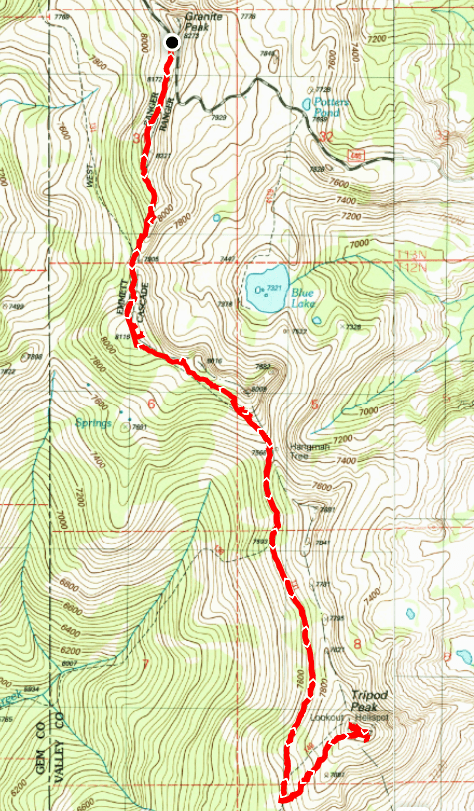
West Mountain Trail travels north-south on the spine of the West Mountains from near Sage Hen Reservoir to the Gem County highpoint west of Cascade Reservoir. This section of the trail begins near the 8,222-foot summit of Granite Peak. Because you start hiking on top of the ridge, the total elevation gain is extremely reasonable considering the destination.
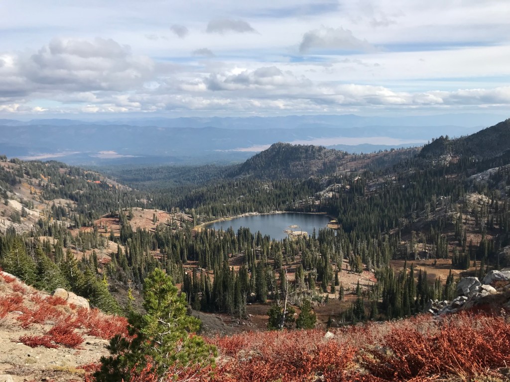
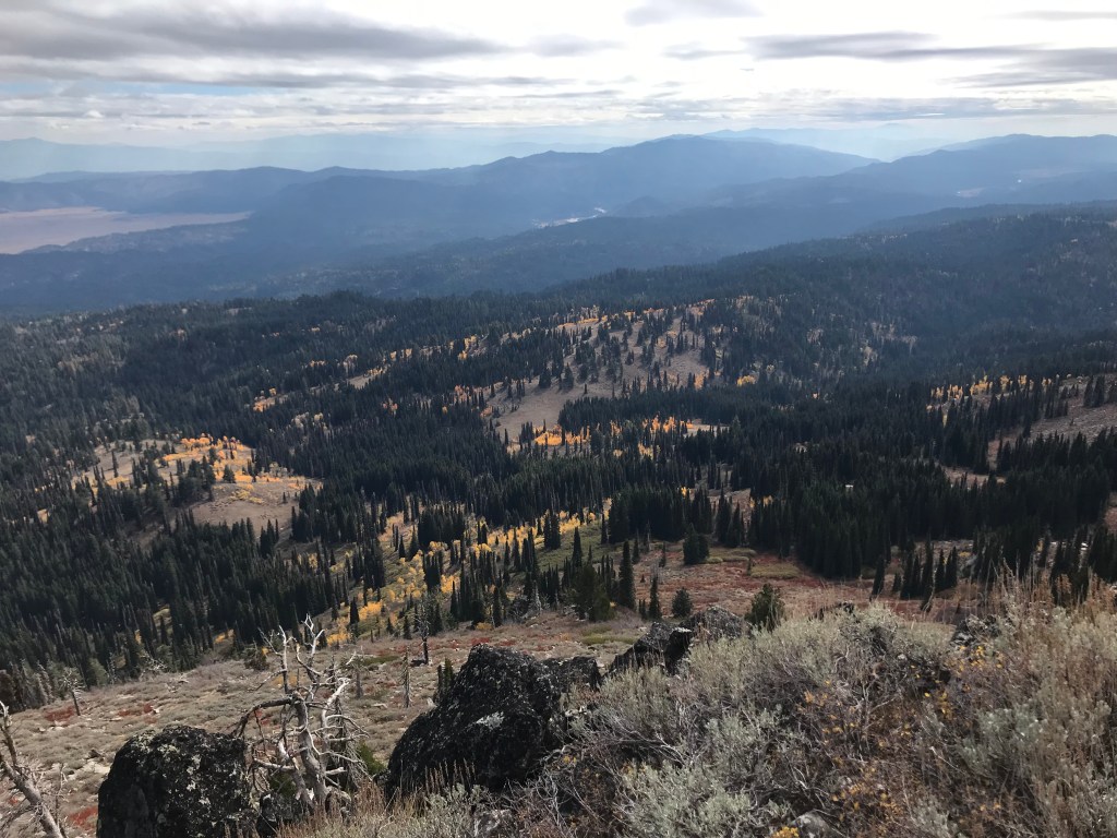
The first mile rides south along the ridge as it descends 300 feet to a saddle, with exceptional views in all directions. However, the highlight of this section is the view down to Blue Lake, one of the more popular hiking trails in the area. I’d guess that it’s one of the most Instagrammed hikes in southern Idaho, after Table Rock and Jump Creek Falls. It’s okay to feel smug about seeing it in solitude from this perspective after passing the typically full parking lot at its trailhead – just don’t ruin the secret, okay?
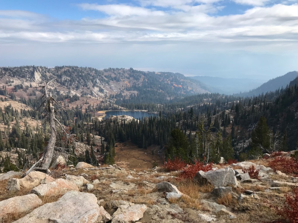
The next mile re-ascends 200 feet before turning southeast and dropping another 500 feet to the low point of the hike (literally, not figuratively). The views of Blue Lake and Long Valley wane as you dip down to the west side of the ridge, where you stay on a relatively level pitch for the next 1.5 miles. This segment plods south along a grassy slope with intermittent shade where wildflowers probably grow waist high in the summer. My girlfriend and I hiked here in mid-October and were treated to a much more earth-tone pallet of plant life.
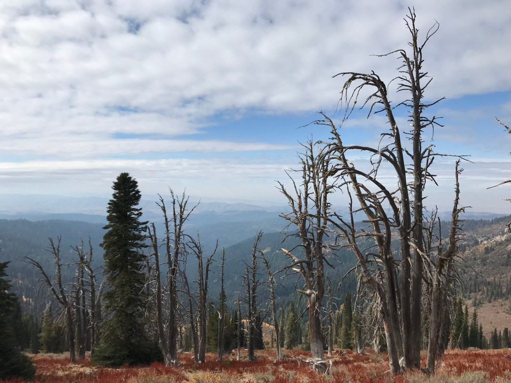
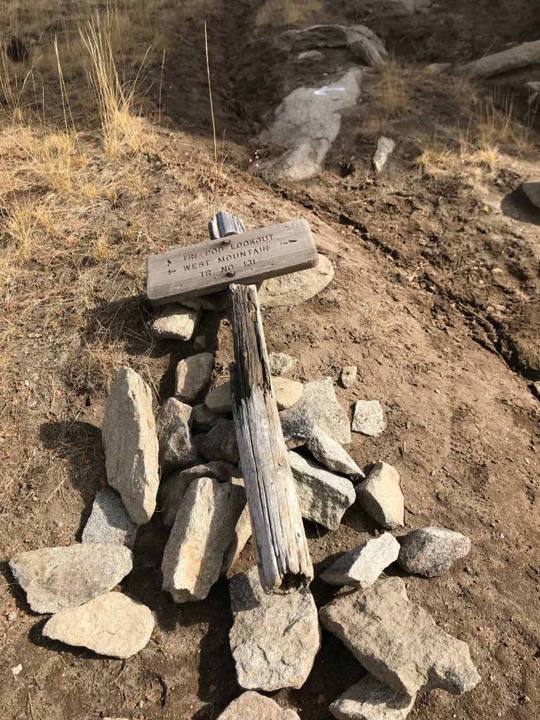
From most points on the hike, you can see the your destination perched atop Tripod Peak, but as you approach, it becomes concealed by the slope in front of you. As you hike south, look for a fallen wooden sign indicating the intersection of West Mountain Trail and “Tri-pod Lookout.” The route isn’t readily apparent, but if you turn sharply back to the northeast and follow the ruts, you’ll pick up the trail again in a hundred yards or so. I’d guess it can be fairly muddy here early in the season.
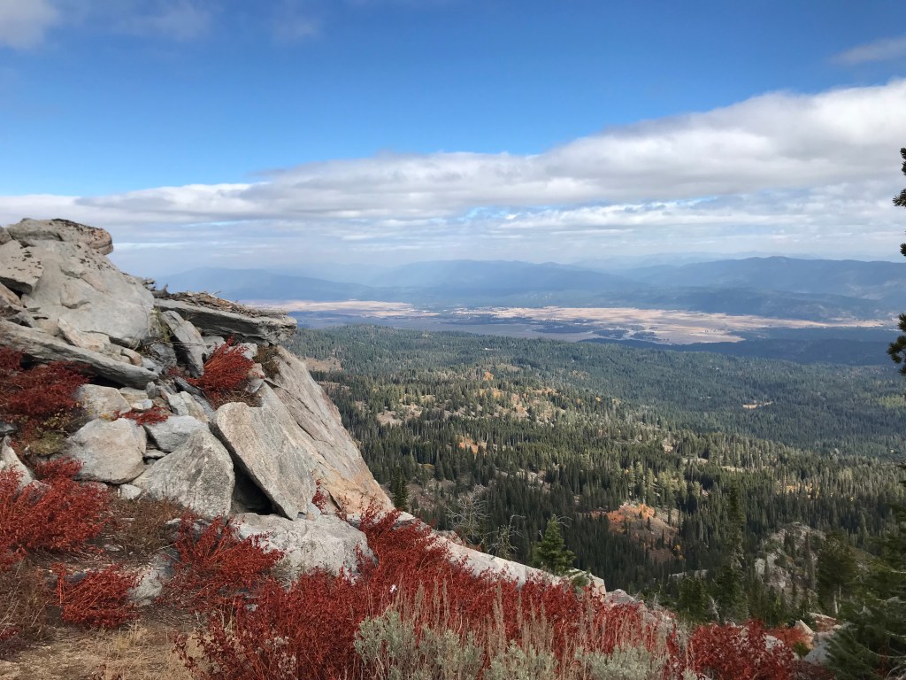
From the intersection, it’s a half-mile and 400 feet up to the peak and the lookout tower, which sits at the very tip of the 8,068-foot summit. Be respectful to the Forest Service if the tower is manned when you visit! I was there in the offseason and the tower was boarded up and locked at the staircase. There is a better lookout point just east of the tower on an rocky promontory point, and if you’re having lunch here, I’d suggest finding a perch there. I could’ve sat there for hours (or until it got too cold).
When you’re done taking in the views, return the way you came. The two ascents on the back end aren’t as tough as the final climb to Tripod, but they come in quick succession. Make sure you budget enough time to get back to your vehicle safely. If you’re backpacking, there are numerous suitable spots along the ridge, although it may be windy. Car campers will find endless options near the Blue Lake trailhead and Potter’s Pond. For a bonus adventure and more good views, drive north on Snow Bank Mountain Road to the radar station and radio towers another mile from the trailhead.
Trail Stats
- Season: Late May to early November
- Difficulty: Moderate
- Type: Out-and-back
- Surface: Single track dirt
- Distance: 8.5 miles
- Starting elevation: 8,178 feet
- Elevation gain: 1,150 feet
My Rating
Great trail, great views, great destination. We saw one other person when we hiked – what more do I need to say? 5/5 no question.
How to Get There
If you’ve hiked the much more the well-known Blue Lake Trail before, you’ll be familiar with the route to Granite Peak Trailhead. For newcomers, this is one of those trips where the drive is almost as beautiful as the hike. The route is suitable for any vehicle, although washboarding is typical higher on the dirt roads. Here is the step-by-step navigation from the intersection of Highway 44/State Street and Highway 55 in Eagle, or use these steps:
- Proceed north of Highway 55 for 61.6 to a turnoff just before Clear Creek Station, the store that is painted half Boise State blue and orange and half Vandal black and gold
- Turn left onto Cabarton Road, passing through a forested residential area, a large meadow, and the Cabarton boat launch on the Payette River
- At 2.5 miles, turn left to continue on Cabarton Road/NF-446 – the road turns to dirt here, but is well-graded the rest of the way
- At 8.6 miles, pass the Blue Lake Trailhead on the left – if you need to use the restroom, this is the last available facility
- At 9.5 miles, reach the saddle of Granite Peak and park in the large gravel lot on the left – this is the trailhead
Preparation
Boise National Forest
Cascade Ranger District
(208) 382-7400
Interactive Map of Road, Trail, and Area Closures
Here are the need-to-know details for hiking West Mountain Trail from Granite Peak to the Tripod Peak Lookout Tower:
- This is black bear country – carry personal protection and know what to do in an encounter (here is a handy guide from the Humane Society of the United States)
- Bring your own water, as there is no reliable water source on the high ridge
- At 1.8 miles, the trail becomes faint and hard to follow – if you lose it, continue downhill along the ridge towards the saddle in front of you and you’ll pick it up again soon
- The trail occasionally becomes hard to follow when making the final ascent towards the lookout – keep heading uphill in a northeast direction towards the summit and you’ll make it
- The trail is single-track dirt and rocks for the entire route and is suitable for dogs and children
- About 25% of the trail is shaded – protect yourself as needed
- Be respectful to other trail users and leave no trace!
Other Useful Resources
- Downloadable GPX track via AllTrails
- The Hiker’s Guide: Exploring Greater Boise by Scott Marchant
- Topographical map via Natural Atlas
