Treasure Valley residents might be surprised to learn that at 8,403 feet, Hayden Peak, the high point of the Owyhee Range, sits almost 900 feet higher than Shafer Butte, the prominent Boise mountain home to Bogus Basin Ski Area. In fact, the four highest points forming the backbone of the Owyhees are all above 8,000 feet. This mixed-trail trek is perfect for peakbaggers looking to capture the three highest summits of the mountain range and county.
On the Trail
The “trail” here is a combination of surfaces, from completely off-trail route-finding along the spine of the Owyhees, to a faint goat path on Cinnabar Mountain, to a multi-use road open to vehicles. If you’re not comfortable hiking cross-country without a trail to follow, this might not be the trip for you. If cruising up and down steep, exposed ridges with no markers is your speed, keep reading.
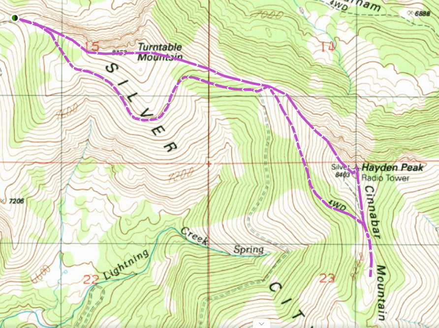
As with many Owyhee hikes, there is no trailhead – just a flat place along a dirt road where you can turn off and park. The road to Hayden Peak is rough and uncomfortable, and you can pull off just about anywhere, depending on how long of a hike you want and how confident you are in your vehicle’s ability on rugged terrain. You can even include War Eagle Mountain if you want to nab all four peaks above 8,000 feet. In my case, my friend Aaron and I took his Jeep and started hiking from the saddle between Turntable Mountain and the unnamed peak to its west.
From the saddle, leave the road and start hiking east-southeast up the main ridge towards Turntable Mountain, the first and lowest of the three high points. The slope is grassy and sparsely forested with a few steep stretches that will warm you up for the major climb. At 0.6 miles, reach the 8,122 foot summit and sign the journal inside the register – the other two peaks don’t have one.
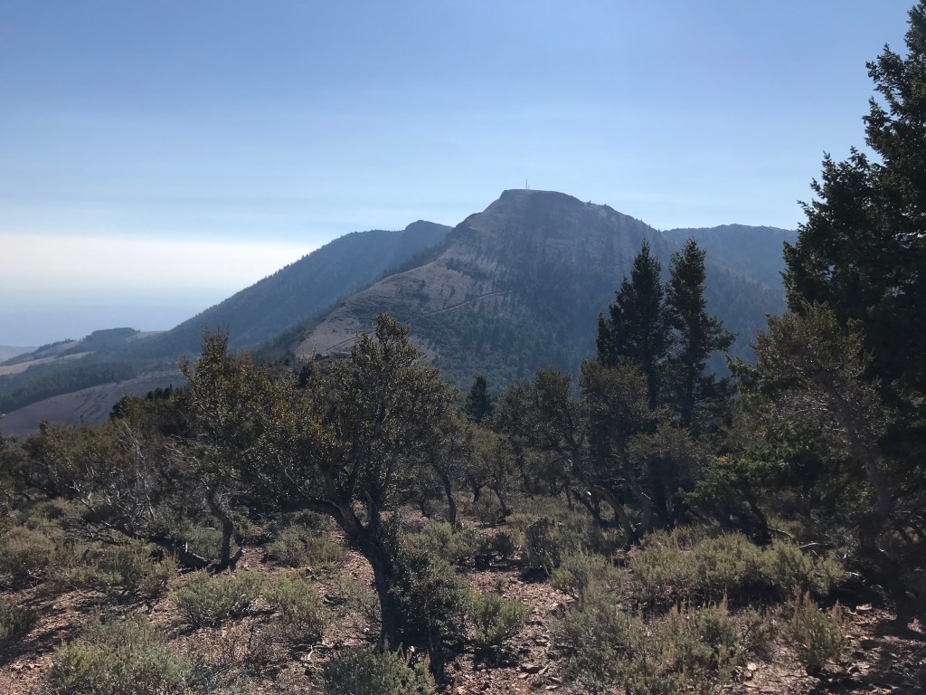
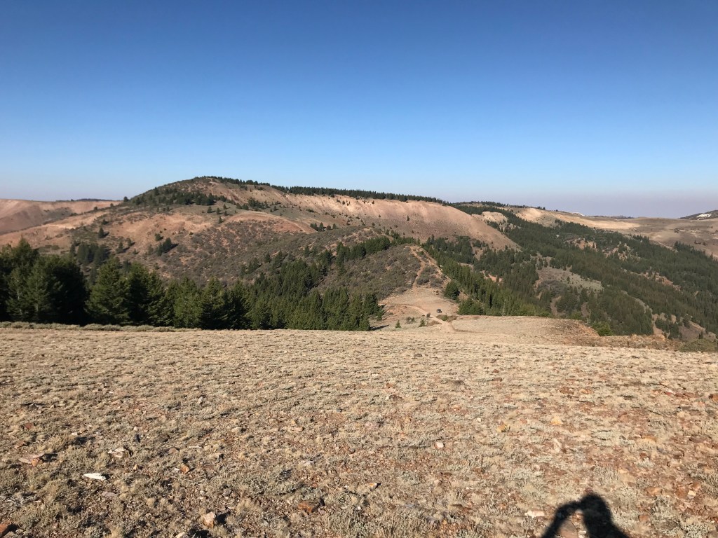
The descent from Turntable Mountain is a shallow slope carpeted with mahogany and sagebrush. You won’t have to bushwhack, but patches overgrown with thorns and snarled branches will force you to choose your path carefully. From this vantage point, the ridge route to Hayden Peak is obvious. Descend east-southeast towards the saddle for 0.6 miles, losing the altitude you’ve gained since leaving the trailhead. Take a breather in the saddle before starting the strenuous climb to Hayden.
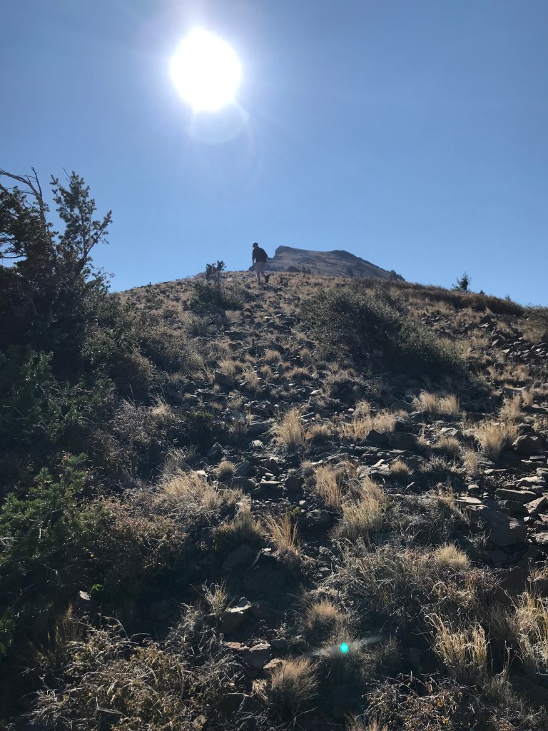
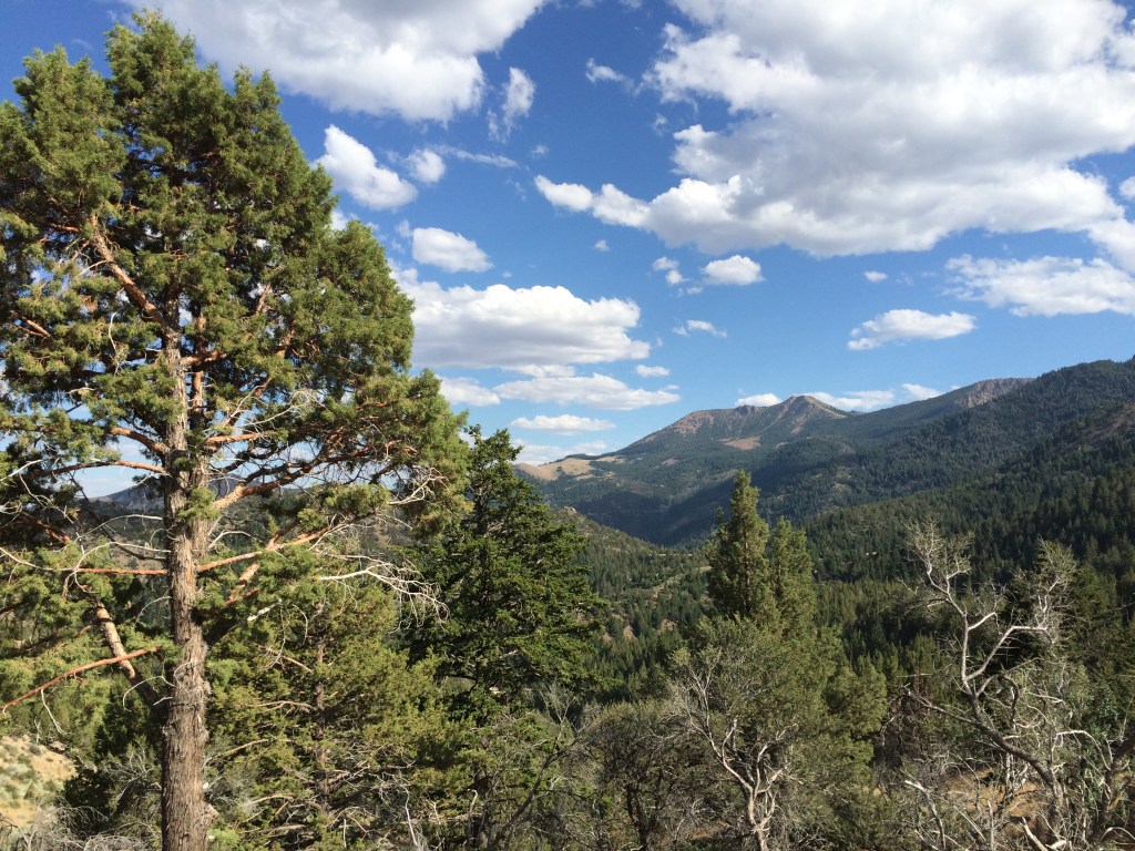
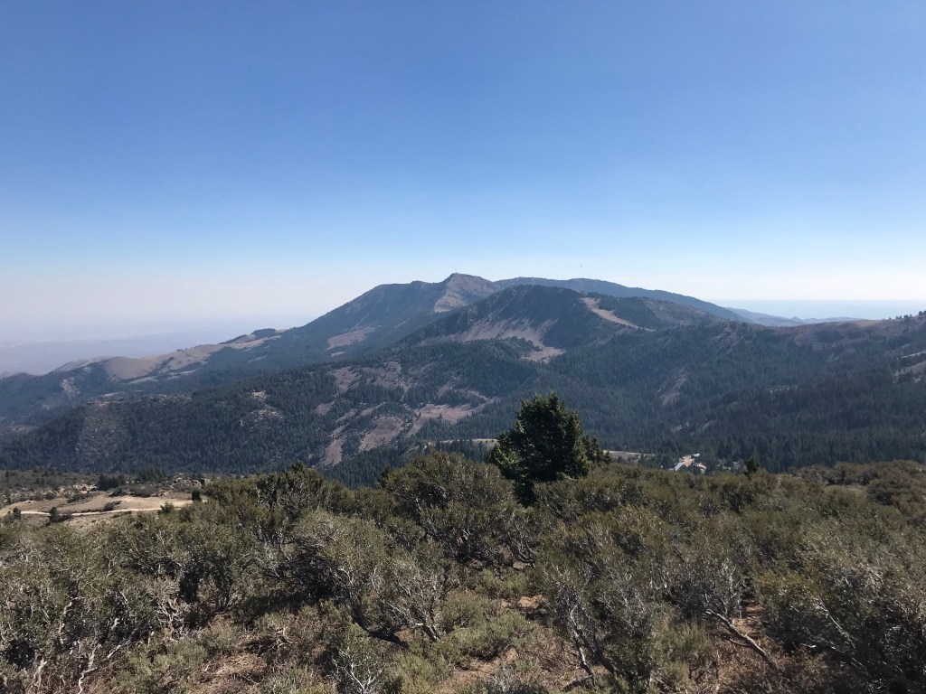
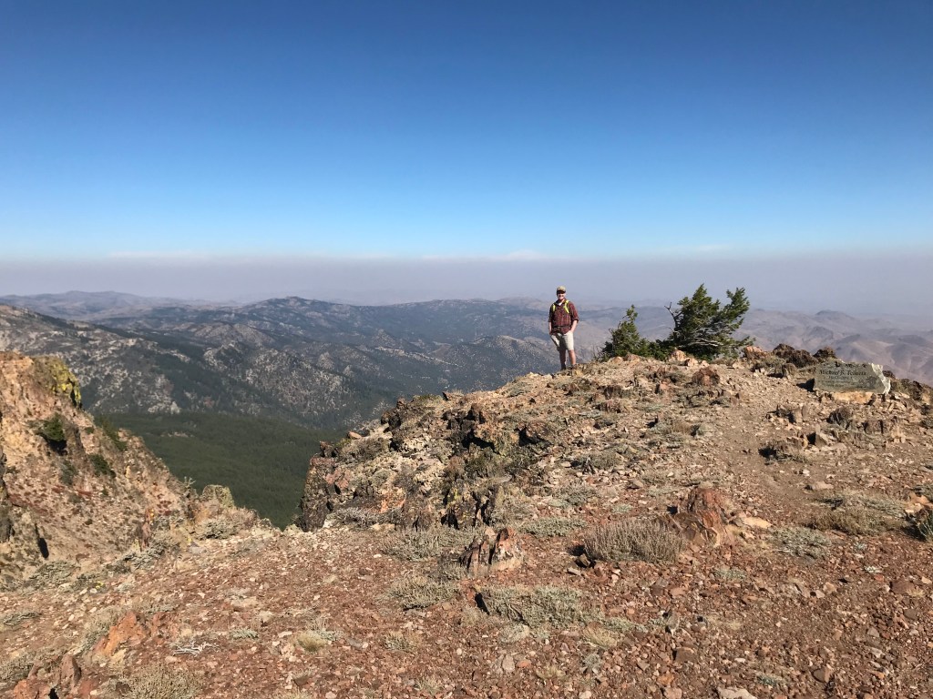
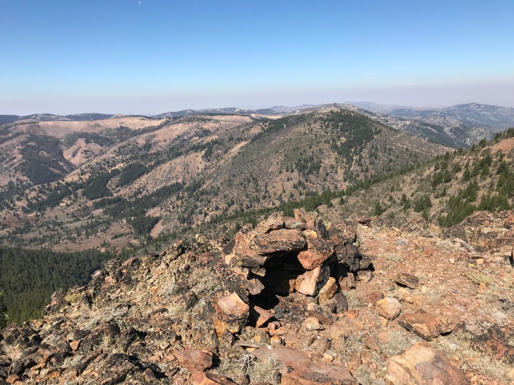
The ascent to Hayden Peak is steep, gaining 765 feet over 0.7 miles. The rocky slope is exposed, unshaded, and rough, with a steep drop-off on the left side. Be cautious on the loose footing as you climb. At 8,403 feet, the flat summit is home to a radio tower, a memorial plaque for a former Rupert resident, and a USGS benchmark, in addition to outstanding 360-degree views of the Owyhee Uplands and Treasure Valley.
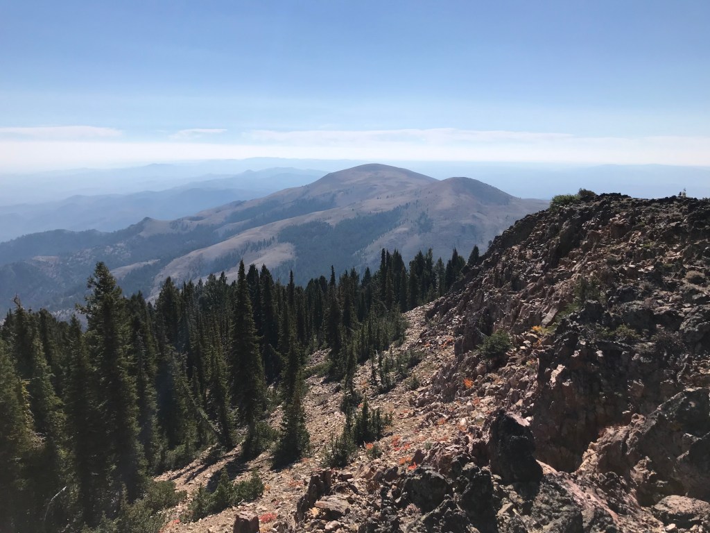
To continue to Cinnabar Mountain, either walk south down the service road or along the ridge for 0.2 miles to the next saddle, losing only 200 feet of elevation. Where the road hairpins back to the north, look for a faint goat path that continues south. Follow it as it wanders for 0.3 miles and 130 feet up to the summit of Cinnabar, 7,920 feet above sea level. There are some great lunch spots here. When you’re done taking in the views, retrace your steps to the road on the goat path to begin the return leg of the loop.
The service road from the Hayden Peak radio tower will take you all the way back to the trailhead. For 0.8 miles, descend 580 feet back to the saddle where the road diverges from the ridge to curve around Turntable Mountain’s south face. For one mile, the road ascends and flattens through pine and mahogany forests before descending steeply back to the trailhead. Bask in the glory of bagging three high points in less than five miles!
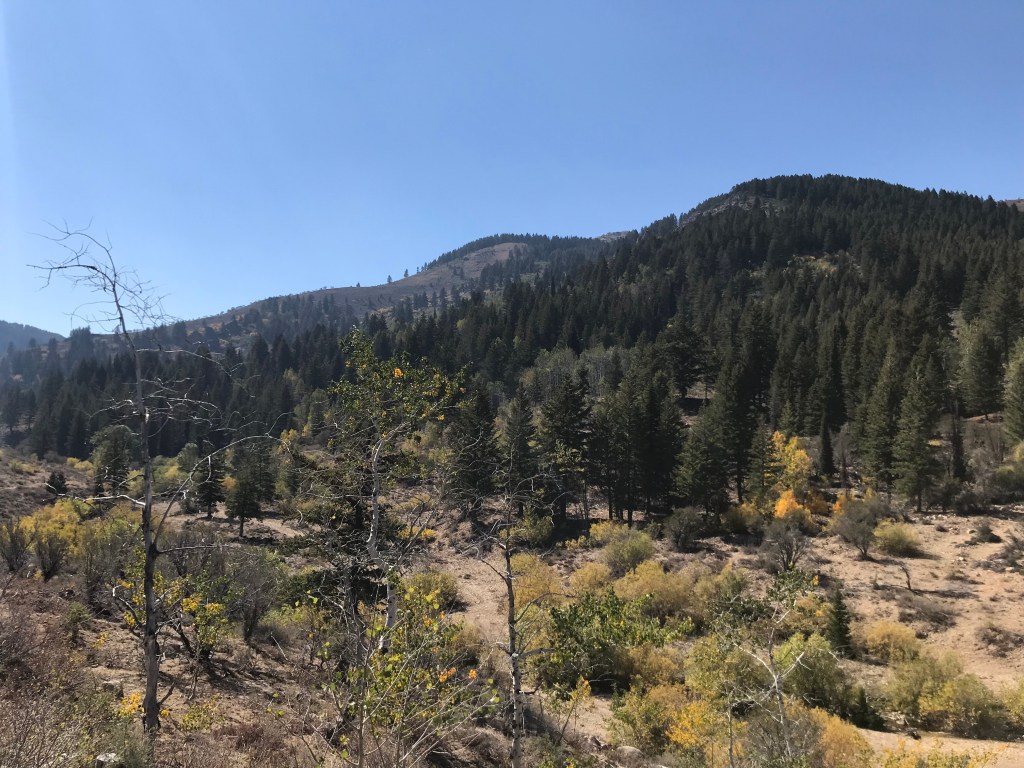
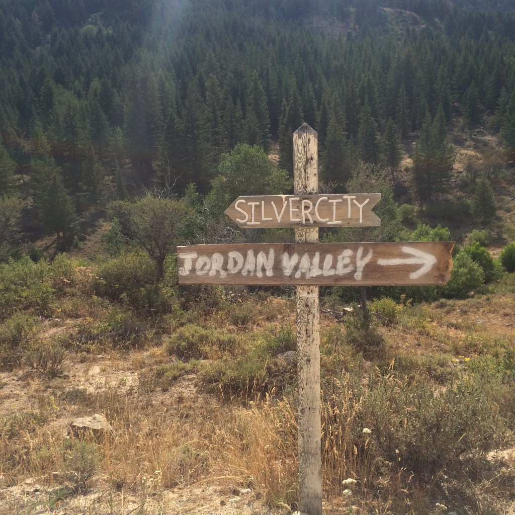
On your way home, I’d highly recommend making the short detour to Silver City, an 1800s mining town that is still home to a few residents. Be sure to check out the historic Idaho Hotel on your way through. If you’re making a weekend trip out of it, Silver City Campground is a great option, or pick a primitive BLM spot along Jordan Creek, where tall stands of cottonwood dot the otherwise piney hillsides, splashing the green forests with bright yellows and reds in the fall. Silver City’s location is a surprisingly lush landscape in a mountain range that, from the Treasure Valley, often appears dusty and unremarkable, which is why I’d urge all hikers to make the trip.
Trail Stats
- Season: May to October
- Difficulty: Strenuous
- Type: Loop
- Surface: Off-trail, goat path, dirt road
- Distance: 4.85 miles
- Starting elevation: 7,619 feet
- Elevation gain: 1,667 feet
My Rating
Three stars for the hike, one for the sense of achievement! It was tough, but we had a lot of fun standing at the summit, even on a hazy day. If you’re tired of the foothills and mountains (and their established trails), this will be fun for you.
How to Get There
The road to Silver City is long, winding, and washboarded, but suitable for any vehicle. However, you should not attempt to travel here after even half an inch of rain. The last mile to the trailhead is very rough, and I wouldn’t recommend driving it in less than a Jeep. You may have to park earlier and hike longer. Here is the step-by-step navigation from the intersection of Highways 45 and 78 in Walter’s Ferry, or use these steps:
- Continue south on ID-78 for 14.3 miles
- Turn right onto Silver City Road and continue for 18.6 miles, as the road deteriorates, snaking up and over New York Summit and down to Slaughterhouse Gulch
- At a parking area with a camp toilet, turn left onto Linehan Flat Road (no signage)
- At 2.5 miles, pass a pioneer cemetery on the left – the lone remaining grave marker here is dated 1877
- At 2.8 miles, continue straight/slight right to stay on Linehan Flat Road, passing several turnoffs for the radio tower on War Eagle Mountain
- Continue 2.8 more miles to the trailhead as described above, or pull off and park anywhere if the road becomes too rough
Preparation
Bureau of Land Management
Owyhee Field Office
(208) 896-5912
Here are the need-to-know details for hiking the Owyhee high points:
- There may still be a few black bears in the Owyhees – carry personal protection and know what to do in an encounter (here is a handy guide from the Humane Society of the United States)
- This area is much more popular with ATV/UTV/dirt bike riders than hikers – be cautious on the trails and listen for motorized vehicles approaching
- Wear sturdy hiking shoes or boots for the off-road hiking and scrambling where the ground is uneven, rocky, and unstable
- Bring your own water, there is no reliable water source in the area
- Route finding is necessary but simple on the outbound stretch of this hike
- Be cautious around the sheer drops on the ascent to Hayden Peak
- This hike is not suitable for young children or dogs
- There is no shade – protect yourself from the sun as needed and expect warm temperatures to feel hotter in the direct sunlight
- Be respectful to other trail users and leave no trace!
Other Useful Resources
- Downloadable GPX track via AllTrails
- Hayden Peak entry from Idaho: A Climbing Guide
- Historic Silver City Idaho
- Silver City and Other Owyhee Treasures via Visit Idaho
- Topographical map via Natural Atlas
