My first hike of spring 2022 is in the books! Up to this point, the posts I’ve written were hiked in either 2020 or 2021, making this my first “live” update of the blog. The weather in Boise has been warming up and conditions are perfect in the Owyhees, so my girlfriend and I headed out towards Succor Creek State Natural Area on a Sunday afternoon for an exploratory hike up and a picnic. One of the many seasonal tributaries of Succor Creek, Sage Creek cuts through a narrow gorge filled with geological wonders that will delight experienced rockhounds and casual hikers alike.

On the Trail
The trail along Sage Creek starts as a two-track road before fading to a faint path in the canyon. Despite this, it’s never hard to follow as it navigates rocks and brush to a wide amphitheater lined with interesting rock formations. One scramble is required, but it’s only a few feet up and manageable for hikers without experience. Young children and dogs could handle it with assistance from adults. There are caves and other points of interest off-trail for those looking for extra adventure.
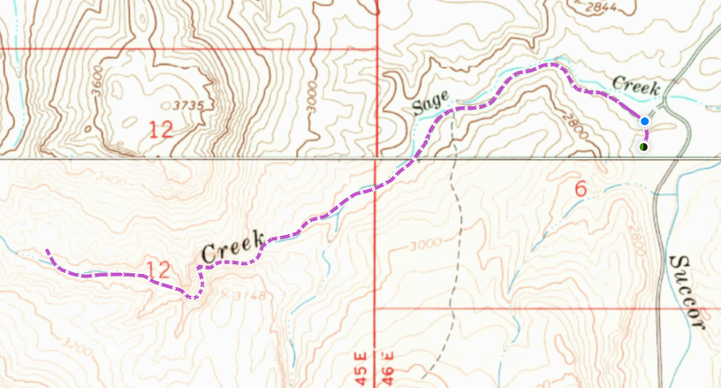
From the trailhead, turn north and identify a two-track road that travels east – look for the big tree if it’s not readily apparent. Walk across a grassy field and turn left onto the road, following it for one mile to the mouth of the canyon. The terrain along the road changes from sagebrush-covered hills to limestone slopes and rhyolite columns as the creek braids through a flat meadow. Just before the canyon, look for the narrower path that descends to creek level from the road.
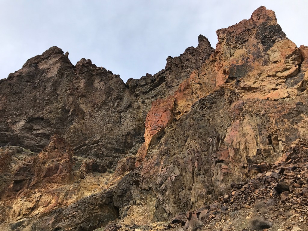
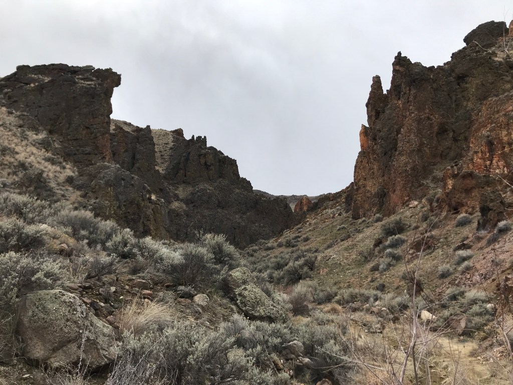
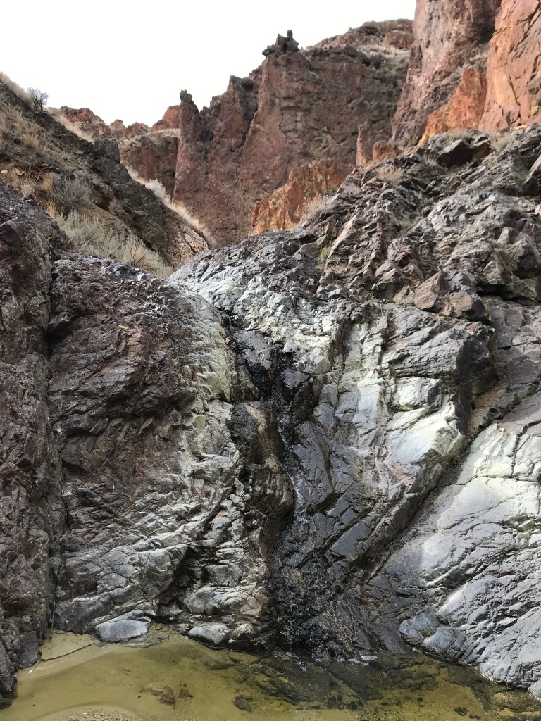
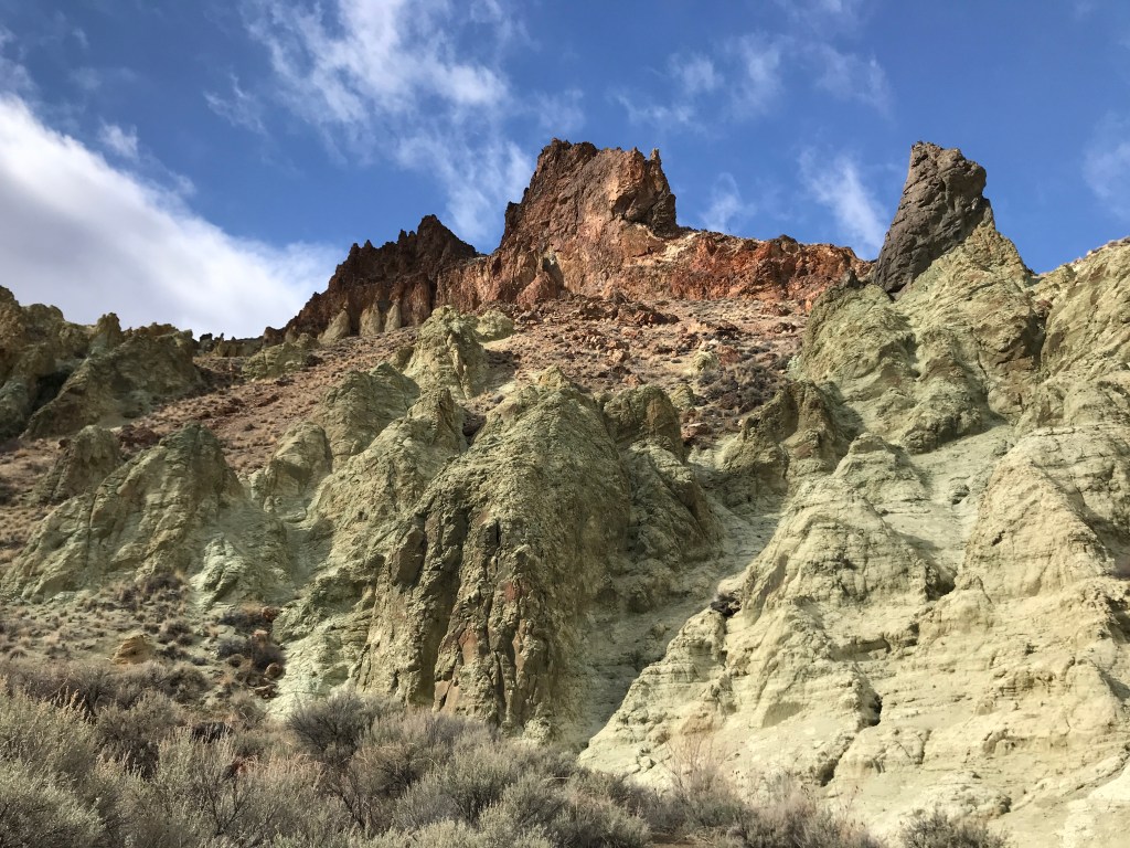
The next half mile zigzags through the red-rock canyon under towering hoodoos and wind-scooped walls. You’ll cross the narrow creek several times and pass two small waterfalls. High iron deposits give the silty banks an acidic green color, contrasting brilliantly against the warmer colors of the gorge. We even saw some blue and purple-tinted rocks and pebbles along the way!
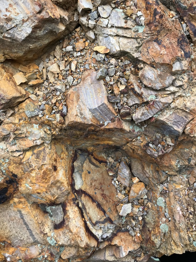
The canyon then widens and the colors turn from red and orange to tan and sandy brown. Here, the creek ambles through a flat valley in a wide amphitheater with a few possible campsites for those interested. The sandy slopes around the creek are where we found the most interesting rock specimens on our trek, including a thunderegg! We ventured a little further up the creek but turned around when the path disappeared into giant sagebrush, which is why I’m suggesting ending the outbound here, 2 miles from the trailhead.
After returning to the trailhead, we drove another 15 minutes south on Succor Creek Road and enjoyed a nice picnic at one of the creekside campsites at Succor Creek State Natural Area. If like me, you’re curious about what a succor is (I’ll admit I thought it was a plant like a succulent), the definition from Dictionary.com is “help; relief; aid; assistance” or “a person or thing that gives help, etc.” I’d have to agree that if you’re in need of the regenerative power of a nature walk, this place will do the trick. I’d suggest that all Sage Creek visitors come check it out before or after hiking.
Trail Stats
- Season: March to November
- Difficulty: Easy
- Type: Out-and-back
- Surface: Two-track dirt trail, goat path, rocks
- Distance: 4.0 miles
- Starting elevation: 2,661 feet
- Elevation gain: 450 feet
My Rating
I was pleasantly shocked at how beautiful Sage Creek is. I’ve hiked a lot of Owyhee Canyons, and this quickly jumped towards the top. If you love the scenery of Jump Creek and hate the crowds, this is the hike for you! The unique geology only makes it that much better. On an unrelated note – this was the 100th trail I’ve submitted to AllTrails – when do they start paying me for my efforts??
How to Get There
Those who have visited the Succor Creek area before will be familiar with the route to Sage Creek, which can be accessed easily in any vehicle from Homedale. Here is the step-by-step navigation from the intersection of Highways 95 and 19, or use these steps:
- Proceed west on SH-19 through the center of Homedale
- At 5.2 miles, cross the state border into Oregon and proceed on OR-201
- At 7.0 miles, turn left onto Succor Creek Road, which quickly turns to rocky gravel
- Continue 11.8 miles to a turnoff on the right that leads to a large dirt parking area – this is the “trailhead”

Preparation
Bureau of Land Management
Malheur Field Office
(541) 473-3144
Here are the need-to-know details for hiking Sage Creek:
- This area is home to coyotes, bighorn sheep, pronghorn antelope, birds of prey, and more – be respectful to local flora and fauna
- Wear sturdy hiking shoes or boots for the off-trail hiking and scrambling where the ground is uneven, rocky, and unstable
- Bring your own water, there is no reliable water source in the area – Sage Creek and Succor Creek are both downstream from farms and may contain livestock excreta and pesticides
- Route-finding is not necessary on this route
- There is some shade in the canyon – protect yourself from the sun as needed
- Be respectful to other trail users and leave no trace!
Other Useful Resources
- Downloadable GPX track via AllTrails
- The Owyhee Canyonlands: An Outdoor Adventure Guide by Steve Stuebner
- Topographical map via Natural Atlas
