
Boise’s Ridge to Rivers trail system encompasses more than 230 miles of hiking, biking, and horseback riding along over 150 trails, stretching from the highpoint of Boise Ridge at Shafer Butte all the way down to just shy of the Boise River, as the name aptly suggests. In the summer of 2021, I achieved my goal of completing the entire system on foot. I’ve hiked many of the trails several times, and some only once, and friends and other hikers often ask: which is the best? Upon reflection, I can’t choose just one – so here are my favorites! I hope you’ll use this information to hike Boise and find your own favorite trails.
Bogus Basin Area
More’s Mountain Interpretive Trail
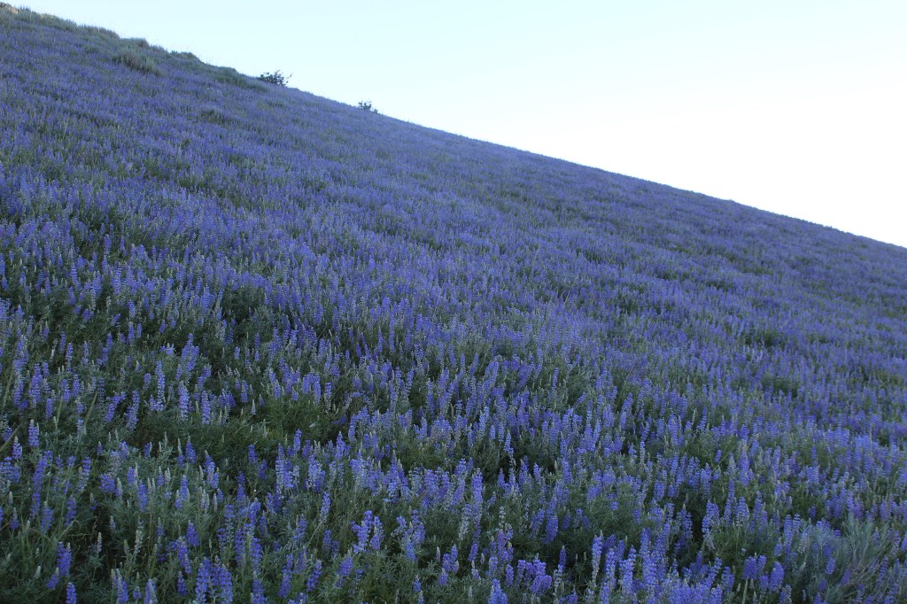
If you hit More’s Mountain in the right window in late July or August, the entire southeast slope is covered in purple lupine wildflowers. Even if you don’t, it’s one of the best trails in the system, especially when it’s hot in the valley. There is plenty of shade, great views, and interesting rock formations to check out along the way, plus, you can grab a beer at Bogus Basin on the way back to Boise if that’s your thing.
Trail Stats
- Season: May to November
- Difficulty: Easy
- Type: Loop
- Surface: Single track dirt, rock
- Distance: 2.1 miles
- Starting elevation: 6,701 feet
- Elevation gain: 505 feet
- Other information: Hikers only, $5 day use fee required
Downloadable GPX route via AllTrails
More’s Mountain Bike Trail to Coyote Rock Overlook
Despite the name, this trail is open to all users, and travels among some large granite formations on the east side of More’s Mountain. The trail ends at NF-374, which you may turn left on and follow to the unofficial Coyote Rock Trail, which gains a ridge and leads to an outcrop overlooking an impressive slab resembling a coyote howling skyward.
Trail Stats
- Season: May to November
- Difficulty: Moderate
- Type: Out-and-back
- Surface: Single track dirt, road
- Distance: 5.5 miles
- Starting elevation: 6,701 feet
- Elevation gain: 820 feet
- Other information: $5 day use fee required
Downloadable GPX route via AllTrails

Deer Point – Around the Mountain – Yellow Brick Road – Sunshine – Shindig – Bogus Creek
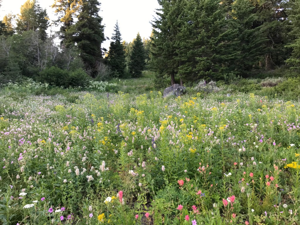
Around the Mountain is consistently ranked as one of the best mountain biking trails in Idaho, and it’s just as good for hikers. As you might guess, it circumnavigates Shafer Butte around the entire ski resort, transitioning from wide-open grassy slopes to dense pine forests to meadows of corn lily and wildflowers. Unfortunately, Bogus Basin has made it very difficult for hikers to return to the base area from the end of Around the Mountain, so you’ll have to take the named trails above to avoid the downhill-mountain bike only trails. Bogus’s trail maps are also disastrously bad at illustrating this. Nonetheless, this loop is worth doing.
Trail Stats
- Season: June to October
- Difficulty: Moderate
- Type: Loop
- Surface: Single track dirt, dirt road, paved road
- Distance: 10 miles
- Starting elevation: 6,170 feet
- Elevation gain: 1,350 feet
- Other information: Around the Mountain is part of the Special Trail Management program and all users must travel in a counter-clockwise direction. You can buy a summer lift ticket and ride Deer Point Express to reduce the distance and uphill hiking.
Downloadable GPX route via AllTrails
Brewer’s Byway – The Face – Tempest – Lodge Trail
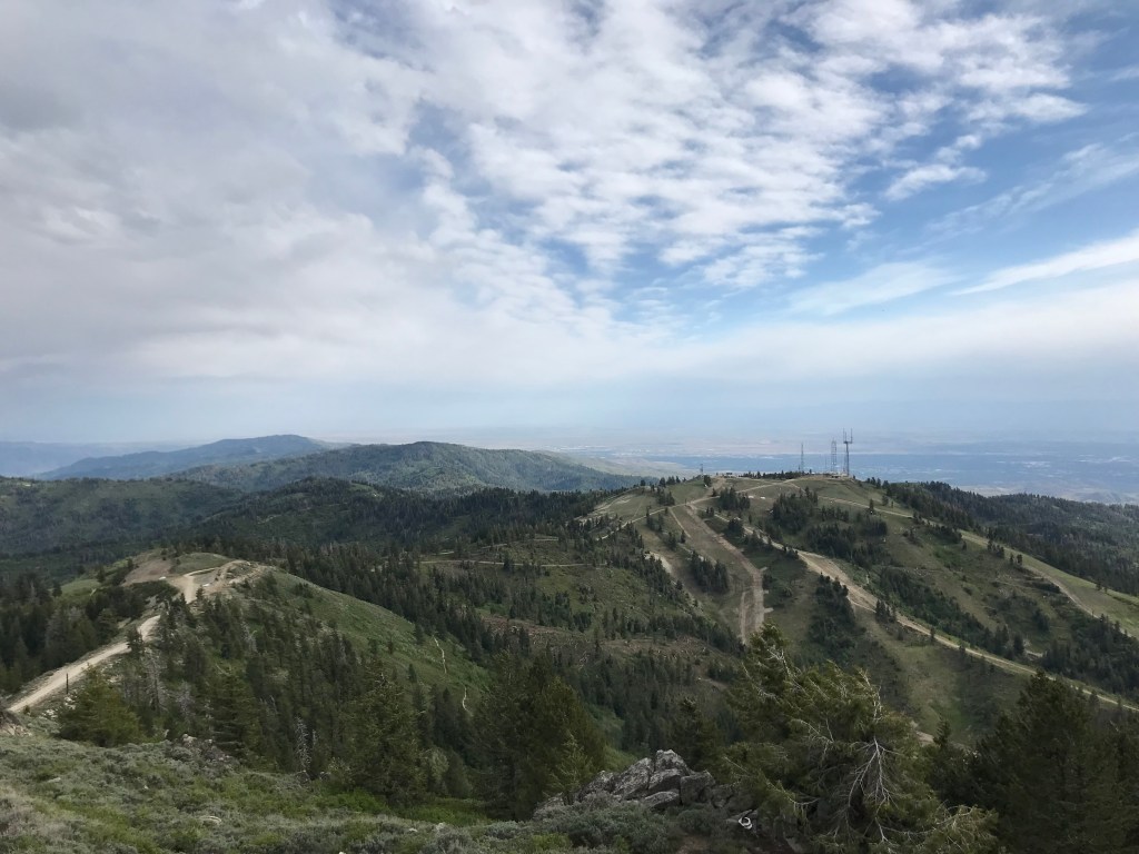
This shorter loop starts from Pioneer Lodge at Bogus Basin and gradually ascends to the summit of Shafer Butte, where a fire lookout tower built in 1958 stands among modern radio antennae and other ski area out-buildings. This loop is a great option if you want a short, easy hike to the top with a quick descent to the lodge. The views-to-lung workout ratio on this one are high!
Trail Stats
- Season: June to October
- Difficulty: Easy
- Type: Loop
- Surface: Dirt single track, dirt road
- Distance: 5.0 miles
- Starting elevation: 6,762 feet
- Elevation gain: 876 feet
Downloadable GPX route via AllTrails
Freddy’s Stack Rock – Eastside – Sinker Creek – Mr. Big Loop
I hold the unpopular opinion that Stack Rock is one of the most disappointing hiking destinations in Boise. It’s a long loop, it’s always crowded with unprepared people, and you get to the end and… it’s just a big rock. I love unique geology, but I just can’t get onboard with a giant boulder that blocks a better view of the valley behind it.
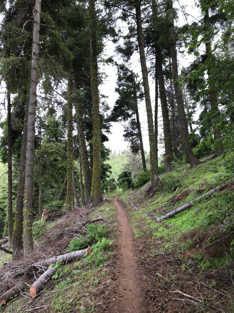
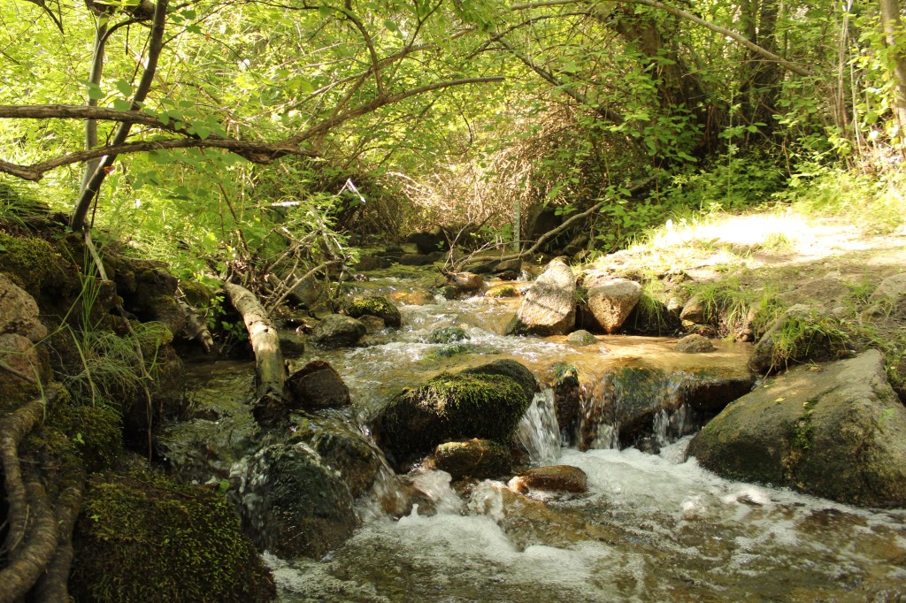
I much prefer this loop, which starts on Freddy’s Stack Rock Trail from the lower “trailhead” at the intersection with Bogus Basin Road. At the big intersection with Eastside, Sweet Connie, and Mr. Big, this route turns north onto Eastside before dropping down onto Sinker Creek, one of my absolute favorite places in the system. Here, the woods are dense, tall, and wet, with mosses and thick grasses blanketing the forest floor. It’s akin to a slice of the Pacific Northwest’s rainforests tucked into a beautiful little ravine. The hike returns to the intersection on Mr. Big before retracing Freddy’s SRT to the trailhead.
Trail Stats
- Season: May to November
- Difficulty: Moderate to hard
- Type: Out-and-back with loop
- Surface: Dirt single track
- Distance: 9 miles
- Starting elevation: 5,591 feet
- Elevation gain: 1,160 feet
Downloadable GPX route via AllTrails
Dry Creek Area
Dry Creek – Shingle Creek Loop
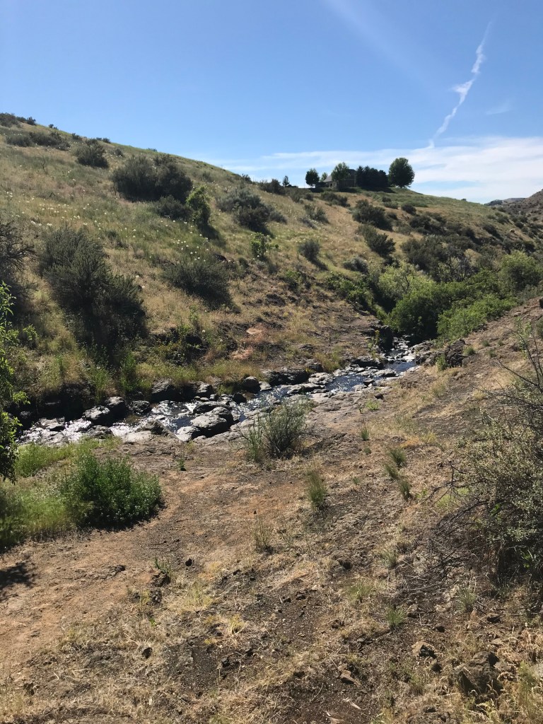
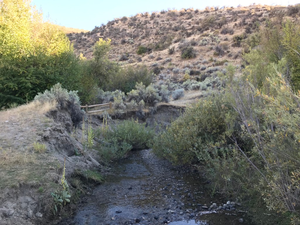
I think this is the quintessential “hard hike” in the system for those looking for high mileage and elevation gain along one route. I love Dry Creek because it’s named exceptionally poorly – it’s actually the only perennial creek that flows from the ridge to the river (pun intended), and red band trout spawn high into it’s well-shaded headwaters. My friend Nate and I first hiked here in July 2017, and it was a hellacious 96 degrees when we set off at 5pm. When we returned to the car in complete darkness at 10pm, it was a much more reasonable 95. We still loved it. I’d encourage you to start earlier in the day if you plan on hiking the entire loop, although the upper reaches are always much cooler and shadier.
Trail Stats
- Season: May to November
- Difficulty: Hard
- Type: Out-and-back with loop
- Surface: Single track dirt
- Distance: 13.25 miles
- Starting elevation: 3,450 feet
- Elevation gain: 2,210 feet
Downloadable GPX route via AllTrails
Bitterbrush – Chukar Butte – Currant Creek – Red Tail
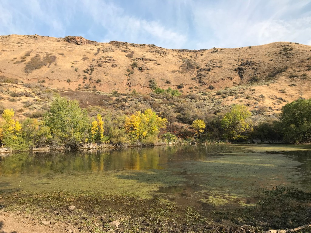
If you’ve ever been hiking in the foothills on a 90-degree plus day as mentioned above, you might’ve hoped you’d stumble onto an oasis. I never actually thought I’d find one, but then I hiked Chukar Butte and discovered the beautiful cow pond tucked away in a notch in the butte. While I wouldn’t swim in it, the willow-lined pool is a welcome respite from on otherwise dusty foothills trail. I’d suggest turning around there, although the intersection with Sweet Connie isn’t much further and brings this route to about 10 miles. The combination with Bitterbrush, Currant Creek, and a small portion of Red Tail make for a great loop that will familiarize you with the trails in Hidden Springs.
Trail Stats
- Season: April to November
- Difficulty: Moderate
- Type: Loop with spur
- Surface: Single track dirt
- Distance: 7.34 miles
- Starting elevation: 3,088 feet
- Elevation gain: 880 feet
- Other information: Be respectful around the cow pond, as it lies on private ranching property with an easement for the trail
Downloadable GPX route via AllTrails
Currant Creek – Landslide Loop – Red Tail
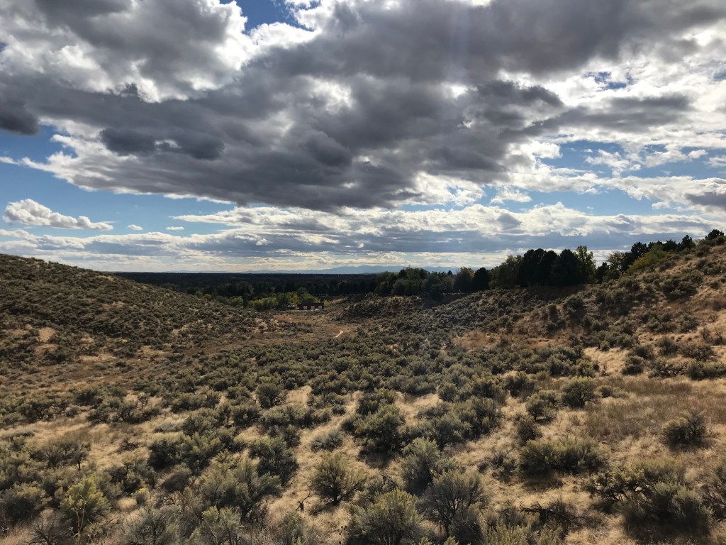
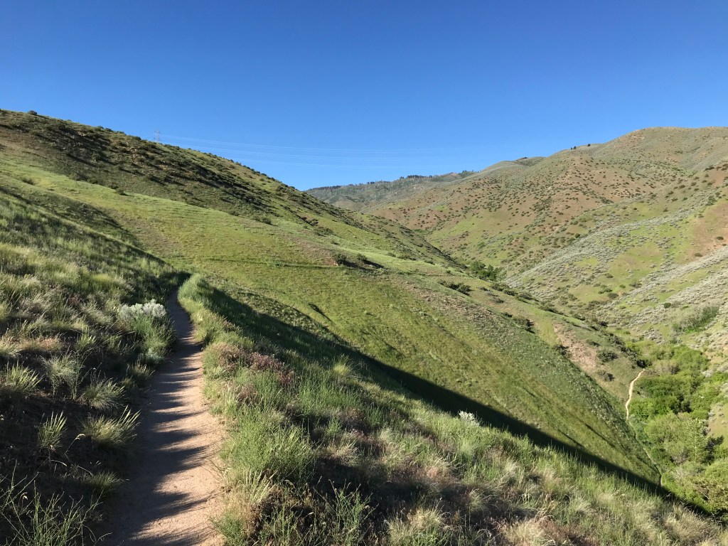
This loop offers all the best that a foothills trail can provide – shady, riparian habitat along a picturesque creek, hillsides blanketed with sagebrush and arrowleaf balsamroot, and excellent views of the Treasure Valley and Boise Mountains. If you’re in Hidden Springs (or willing to drive a little extra from downtown), I think this is the best loop to start with.
Trail Stats
- Season: April to November
- Difficulty: Easy
- Type: Loop
- Surface: Single track dirt
- Distance: 4.0 miles
- Starting elevation: 3,042 feet
- Elevation gain: 500 feet
- Other information: Landslide Loop is officially closed from December 1st to March 31st for wintering wildlife habitat
Downloadable GPX route via AllTrails
Peggy’s
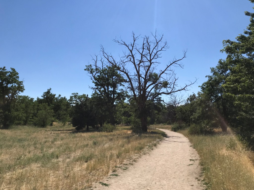
As you might’ve guessed from reading this far, I’m a sucker for a nice creek. Peggy’s trail parallels a scenic stretch of Dry Creek downstream from the Dry Creek trailhead and upstream from the Hidden Springs community. Interesting rock formations dot the grassy hillsides and cottonwood stands and oaks line the creek bed here. Because of it’s length, it’s tough to create a loop in this area less than 15 miles, so I’d suggest just hiking out-and-back on Peggy’s from the Cartwright Road Trailhead.
Trail Stats
- Season: April to November
- Difficulty: Moderate
- Type: Out-and-back
- Surface: Single track dirt
- Distance: 9.4 miles
- Starting elevation: 3,322 feet
- Elevation gain: 1,030 feet
Downloadable GPX route via AllTrails
North Boise/Eagle Area
Veteran’s – Rabbit Run – REI Connection – Big Springs Loop
If you’re interested in mountain biking too, this route takes you through the Eagle-Ada Bike Park, 200 acres of trails, tracks, and jump lines for bikers of all abilities to hone their skills. The rest of the hike is along quieter stretches of trail with great views of Eagle.
Trail Stats
- Season: April to November
- Difficulty: Easy
- Type: Out-and-back with multiple loops
- Surface: Single track dirt
- Distance: 3.8 miles
- Starting elevation: 2,648 feet
- Elevation gain: 510 feet
Downloadable GPX route via AllTrails
Polecat Reserve
Polecat Loop – Doe Ridge – Polecat Loop
This is the short version of one of the most popular loops in the entire system, and it’s easy to see why when you hike it. You can opt for the long loop that sidewinds around the hills, but I like to take the shortcut on Doe Ridge before picking up the loop again. There’s not much else to say about this one… go check it out and see for yourself!
Trail Stats
- Season: April to November
- Difficulty: Easy
- Type: Loop
- Surface: Single track dirt
- Distance: 5.1 miles
- Starting elevation: 3,010 feet
- Elevation gain: 715 feet
- Other information: Polecat Loop is part of the Special Trail Management program and all users must travel in a clockwise direction
Downloadable GPX route via AllTrails
Harrison Hollow Reserve
Full Sail – West Climb – Buena Vista – Kemper’s Ridge Loop
Full Sail starts from the park at Hillside Junior High, parallels the cart path on hole 16 of Quail Hollow Golf Course, then ascends into the foothills and curls around to Harrison Hollow Reserve via West Climb and Buena Vista trail. The apex on Kemper’s Ridge offers exquisite views of the golf course and surrounding neighborhoods, and the return loops back on Buena Vista.
Trail Stats
- Season: April to November
- Difficulty: Easy to moderate
- Type: Out-and-back with multiple loops
- Surface: Single track dirt
- Distance: 5.4 miles
- Starting elevation: 2,723 feet
- Elevation gain: 770 feet
Downloadable GPX route via AllTrails
Harrison Ridge – Who Now Loop – Harrison Hollow
Harrison Hollow is a great trailhead if you want a quick workout or scenic walk after work, with a variety of easy and moderate trails to create your own loop from. This route will give you a good introduction to the area, which is popular with dog walkers, as leashes aren’t required.
Trail Stats
- Season: Year-round if not muddy
- Difficulty: Easy
- Type: Figure eight
- Surface: Single track dirt
- Distance: 3.7 miles
- Starting elevation: 2,756 feet
- Elevation gain: 440 feet
Downloadable GPX route via AllTrails
Camel’s Back Park/8th Street Area
Camel’s Back – Red Fox – Chickadee Ridge – Kestrel – Owl’s Roost – Gold Finch – Florence’s Trail
One of the most iconic trails in the Ridge to Rivers system is the staircase up Camel’s Back Hill at Hyde Park, which rises at almost a 40% grade to a great viewpoint of downtown Boise and the North End. From there, this route continues along popular, well-shaded trails to the Foothills Learning Center before looping back to the park. If you want a quick workout up the steps followed by a relaxing nature walk, this is a great option. I’d highly recommend exploring the Hyde Park neighborhood afterwards for dinner, drinks, or desserts.
Trail Stats
- Season: Year-round if not muddy
- Difficulty: Easy
- Type: Loop
- Surface: Single track dirt, doublewide dirt and gravel
- Distance: 3.0 miles
- Starting elevation: 2,752 feet
- Elevation gain: 325 feet
Downloadable GPX route via AllTrails
Kestrel – Crestline – Lower Hull’s Gulch
This loop starts with a relatively easy ascent up Kestrel before turning towards the hills on Crestline and maintaining elevation until the Hull’s Creek crossing and intersection with Lower Hull’s Gulch, which parallels the creek down a narrow ravine that gradually opens into a wide meadow. This is an extremely popular trail with hikers and bikers – hence the addition of the Special Trail Management strategy listed below.
Trail Stats
- Season: April to November
- Difficulty: Easy
- Type: Loop
- Surface: Single track dirt
- Distance: 5.25 miles
- Starting elevation: 2,899 feet
- Elevation gain: 650 feet
- Other information: Lower Hull’s Gulch is part of the Special Trail Management program and can only be hiked on even-numbered days of the month (it is only open to downhill mountain biking on odd-numbered days)
Downloadable GPX route via AllTrails
Hull’s Gulch Interpretive Trail Loop
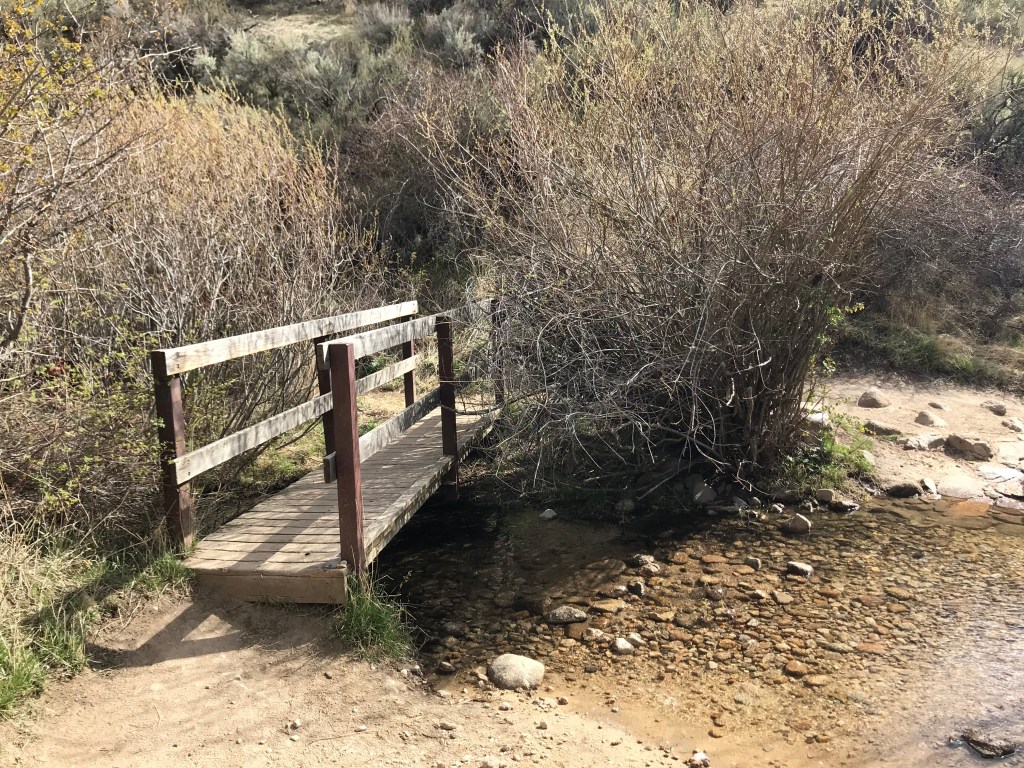
One of the few trails in the system only open to hikers, Hull’s Gulch Interpretive Loop starts from a higher trailhead than the previous entry and continues uphill, gradually ascending and crossing the creek on steel bridges several times before navigating a rocky loop at the top, where cooler air and views of pine trees on Boise Ridge complement a small waterfall that tumbles under the final bridge crossing. In the late summer, sunflowers and stalks of great mullein tower over the trail.
Trail Stats
- Season: April to November
- Difficulty: Easy to moderate
- Type: Out-and-back with loop
- Surface: Single track dirt, rock
- Distance: 6.6 miles
- Starting elevation: 3,833 feet
- Elevation gain: 1,110 feet
Downloadable GPX route via AllTrails
Hull’s Gulch Interpretive Trail – Scott’s – Corrals
I wasn’t initially planning on including repeat routes in my list, but Hull’s Gulch deserves to be hiked more than once, and this longer loop includes two other trails that are hard to loop in with anything else. From the waterfall apex of Hull’s Gulch, hikers will stay high and cross the road to access Scott’s, which descends 600 feet quickly to Corrals, a long trail that connects Bogus Basin Road to 8th Street just below the Upper Hull’s Gulch trailhead.
Trail Stats
- Season: April to November
- Difficulty: Moderate
- Type: Loop
- Surface: Single track dirt, rock
- Distance: 7.7 miles
- Starting elevation: 3,833 feet
- Elevation gain: 1,400 feet
Downloadable GPX route via AllTrails
Military Reserve
Military Reserve Connection – Crestline – Sidewinder – Fat Tire Traverse – Freestone Ridge – Three Bears
This route will show you how easy it is to get from one trailhead to another, as you start from the Military Reserve area then ascend to Crestline, which is also easily accessed from the Lower Hull’s Gulch trailhead. From there, you’ll leave Crestline to ascend Sidewinder, before skirting a high hillside on Fat Tire Traverse and descending a steep spine on Freestone Ridge – be mindful of mountain bikers here, because I bet they can go fast. From Freestone, you catch the end section of Three Bears, which returns you to the Military Reserve near the archery range. Depending on where you parked, you can walk along the road or on Ridge Crest or Mountain Cove back to your vehicle.
Trail Stats
- Season: April to November
- Difficulty: Moderate
- Type: Loop
- Surface: Single track dirt, dirt road
- Distance: 7.3 miles
- Starting elevation: 2,913 feet
- Elevation gain: 1,170 feet
Downloadable GPX route via AllTrails

Mountain Cove – Ridge Crest – Toll Road
This easy route is great in the dog days of summer, when it’s routinely pushing 100° in Boise. There is shade along Mountain Cove and Toll Road, with an easy up-and-down along Ridge Crest between them.
Trail Stats
- Season: Year-round if not muddy
- Difficulty: Easy
- Type: Loop
- Surface: Single track dirt, dirt road
- Distance: 2.8 miles
- Starting elevation: 2,792 feet
- Elevation gain: 315 feet
Downloadable GPX route via AllTrails

Eagle Ridge – Cottonwood Creek – The Ponds Loop
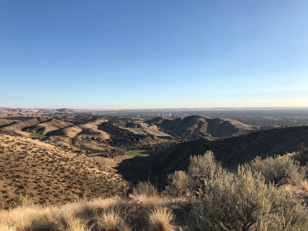
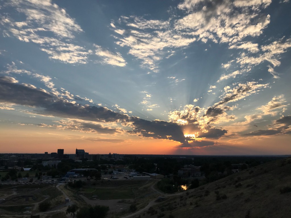
Eagle Ridge is less than a mile from the Capitol, offering exceptional vistas of downtown Boise with minimal effort. I’d recommend timing your hike to coincide with sunset for optimal viewing pleasure. The return along Cottonwood Creek weaves in and out of poplar stands, and a chorus of bullfrogs, crickets, and songbirds will accompany your trek.
Trail Stats
- Season: Year-round if not muddy
- Difficulty: Easy
- Type: Figure eight
- Surface: Single track dirt
- Distance: 2.7 miles
- Starting elevation: 2,746 feet
- Elevation gain: 230 feet
Downloadable GPX route via AllTrails
Rocky Canyon Area
Shane’s Trail – Three Bears Loop
Rocky Canyon Road passes through a narrow, gate-like chasm near the trailhead for Shane’s, which steeply ascends the canyon wall before looping around a high bluff with Three Bears. From here, you’ll see how larger loops with the Military Reserve and upper foothills trails can be made.
Trail Stats
- Season: April to November
- Difficulty: Easy to moderate
- Type: Loop
- Surface: Single track dirt
- Distance: 3.4 miles
- Starting elevation: 3,265 feet
- Elevation gain: 530 feet
Downloadable GPX route via AllTrails
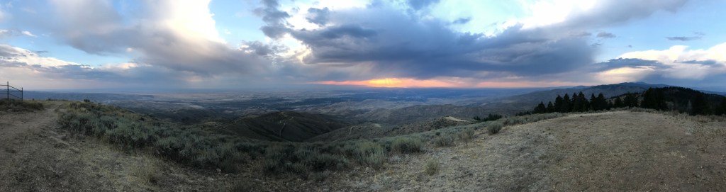
Five Mile Gulch – Watchman – Three Bears
There is a certain serenity in being this high up in the foothills, especially later in the day as the setting sun illuminates the velvety grass in golden light. Five Mile Gulch ascends along a scenic creek before branching off to Watchman, where you’ll feel like you’re much higher in the mountains as you flank a hillside over a deep, steep gulch. A quick descent down Three Bears returns you to the trailhead in scenic Rocky Canyon.
Trail Stats
- Season: April to November
- Difficulty: Moderate
- Type: Loop
- Surface: Single track dirt
- Distance: 6.0 miles
- Starting elevation: 3,809 feet
- Elevation gain: 1,010 feet
Downloadable GPX route via AllTrails
Orchard Gulch
If you continue a little farther up Rocky Canyon Road past the Five Mile Gulch trailhead, you arrive at Orchard Gulch, named for the variety of fruit trees that grow along the creek. I’d recommend hiking it as an out-and-back to the intersection with Five Mile Gulch, which you can continue on all the way to Boise Ridge Road. If you opt for the tougher workout, add 2.9 miles and 1,120 feet of elevation gain.
Trail Stats
- Season: April to November
- Difficulty: Easy to moderate
- Type: Out-and-back
- Surface: Single track dirt
- Distance: 3.2 miles
- Starting elevation: 4,178 feet
- Elevation gain: 570 feet
Downloadable GPX route via AllTrails
Table Rock Area
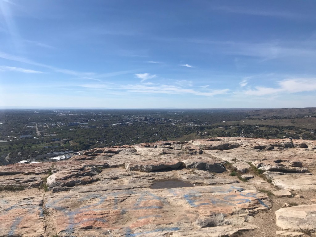
Shoshone-Bannock – Shoshone-Paiute – Quarry – Access Trail – Table Rock Loop
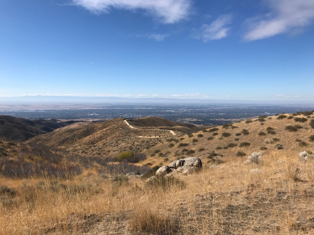
If you’re not quite ready to tackle Table Rock yet, this route around Eagle Rock is a great short loop with nice views of downtown and southeast Boise. I’ve also included a quick loop through the neighborhood behind the rock, which takes you around a picturesque vineyard that was for sale last time I hiked it, if you’re interested. This will also give you a good introduction to the Old Pen, Botanical Gardens, and other museums in the area.
Trail Stats
- Season: Year-round if not muddy
- Difficulty: Easy
- Type: Loop
- Surface: Single track dirt, dirt road
- Distance: 2.7 miles
- Starting elevation: 2,736 feet
- Elevation gain: 335 feet
Downloadable GPX route via AllTrails

Old Pen – Table Rock – Table Rock Quarry Loop
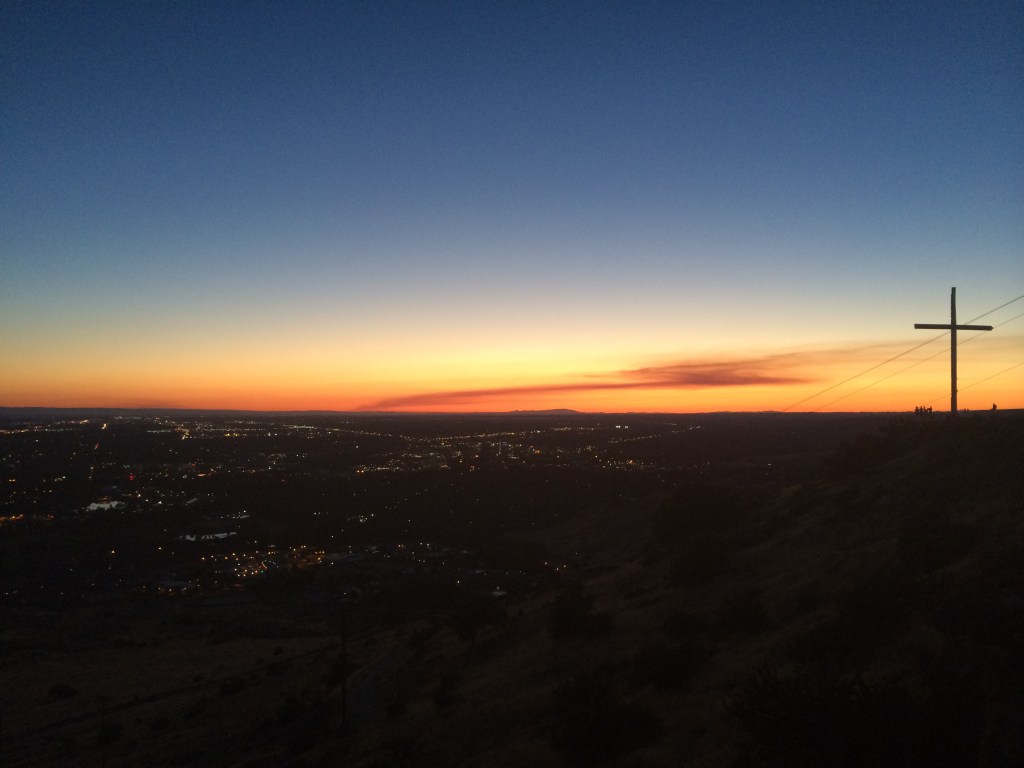
I often refer to Table Rock, Stack Rock, and Jump Creek Falls as “Holy Trinity of Basic Boise Hikes” due to their popularity and frequency of Instagram posts, and while I don’t want to gatekeep hiking, you can tell someone hasn’t hiked anywhere else if they list any of these three as their favorite. However, that doesn’t mean that they’re not good or worth doing, and I do encourage all new Boiseans to hike or drive to the cross at Table Rock to enjoy a sunset. This route utilizes Old Pen for the ascent, then avoids the steep uphill section of the main Table Rock trail, opting instead to go around the side via the quarry before descending the normal route. Bring more water than you think you’ll need – it’s always a little steeper and hotter than you expect!
Trail Stats
- Season: Year-round if not muddy
- Difficulty: Moderate
- Type: Figure eight
- Surface: Single track dirt, doublewide dirt
- Distance: 3.9 miles
- Starting elevation: 2,780 feet
- Elevation gain: 840 feet
Downloadable GPX route via AllTrails
Tram – Table Rock Quarry – Connector – Rock Garden – Rock Island West Loop
Tram is the quintessential workout trail in the system, as it follows the course of the old gondola that delivered sandstone from the quarry atop Table Rock to waiting freight trains at the Warm Springs Station below. Because of this, sections of it are exceedingly steep and will challenge the lungs of even the fittest hiker. I think everyone should try it once, and this loop offers a great variety of terrain on the mesa below Table Rock.
Trail Stats
- Season: Year-round if not muddy
- Difficulty: Hard
- Type: Out-and-back with loop
- Surface: Single track dirt, rock
- Distance: 4.2 miles
- Starting elevation: 2,726 feet
- Elevation gain: 925 feet
Downloadable GPX route via AllTrails
Lucky Peak Area
Homestead Trail
This out-and-back along Homestead Trail starts in the neighborhoods of Barber Valley and ascends to an intersection with Lucky Peak Trail. There are shady stretches, great views of the Barber Pool Conservation Area along the river, and a nice mix of steep and flat, making this a great option for a post-work workout in the summer.
Trail Stats
- Season: April to November
- Difficulty: Moderate to hard
- Type: Out-and-back
- Surface: Single track dirt, doublewide dirt
- Distance: 4.3 miles
- Starting elevation: 2,871 feet
- Elevation gain: 925 feet
Downloadable GPX route via AllTrails

Lucky Peak Trail – Shaw Mountain Road
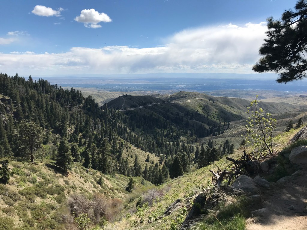
One of the four Grand Slam hikes, Lucky Peak offers a good training exercise for mountaineers interested in bagging higher and more difficult peaks later in the season, such as Idaho’s high point, Mount Borah. This loop is steep, exposed, and long, but the payoff is well worth it, and the Intermountain Bird Observatory camp at the summit is neat. This was my last hike to complete the Ridge to Rivers system, and while I won’t say I saved the best for last, it was certainly better than I expected.
Trail Stats
- Season: May to October
- Difficulty: Hard to Strenuous
- Type: Loop
- Surface: Single track dirt, dirt road, rock
- Distance: 9.6 miles
- Starting elevation: 4,285 feet
- Elevation gain: 2,340 feet
Downloadable GPX route via AllTrails
Oregon Trail Reserve
Ezra Meeker Loop – Joel Palmer Trail – Kelton Freight Trail
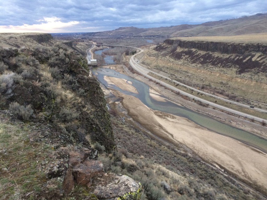
This newly adopted area gives users the opportunity to ponder the hardships of the pioneers who traveled to Idaho and beyond along the Oregon Trail. The old wagon ruts are visible along these trails, which are named after early settlers. This route ends at a beautiful overlook of the Boise River Canyon downstream from Lucky Peak Dam.
Trail Stats
- Season: Year-round if not muddy
- Difficulty: Easy
- Type: Loop with spur
- Surface: Single track dirt, rock
- Distance: 3.3 miles
- Starting elevation: 3,019 feet
- Elevation gain: 350 feet
Downloadable GPX route via AllTrails
System Stats
- Season: Ranges from all-year to summer and fall only
- Number of trails: 157
- Total distance: 238 miles
- Lowest point: City of Boise, 2,704 feet
- Highest point: Shafer Butte, 7,582 feet
- Total elevation gain: ~53,000 feet
Preparation
Here are the need-to-know details for hiking the Ridge to Rivers system:
- Bring your own water, there is no reliable water source in most of the foothills if you run out
- Route-finding is not necessary anywhere in the system, as all trailheads and intersections are signed
- Almost all Ridge to Rivers trails outside of the Bogus Basin/Stack Rock area are unshaded and exposed – protect yourself from the sun as needed
- While some trails have cell coverage, most don’t – make a plan and tell someone where you’re going before you leave
- Be respectful to other trail users and leave no trace!
