The Trinity Peak fire lookout tower watches over some of the most magnificent and expansive terrain in the Boise Mountain Range, including the nine lakes along Rainbow Basin Trail, all of which can be hiked to in one day along this 12.4-mile route. If you’re seeking a trail that is as strikingly beautiful as any Sawtooth hike and as remote as an Owyhee canyon, the Rainbow Lakes are for you. EDIT: I returned in September 2023 for an Idaho Trails Association project. We spent three days clearing deadfall and overgrowth and creating irrigation bars – the trail is in tip-top shape!
On the Trail
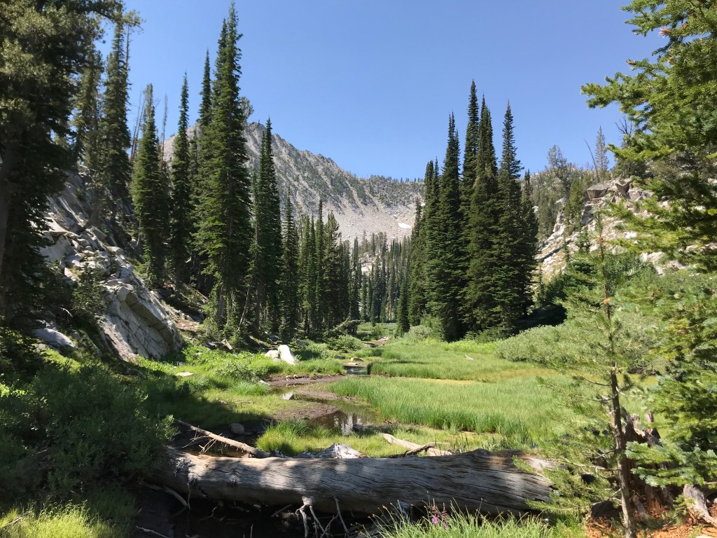
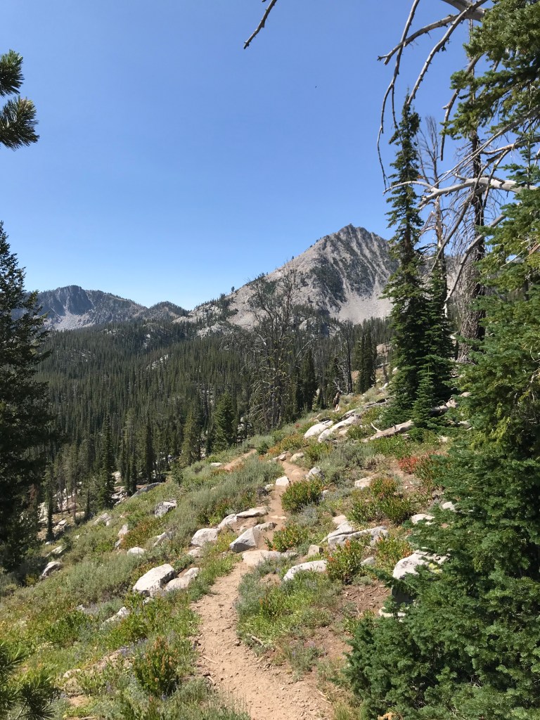
From the trailhead at Big Trinity Lake Campground, the trail ascends gradually through a meadow, then very steeply to the saddle between the Trinity Lakes drainage and Rainbow Basin. Don’t be dissuaded by this section – it’s by far the most difficult stretch and is worth the effort. From this vantage point, the lakes are concealed by thick forest and rocky ridges, but the views are still incredible. The descent into the basin is more gradual and features a dozen or so switchbacks and is much easier on the knees.
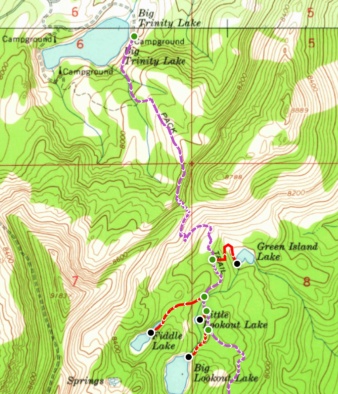
On these maps, the main trail is purple, with the spurs to each lake in red. If you only hike the main trail, the distance is reduced to about nine miles, but you will miss the most scenic points along the way.
Once the trail flattens out at 1.5 miles, look for an intersection on the with left with the spur to Green Island Lake. All of the intersections are signed, but some of them have fallen over or broken. The spur is 0.25 miles and loses about 100 feet quickly. There are a few small waterfalls and some great backpacking sites at Green Island Lake.
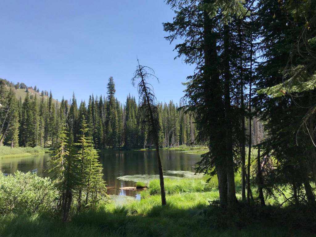
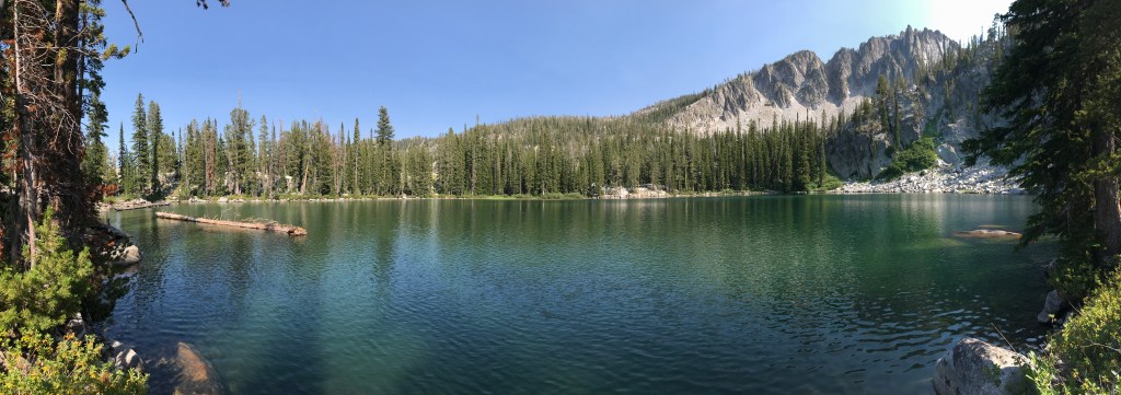
After another quarter mile on the main trail, the intersection for Fiddle Lake, named because of it’s shape, will be on the right. This was my favorite lake on the trail! The spur travels through a narrow meadow framing the lake and Trinity Peak in the distance, and there are several great backpacking spots here too. We saw large rainbow trout from the water’s edge, where we took our first snack break of the day.

The next intersection on the main trail is a short tenth of a mile from the previous turnoff and leads to Little Lookout Lake less than 200 yards away on the right. If you have a big backpacking group, there was a large flat space here that would be ideal for pitching four or five tents.

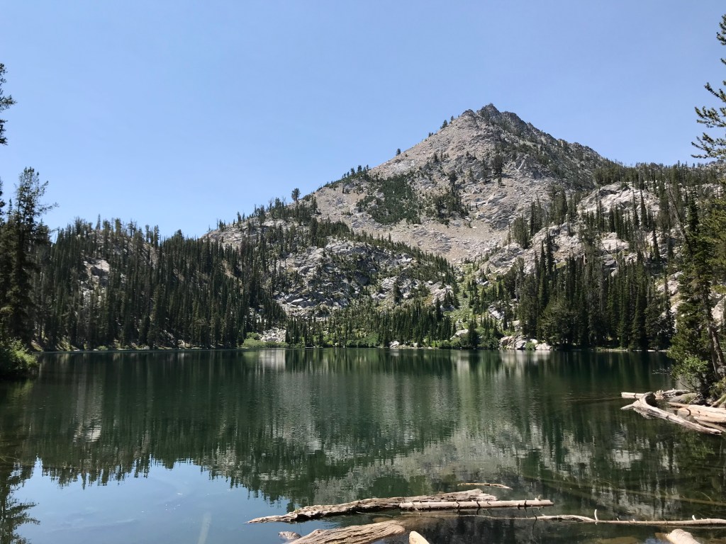
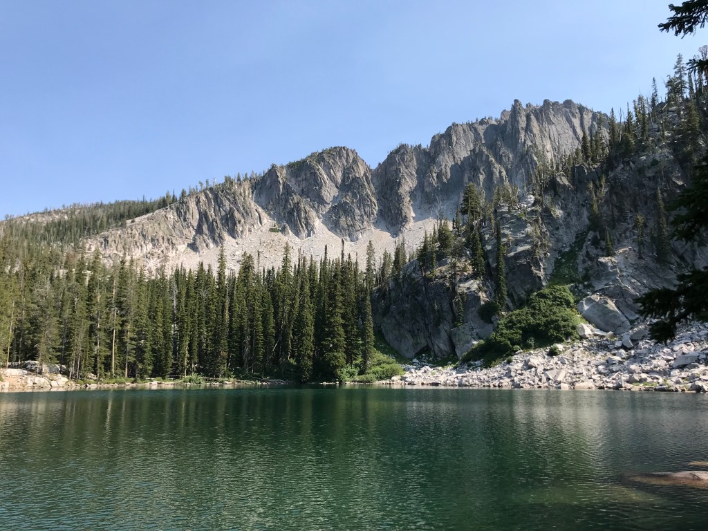
Another tenth of a mile on the main trail brings you to the turn for Big Lookout Lake on the right. Follow this spur uphill for 0.2 miles to the next lake, where the lookout tower perched precariously atop Trinity Peak is easily recognizable. The terrain here is rockier and more jagged, shaping a deeper lake with fewer campsites along the craggy shores. If you have young children or unathletic dog breeds, I’d suggest turning around here, as the overall length and difficulty of the trail increase steadily as you continue.
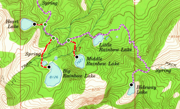
Once you return to the main trail, you’ll have about a mile of uninterrupted hiking to the next turnoff. This section descends a sneaky amount of elevation that you won’t notice until you return and have to climb back up. The forest here is thick and wildflowers grow abundantly where sun penetrates the pine canopy. Look for a turnoff on the right to Heart Lake – named for the deep heart-shaped basin it fills.
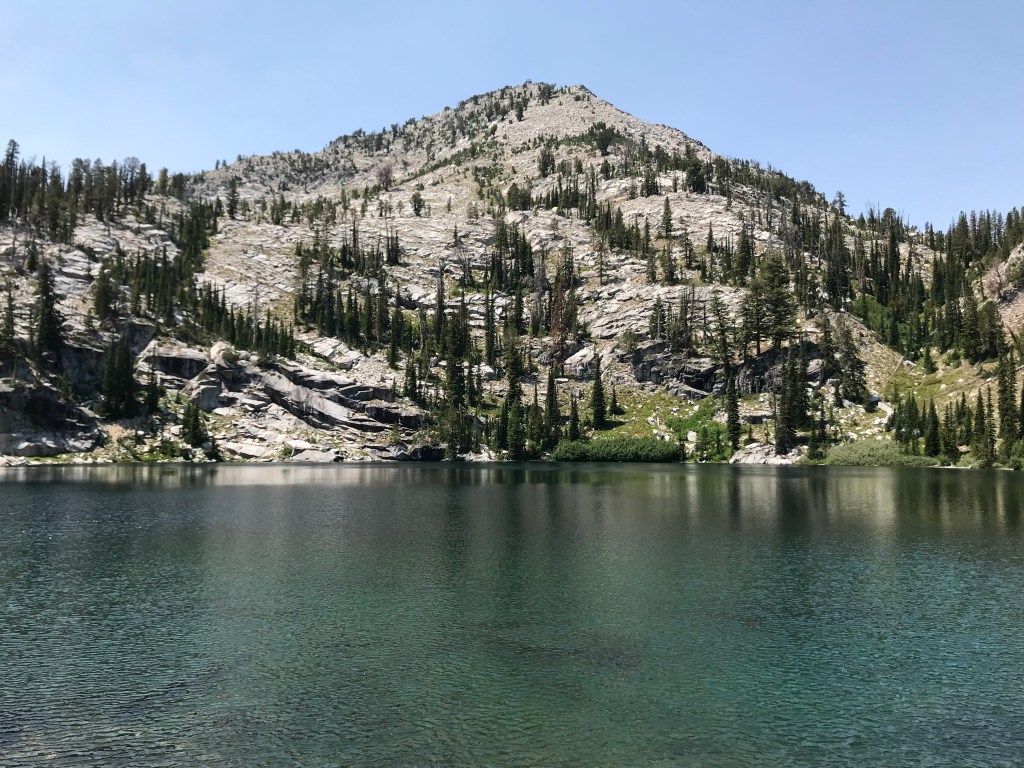
The next quarter mile on the main trail loses and then regains about 100 feet of elevation before the turnoff for the first of the three eponymous lakes on the route, Big Rainbow Lake, which is framed by jagged cliffs rather than Trinity Peak. Eyeballing the topographical map tells me that this is also the largest lake of the hike by surface area. My friend Aaron and I vowed to return here with backpacking gear, fishing poles, and an inflatable kayak.
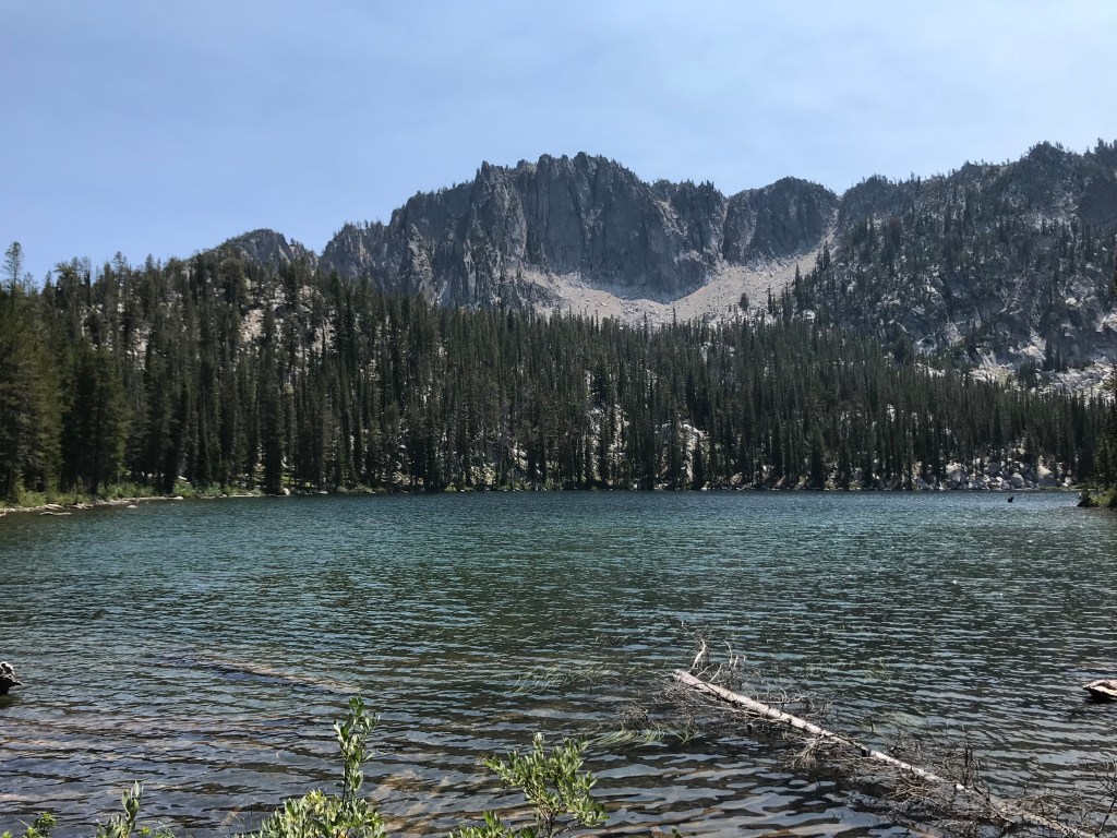
Another quarter mile later, the spur for Middle Rainbow Lake juts off the to the right, offering even better views of the vertical cliffs that punctuate the spine of the Trinity Range. The scenery here is remarkably similar to several Sawtooth lakes. This is the final spur, as the last two lakes are both on the main trail.
About a half mile of downhill hiking on the main trail brings you to Little Rainbow Lake, the lowest point in the basin at around 7,800 feet. After skirting the north shore, the trail crosses a picturesque meadow that seems like an ideal spot for deer or elk to graze on the lush grass. This is a great spot to take a snack break before the steep push to the final lake.

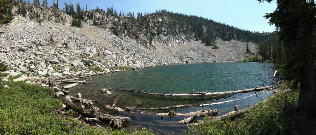
The ascent to Hideaway Lake rises over 600 feet in one mile, with steep, rocky sections that will elicit a burning sensation in the calves and lungs of hikers in good and bad shape alike. Unlike the other lakes thus far, Hideaway is tucked into a narrow, sheltered basin. Because the outbound took us longer than expected, we only stayed here long enough to eat a Clif bar and filter water into our CamelBaks to keep us hydrated on the inbound.
If you skip all the spurs on the return, the trail is about 4.6 miles with steady elevation gain from Little Rainbow Lake to the saddle between Rainbow Basin and Big Trinity Lake. Ensure you bring enough water, electrolytes, and snacks for the entire trail if you plan on visiting every lake. We brought a picnic lunch to enjoy at a campsite at the trailhead, which I’d absolutely recommend, considering the drive time back to Boise.
Trail Stats
- Season: June to October
- Difficulty: Moderate to hard
- Type: Out-and-back with spurs
- Surface: Single track dirt
- Distance: 12.4 miles
- Starting elevation: 7,768 feet
- Elevation gain: 2,780 feet

My Rating
I’d rate this as a top five hike in Idaho, no question. If you love the Sawtooths but want to try something a little different and less crowded that will still wow you with amazing scenery, Rainbow Basin is an excellent choice. I’ll be back this summer to hike some of the other trails in the Trinity Range.
How to Get There
Much like the Upper Lava Mountain Trailhead, the Big Trinity Lake Campground and Rainbow Basin trailhead are less than 40 miles from Boise in a straight line, but three hours away driving due to the circuitous route on dirt roads. The route on NF-172 from Featherville is suitable for all vehicles, while the route on NF-123 and NF-129 from Fall Creek Resort & Marina is not, despite what navigation apps tell you. Here is the step-by-step navigation from the intersection of Interstate 84 and US-20 in Mountain Home, or use these steps:
- Proceed northeast on US-20 for 31.7 miles
- Turn left onto NF-61/Louse Creek Road
- Continue 18.1 miles to the town of Pine
- Turn right onto NF-61/N Pine-Featherville Road
- Continue 9.7 miles to the town of Featherville
- Turn left onto NF-172/Trinity Mountain Road
- Continue 7.2 miles to a hairpin intersection
- Turn sharp right to continue on NF-172/Trinity Mountain Road
- Continue 6.9 miles to a T-intersection
- Turn left onto NF-129/Trinity Mountain Road/Trinity Ridge Road
- Continue 3.2 miles to an intersection at Big Trinity Lake
- Turn left onto NF-129E and follow it around the north and east sides of the lake to the campground and trailhead, a little under a mile
Preparation
Boise National Forest
Mountain Home Ranger District
(208) 587-7961
Interactive Map of Road, Trail, and Area Closures
Here are the need-to-know details for hiking Rainbow Basin:
- This is black bear country – carry personal protection and know what to do in an encounter (here is a handy guide from the Humane Society of the United States)
- There are a few steep sections along the trail, but it is suitable for children and dogs
- There are several water crossings; however, most of them are shallow creeks less than three feet wide and can be easily hopped over or walked through
- There are numerous sources to pump and filter water from
- Route-finding is not necessary at any point on this trail
- Most of the trail is well-shaded by pine trees – protect yourself as needed
- Most of the elevation gain is on the return leg – plan accordingly and understand your own abilities
- Be respectful to other trail users and leave no trace!
Other Useful Resources
- Downloadable GPX route via AllTrails
- The Hiker’s Guide: Exploring Greater Boise by Scott Marchant
- Trails of Western Idaho by Margaret Fuller
- Topographical map via Natural Atlas
