It’s been a few months since my last post, and in that time, I’ve officially eclipsed one thousand miles of hiking since the COVID-19 shutdown in early 2020! Throughout the summer, I’ve maintained my goal of 40 miles per month, bringing my 2022 total to 177 miles. Unfortunately, many of those miles have been on trails deemed non-blog worthy – usually decided by popular vote of whoever is hiking with me. Last weekend we finally struck gold on a beautiful hike to several alpine lakes just south of McCall!
On the Trail
If you’re familiar with popular hikes around McCall, you’ve probably been to the Boulder Meadows Reservoir Trailhead to hike to Louie Lake. While that’s on my list too, I set out last weekend intending to hike 10+ miles and get away from some of the crowds, so I opted to visit Boulder Lake, Rapid Lake, and Vic’s Lake via Boulder Creek Trail and North Fork Kennally Creek Trail, which are accessed from the same trailhead. As seen below, the route is an out-and-back (purple) with a very short spur to the shore of Rapid Lake (red). In total, we hiked about 11 miles and 2,000 feet of elevation gain, but it felt much easier than that. If you’re looking for a great half- to full-day trip from Boise that has a little bit of everything, keep reading!
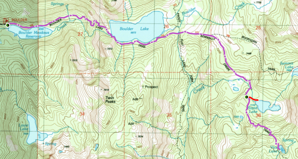
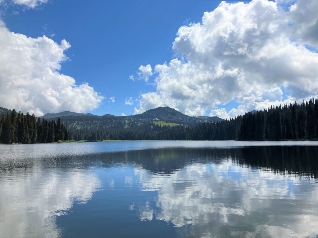
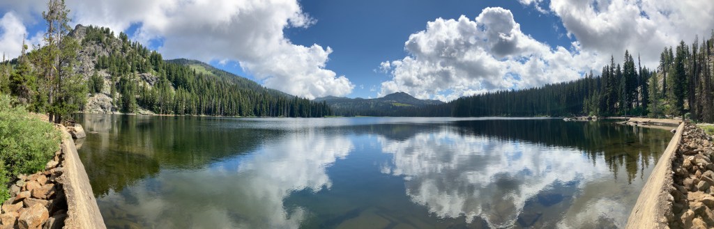
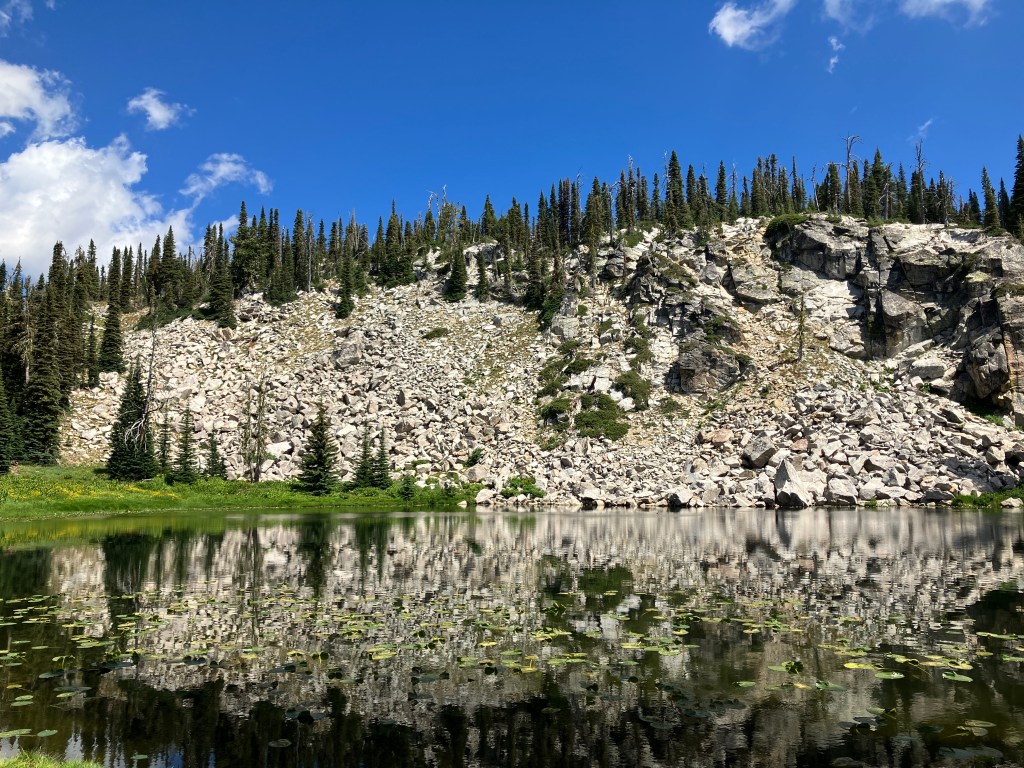
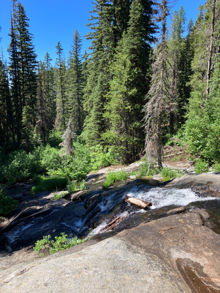
From the trailhead, you’ll ascend to the dam and skirt the north side of Boulder Meadows Reservoir for about a half-mile. Between pine trees, look across the water for the pointed apex of Jug Mountain to the south. After leaving the reservoir, you’ll steadily gain elevation up a shady hillside. At the one-mile marker, you’ll enter rockier terrain and navigate the first of a few switchbacks. Over the next three quarters of a mile, the grade steepens and the trail traverses huge slabs of granite. If you’re there early in spring or during a high-water year like we were, look for rogue streams spilling down the smooth slabs. At 1.8 miles, you’ll reach the rudimentary dam holding back Boulder Lake, which is framed impressively by the 8,458-foot Buckhorn Mountain.
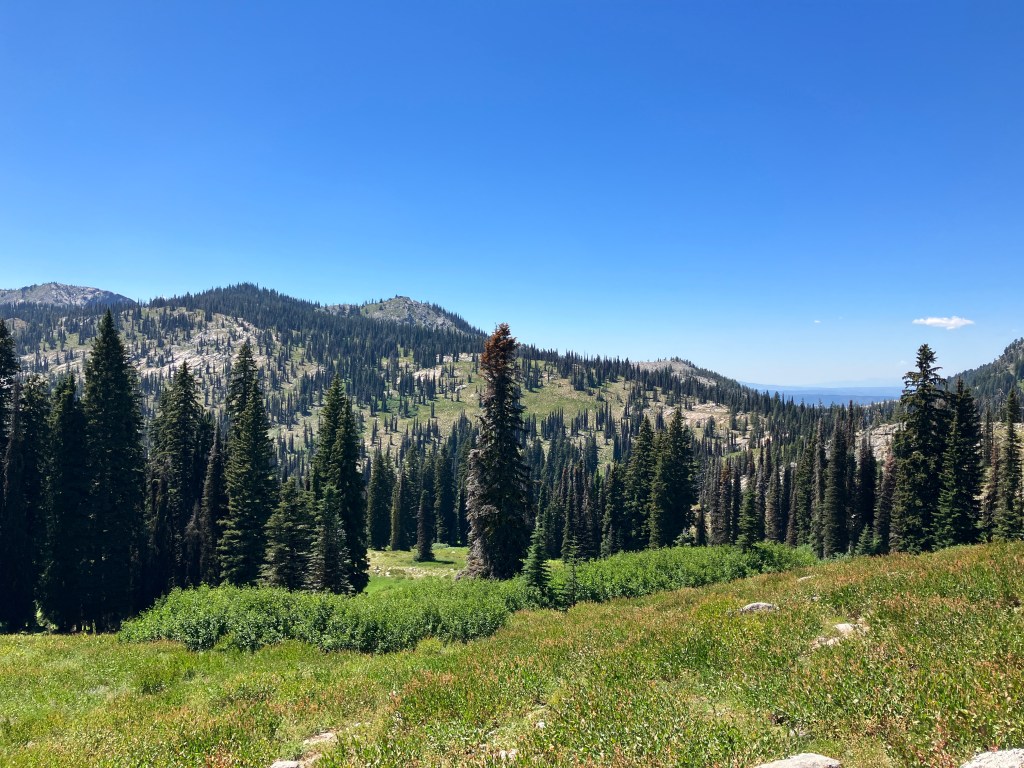
If you’re interested in turning your outing into a weekend backpacking trip, there are dozens of great campgrounds dotting the south shore of Boulder Lake. It’s central location makes it a great base camp to explore several trails in the area. If you’re day hiking like we did, follow the trail as it parallels the lake for three quarters of a mile. Pass an unsigned intersection with a trail on the right that loops back to Louie Lake. Shortly after, pass straight through a four-way intersection. Here, 2.5 miles from the trailhead, Boulder Lake Trail becomes North Fork Kennally Creek Trail. Ascend an open meadow for a half-mile to a Y-intersection and take the right fork. The left fork is Buckhorn Creek Trail, which I’ll return to hike soon.
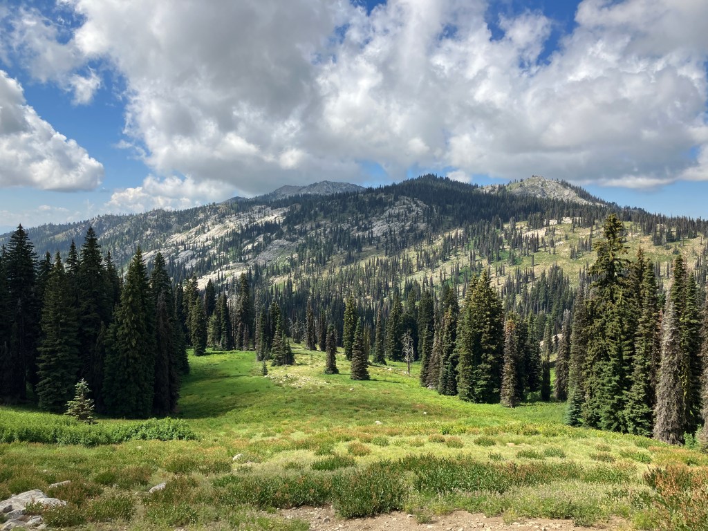
After the intersection, the trail turns southeast and crosses an open hillside bestrewn with wildflowers. Descend to cross a marshy meadow, cross Rapid Creek, then ascend a gentle slope to another grassy opening. Four miles from the trailhead, the short spur to Rapid Lake splits off the left. It’s only 0.2 miles and another creek crossing to the west shore, a great spot to stop for a snack. Look for Columbia spotted frogs and tadpoles in the shallow, clear waters. There are several good backpacking sites around the north side of the lake, which sits picturesquely below 8,258-foot Rapid Peak.
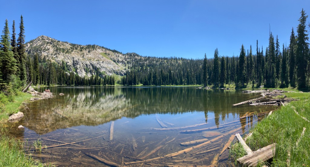
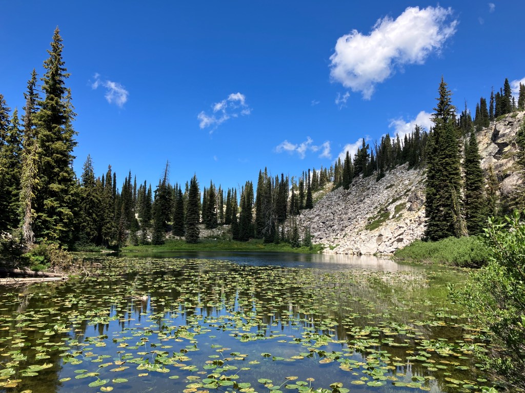
Back on the main trail, it’s one more mile and 400 feet of gain to Vic’s Lake, nestled just on the other side of a high saddle. There are two obvious campsites next to the lily pad-covered lake, both of which offer excellent photo opportunities and shady lunch spots. Our only company here was a lone loon floating on the calm water, occasionally diving for fish – even the mosquitos were few and far between! Had we visited a few weeks later, lily flowers would’ve been in full bloom. Nevertheless, Vic’s Lake is a delightful destination for a solid 10-mile hike that can be easily day-tripped from Boise.
Those looking for an extended adventure can continue down the trail to an intersection just beyond Vic’s Lake. The right fork descends 250 feet in a half-mile to Fogg Lake, while the left fork ascends 350 feet in six-tenths of a mile to Kennally Creek Summit at 7,914 feet. In his guidebook, Scott Marchant recommends ascending to the summit, then turning south off-trail to a knoll with a view. Lamentably, we didn’t have time for either of these due to a barbecue in Boise later in the evening. In any case, to return to the trailhead, simply retrace your steps and hike back the way you came.
Trail Stats
- Season: June to October
- Difficulty: Moderate to hard
- Type: Out-and-back with short spur to Rapid Lake
- Surface: Single track dirt, rock
- Distance: 11.0 miles
- Starting elevation: 6,240 feet
- Elevation gain: 2,020 feet
My Rating
I had lofty expectations for this trail, and it exceeded all of them! It’s well-maintained, the lakes are beautiful, the views are marvelous, and there is plentiful shade. It was still extraordinarily green in mid-August and the creeks and lakes were overflowing. The crowds were moderate and dwindled as we moved further up the route, offering the solitude we’re always seeking in Idaho’s wilderness. I’d highly recommend this hike to anyone in Boise or McCall!
How to Get There
The Boulder Meadows Reservoir Trailhead is a quick 25 minutes off of Highway 55 when driving from the south and even less if you’re coming from McCall or other points north. Only the last five miles are dirt and gravel, and it’s well-graded save for a few corners with potholes and weather erosion. Just about any type of vehicle should be able to make it, but lower-riding sedan drivers will need to be vigilant. This trailhead is typically busy due to the popularity of Louie Lake Trail and the myriad other trails that branch off within a few miles. Here is the step-by-step navigation from the intersection of Highway 55 and Lake Fork Road from Lake Fork, or use these steps:
- Turn right (east) onto Lake Fork Road
- Continue 1.8 miles to a four-way intersection at the entrance of Jug Mountain Ranch Golf Course
- Turn left onto Durham Lane/Farm to Market Road
- Continue 2.8 miles to an angled intersection
- Turn sharp right onto Boulder Lake Road
- Continue 3.2 miles – Google Maps may tell you to continue straight here, but the road is closed and the correct route corners sharp left and uphill
- Continue 2.2 miles on Boulder Lake Road, avoiding minor roads on the left and right – this is where the few rough spots require attention
- Arrive at a large parking area just below the Boulder Meadows Reservoir dam and look for the trailhead at the northwest corner of the reservoir
If you’re driving from McCall, you’ll want to cut off a few miles by turning left (east) onto Elo Road and following it to Boulder Lake Road, as shown here.
Preparation
Payette National Forest
McCall Ranger District
(208) 634-0400
Maps & Publications
Here are the need-to-know details for hiking to Boulder Lake, Rapid Lake, and Vic’s Lake:
- This is black bear country – carry personal protection and know what to do in an encounter (here is a handy guide from the Humane Society of the United States)
- The initial ascent to Boulder Lake and the final ascent to the saddle above Vic’s Lake have steep and rocky sections, but are suitable for children and dogs
- There are several creek crossings, most of which are bridged; some smaller ones require hopping across strategically-placed rocks
- There are numerous sources to pump and filter water from
- Route-finding is not necessary at any point on this trail
- The stretch from the trailhead to the end of Boulder Lake is well shaded; after that, it is a mix of shaded and exposed – protect yourself from the sun as needed
- Much of the elevation gain is between the trailhead and Boulder Lake, with another steep stretch between Rapid Lake and Vic’s Lake – plan accordingly and understand your own abilities
- Be respectful to other trail users and Leave No Trace!
Other Useful Resources
- Downloadable GPX route via AllTrails
- The Hiker’s Guide: McCall and Cascade by Scott Marchant
- Trails of Western Idaho by Margaret Fuller
- Topographical map via CalTopo

One response to “Boulder Lake, Rapid Lake, and Vic’s Lake”
[…] the blog: We’d already hiked parts of this trail last year, which I wrote about in my post Boulder Lake, Rapid Lake, and Vic’s Lake. We liked those three lakes better than the combination of Summit and Louie Lakes, which is a […]
LikeLike