When you think “lakes in the Sawtooths,” your mind probably goes straight to Redfish, Alice, Toxaway, and Imogene – some of the most popular and beautiful hiking locations in the state of Idaho. While I’d highly recommend the latter three to anyone looking for an incredible backpacking loop and Redfish for boating or paddling, I’ve found two lesser-known lakes that are the perfect day trip for an introduction to the grandeur of the Sawtooth Range. Thirteen miles north of Stanley, you’ll find the Trap Creek Trailhead and the moderately easy trail to Marten and Kelly Lakes.
On the Trail
Coming in around 10 miles and less than 1,300 feet of uphill, this trail offers excellent value in terms of destinations and views per miles hiked and feet of elevation gained. You won’t find many other trails in the Sawtooths with such a gentle ascent – especially with lakes along the way. There are great campsites at both lakes if you’re interested in backpacking. I won’t ruin the surprise, but there’s an especially awesome spot on the west shore of Kelly Lake near the rock fall – look for it even if you’re day hiking and you’ll understand my quasi-secrecy in revealing it.

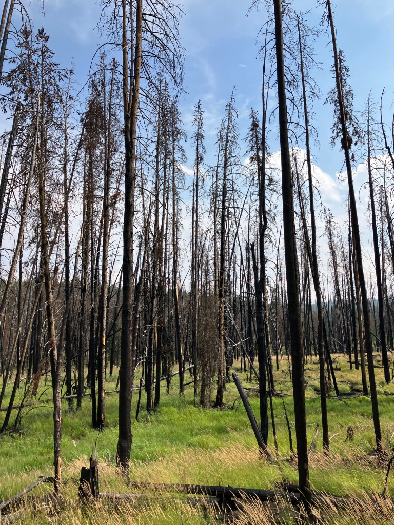
The trailhead and first mile or so burned intensely in September 2020, and the area has seen little vegetation regrowth since. The landscape is almost alien, comprised of densely packed, charred-black tree trunks, billowing grasses, a few irrepressible wildflower species, and ashy dirt. After traveling south for a half-mile, you’ll turn southwest at a meadow bisected by Trap Creek and travel up it’s drainage to Marten Lake.
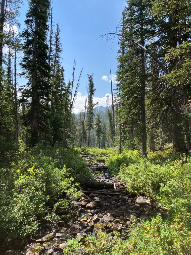
The next 3.5 miles are very non-descript hiking – you might even forget you’re in the Sawtooth Range. At the very least, the forest is alive and well, but the dense pines reduce views to slivers. The ascent is gentle along this stretch, picking up only 700 feet with a handful of short steep hills. You’ll pass a few small ponds and marshes that I’d wager are a cesspit of mosquitos and flies in the late spring, but we had no bug problems in late August. Around three miles in, you’ll traverse a series of small creek crossings. None are bridged, but they’re easy enough to navigate on rocks and deadfall. The final ascent to Marten Lake features boardwalks over a vibrant, marshy hillside.
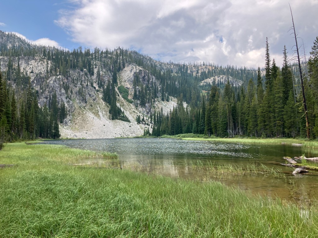
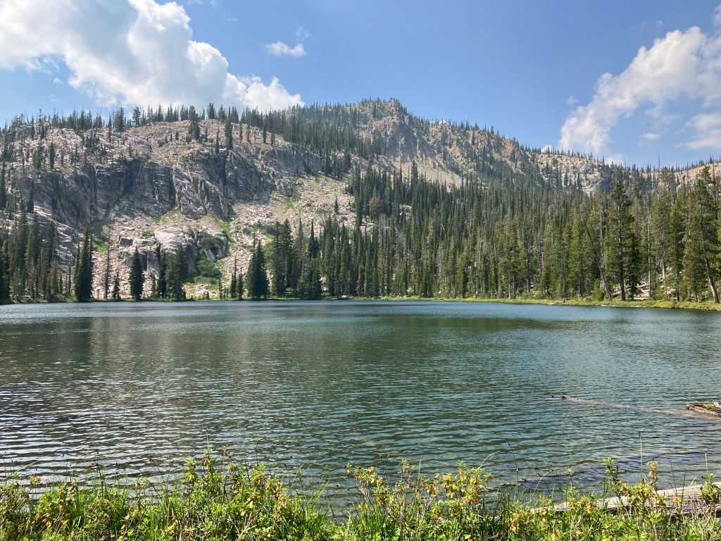
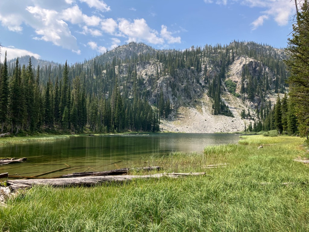
At four miles, you’ll arrive at an intersection with Swamp Creek Trail, which is open to dirt bikes. Continue straight through and down a short spur to the grassy outlet of Marten Lake, which is framed picturesquely by the ridge forming the boundary of Boise and Custer Counties. We saw loads of tadpoles and Columbia spotted frogs in the shallow, clear water. The right (north) side of the lake has a few great campsites. We found some great sitting logs in a muddy clearing and ate lunch here.
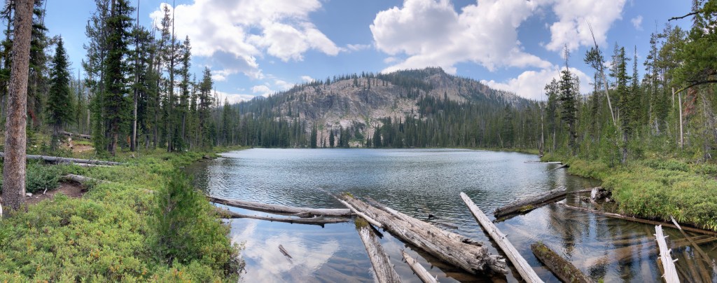
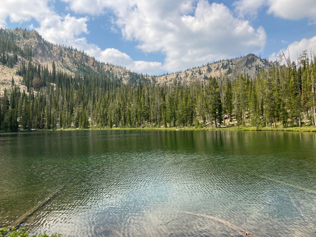
To continue, backtrack to the intersection and turn south (right) onto Swamp Creek Trail. It’s less than a mile and about 350 feet up to Kelly Lake, the more scenic and larger of the two lakes. The trail is a bit rockier and steeper here, but it’s still easily doable for kids and dogs. As stated earlier, head around the lake to the rockfall on the west edge for a neat surprise! When you’re done relaxing and taking in the views, retrace your steps back to the trailhead, being mindful that later in the day, the sun can be oppressive in the final burn-scarred mile.
Trail Stats
- Season: June to October
- Difficulty: Moderate
- Type: Out-and-back
- Surface: Single track dirt, rock
- Distance: 10.2 miles
- Starting elevation: 6,873 feet
- Elevation gain: 1,240 feet
My Rating
A few miles into this trail, my friends and I gave it a solid three stars – a nice outing, but nothing special. When we arrived at Marten Lake, we bumped it up to four. Once we reached Kelly Lake, it became obvious that not only is this a five-star trail, it achieves “hidden gem” status. Due to it’s close proximity to the most famous Sawtooth lakes and trails, it is overlooked, but it is undoubtedly worth hiking. I’d especially recommend it to novice or intermediate hikers looking to try a longer day hike that isn’t difficult or strenuous, or a first-time backpacking trek.
How to Get There
The trailhead for Marten and Kelly Lakes is just a few miles north of Stanley in the Sawtooth National Recreation Area. From the Boise area, you can take your pick of Highway 21 or Highways 55 and 17 to Lowman, depending on which side of the valley you live on – either route takes about 2.5 hours. While most of the route is paved highway driving, the last 0.8 miles are on a fairly rough dirt road that is only suitable for vehicles with medium to high clearance due to exposed bedrock. There is a small dirt parking area near the highway for vehicles unable to make the final ascent. Here is the step-by-step navigation from the intersection of Highways 17 and 21 in Lowman, Idaho, or use these steps:
- Continue east on Highway 21 for 45.4 miles
- Turn right onto Flat Creek Road
- Proceed 0.8 miles to the burned trailhead sign on the left – there is parking for about eight vehicles here
If you’re coming from Stanley or other points south or east, here are the step-by-step directions from the intersection of Highways 21 and 75, or use these steps:
- Continue west on Highway 21 for 12.7 miles
- Turn left onto Flat Creek road
- Proceed 0.8 miles to the burned trailhead sign on the left – there is parking for about eight vehicles here
Preparation
Sawtooth National Recreation Area
Sawtooth NRA Headquarters
(208) 727-5000
Here are the need-to-know details for hiking to Marten Lake and Kelly Lake:
- This is black bear country – carry personal protection and know what to do in an encounter (here is a handy guide from the Humane Society of the United States)
- Despite the length of this hike, the elevation gain is very moderate and only steep for a few brief sections, making it a great choice for families and pets
- There are several creek crossings, some of which are bridged; some smaller ones require hopping across strategically-placed rocks and fallen logs
- There are numerous sources to pump and filter water from
- Route-finding is not necessary at any point on this trail
- The first mile travels through a severe wildfire burn scar from 2020 and is exposed, but the rest of the trail is well-shaded – protect yourself from the sun as needed
- Be respectful to other trail users and Leave No Trace!
Other Useful Resources
- Downloadable GPX route via AllTrails
- The Hiker’s Guide: Idaho’s Sawtooth Country by Scott Marchant
- Topographical map via CalTopo
