All I really need to say about North Star Lake and Lava Mountain Trail is that I like them so much, this is my second blog post about them. Having hiked the entirety of Lava Mountain Trail, I can comfortably say it’s one of the best trails in the Boise National Forest, and it would see substantially more hikers if it was more well known. While the previously written about upper trailhead is a three-hour drive from Boise, the lower trailhead is a quick and spectacular 90-minute drive and offers an equally outstanding hiking experience while leading to the same destination.
On the Trail
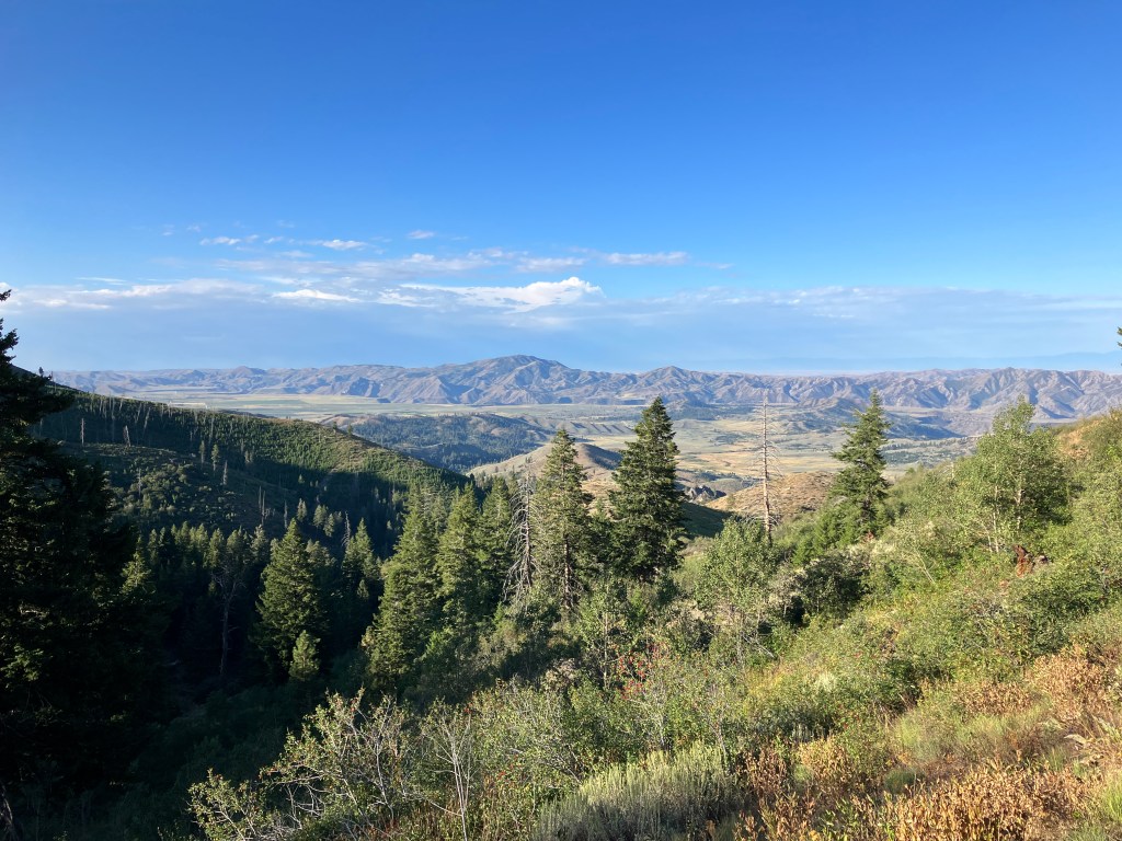
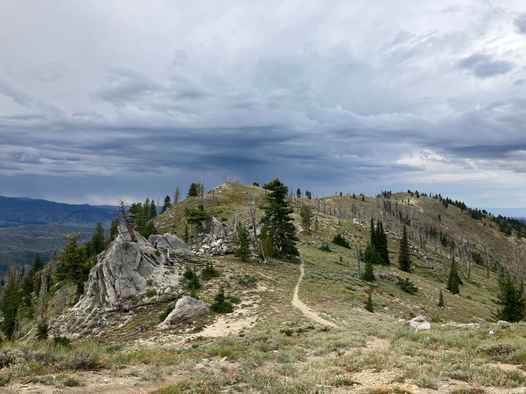
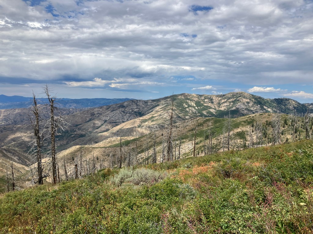
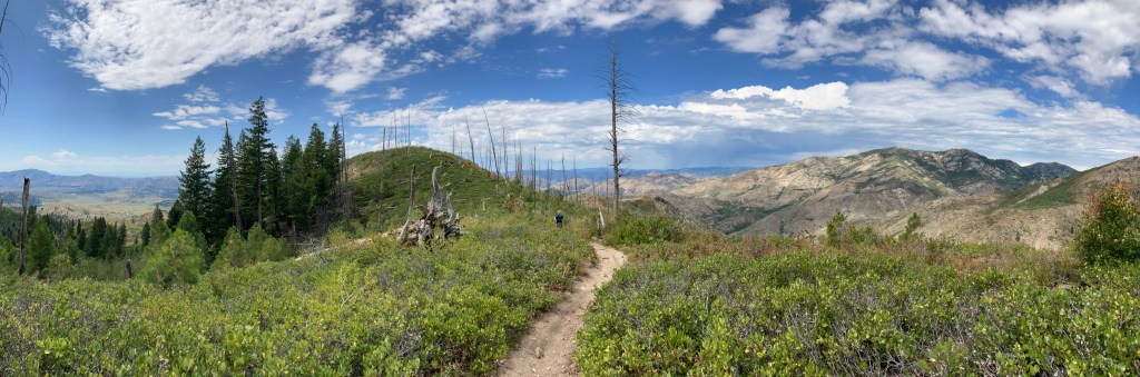
From the lower trailhead, Lava Mountain Trail gains a high ridge that climbs gradually towards the Trinity Range, offering excellent views to its prominent peaks to the east and the rugged interior of the Boise National Forest to the west. The landscape along the trail varies from dense pine forests to expansive grassy slopes and sprawling meadows overrun with wildflowers. Interesting rock formations dot the ridge and seasonal creeks form extra-lush veins in the sandy slopes near the lake.

The initial ascent takes you through a series of switchbacks with views immediately opening up to the Smith Prairie and Danskin Mountains behind you, with the South Fork Boise River canyon visibly composing the border between them. At 1.3 miles and about 900 feet gained, you’ll reach an east-west ridge where the incline steepens significantly – it’s evident here that the trail was built with dirt bikes in mind. The next mile encompasses another 700 feet of gain without any substantial switchbacks, but there is significantly more shade.
At 2.3 miles, the tread dead-ends at a T-intersection with Lava Ridge Trail. Turn left to continue on Lava Mountain Trail. From here, you’ll hike along the ridgeline for several miles to North Star Lake. Within the next mile, the ridge rises about 400 feet towards the summit of Lava Mountain, which is an easy off-trail side trip for peak baggers interested in nabbing it. There is, however, some controversy regarding the real location of the summit, as described in Idaho hiking and climbing legend John Platt’s guide. My buddy Robby and I will stick with the USGS topographical map’s position for our own bragging rights.
The leisurely walk along the ridge continues until you’re about five miles from the trailhead, with almost no elevation gained or lost in the last two miles. After a short decent to a saddle, you’ll pass straight through an intersection with Bear Gulch Trail, which leads to the Devil’s Creek and Rattlesnake Basin Trails to the northwest, which connect the Trinities to the Middle Fork Boise River via the beautiful William H. Pogue National Recreational Trail. There are several different point-to-point backpacking trips that could be conceived in this rarely hiked trail system.
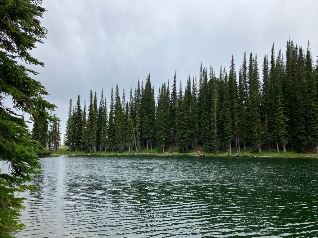
After the intersection, you’ll leave the ridge and begin skirting along southeast-facing slopes for another mile and a half. We were pleasantly surprised to find almost no elevation gain along this stretch. At 6.8 miles, you’ll enter a flourishing meadow along an unnamed creek. For a short section, the trail is extremely rocky and damaged by erosion from runoff. In 0.1 miles, the upper section of trail from Smith Creek Lake joins from the right, and the short spur to North Star Lake doubles back up and to the left. It’s another quarter mile and less than one hundred feet to the lakeshore.
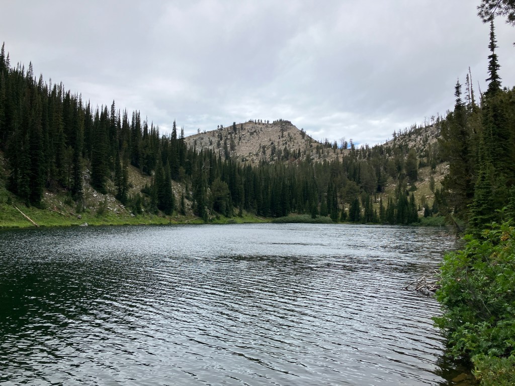
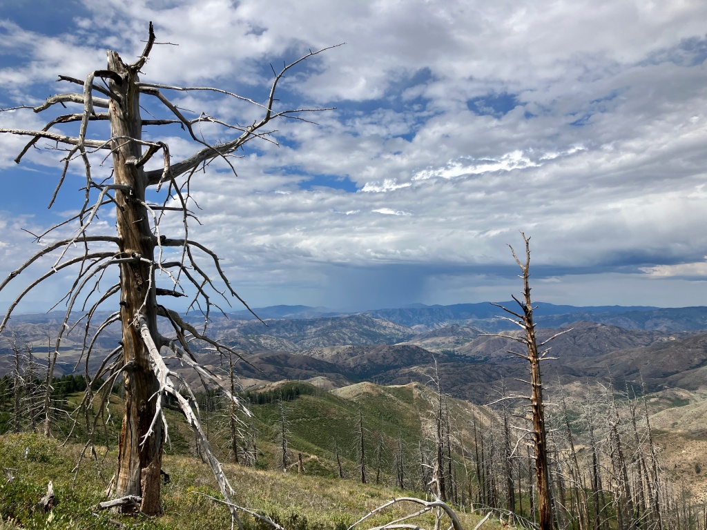
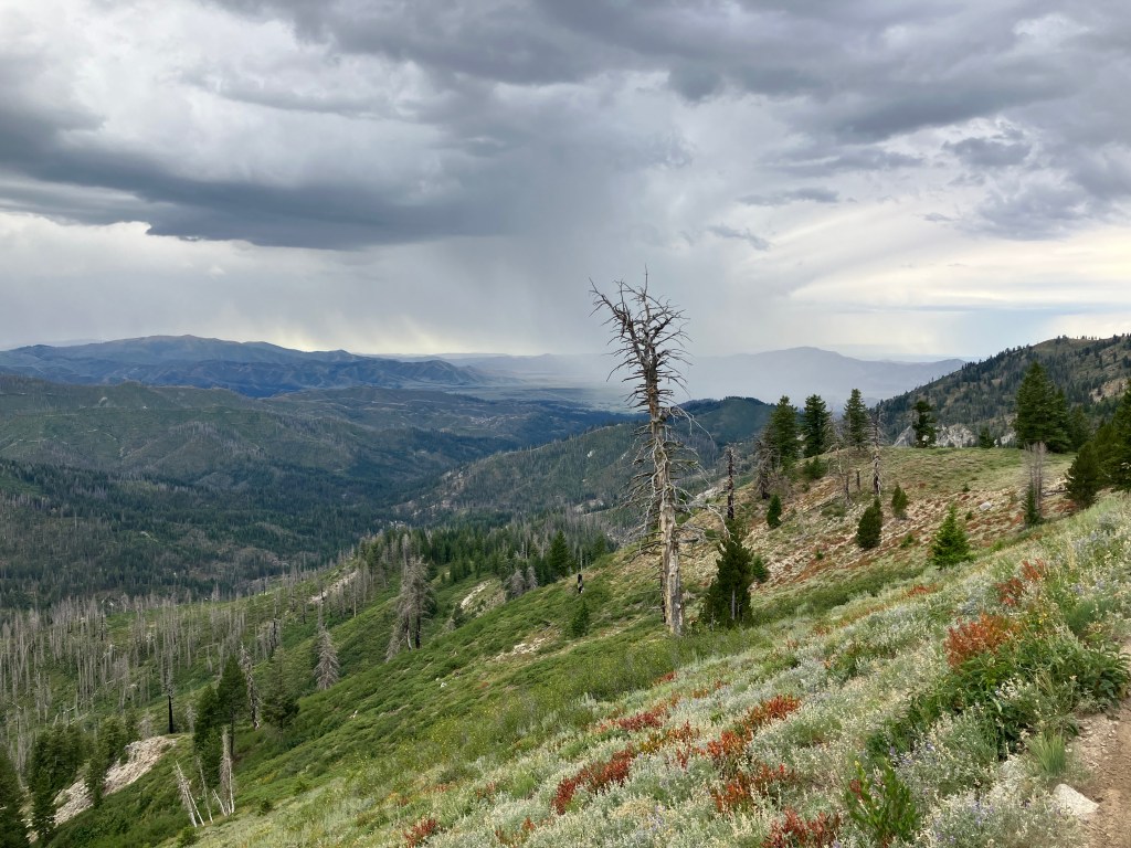
There are several great backpacking sites on the eastern side of North Star Lake, which sits in a narrow basin below what John Platt and others consider to be the real Lava Mountain. Unfortunately, during my visit, we were pelted with rainfall as soon as we sat down to eat lunch, so we didn’t spend much time here – the previous picture shows the curtain of rain traveling towards us from the prairie. We were also disappointed to find that recent campers had left piles of trash at each site. When enjoying the outdoors, please adhere to the Leave No Trace principles of “take only photos, leave only footsteps.”
When you’re ready to return, retrace your steps all the way back to the trailhead. Despite the distance, this is an easily doable day hike, given the front-loaded elevation gain and effortless cruise along the ridge. I’m not typically a very fast hiker, but Robby and I completed the trek in under six hours.
Trail Stats
- Season: June to October
- Difficulty: Hard to strenuous
- Type: Out-and-back
- Surface: Single track dirt (off trail if you bag Lava Mountain summit)
- Distance: 14.4 miles
- Starting elevation: 5,875 feet
- Elevation gain: 2,980 feet
My Rating
As mentioned, I’d already hiked to North Star Lake from the upper trailhead of Lava Mountain Trail, so I knew I liked the destination. I had a good idea of what the lower reaches of the trail would look like, but the scenery was even better than expected. The Smith Prairie is a uniquely beautiful part of the Boise Mountains that is highlighted early on this route, with expansive views of the Danskins, Trinities, and more isolated Boise Range peaks opening up as you hike further up the trail. That, paired with the gorgeous drive to the trailhead make this a five-star day trip.
How to Get There
From Boise, the drive to Lower Lava Mountain Trailhead is along the unofficially designated “South Fork Boise River Scenic Byway,” which I’ve written about at length. It’s one of my favorite drives in southern Idaho, especially in the early spring when runoff is high and waterfalls are flowing. Even later in the year, when all the snow has melted and Lava Mountain Trail is open, the scenery along the byway is as beautiful (if not more) than the scenery along the trail. The byway road surface is well-graded dirt that’s suitable for all vehicle types. The last two miles to the trailhead are extremely rutted and rocky, and only suitable for vehicles with medium clearance or better.
Here is the step-by-step navigation to the trailhead from the Black’s Creek Road exit on Interstate 84 southeast of Boise, or use these steps:
- Exit the interstate on turn left (northeast) onto Black’s Creek Road
- Continue 6.3 miles
- Turn left to continue on Black’s Creek Road/E Mayfield Road/NF-189
- The road surface changes from paved to dirt within one mile
- Continue 25.6 miles
- Arrive at a Y-intersection in the small town of Prairie and turn sharply left onto NF-213/Long Gulch Road
- Continue 3.9 miles
- Turn right onto NF-222 and continue 2.1 miles to the trailhead – there is room for about eight vehicles to park
Expect the drive to take about an hour and twenty minutes, depending on where in the Treasure Valley you’re starting from. Prairie has a great one-stop store for last minute snacks and drinks, but the nearest full facilities are in southeast Boise. For campers, there are decent dispersed sites near the trailhead. Water availability is suspect, although Lava Creek was still flowing when we hiked here in late August 2023.

Preparation
Boise National Forest
Mountain Home Ranger District
(208) 587-7961
Interactive Map of Road, Trail, and Area Closures
Here are the need-to-know details for hiking to North Star Lake via Lower Lava Mountain Trail
- This is black bear country – carry personal protection and know what to do in an encounter (here is a handy guide from the Humane Society of the United States for black bears) – I always include this note, but we did actually see a bear cub near the trailhead
- The initial ascent to Lava Mountain Ridge is steep and sun-exposed – plan accordingly and understand your own abilities
- North Star Lake and Lava Creek (near the trailhead) are the only reliable sources of water on this trail
- Route-finding is not necessary at any point on this trail
- About 25% of the trail is shaded, but long stretches burned severely in the Grape Fire in 2016, increasing the sun exposure – protect yourself as needed
- Backpackers will find several great campsites along the southern and eastern sides of the lake
- Be respectful to other trail users and Leave No Trace!
Other Useful Resources
- Downloadable GPX track via AllTrails
- Topographical map via Natural Atlas
- The Hiker’s Guide: Exploring Greater Boise by Scott Marchant
