High in the Boise Range, two pristine alpine lakes sit largely undisturbed, seldom visited by hikers despite their proximity to the Boise metro area. They are the two major landmarks along Lava Mountain Trail, which travels east-west from the town of Prairie to the western slope of Trinity Peak. From the upper trailhead, both lakes can be reached in one day via a challenging but rewarding 12-mile out-and-back hike. I celebrated America’s 244th birthday here on the Fourth of July, 2020.
On the Trail
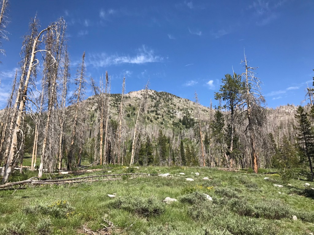
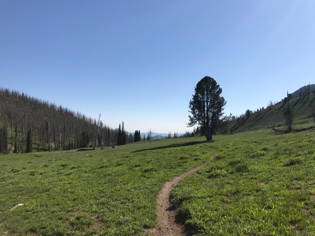
The Upper Lava Mountain Trailhead sits in the morning shadow of Trinity Peak, one of the most prominent mountains in the Boise range at a height of 9,536 feet. Near the trailhead, there are some excellent spots to car camp and a ramp for offloading dirt bikes or ATVs, which are allowed on this trail. The hike begins with a gradual ascent that parallels the East Fork of Fall Creek towards an obvious saddle, passing its headwaters as it gains elevation. This section is well-shaded by tall pines and lined with wildflowers in the summer.
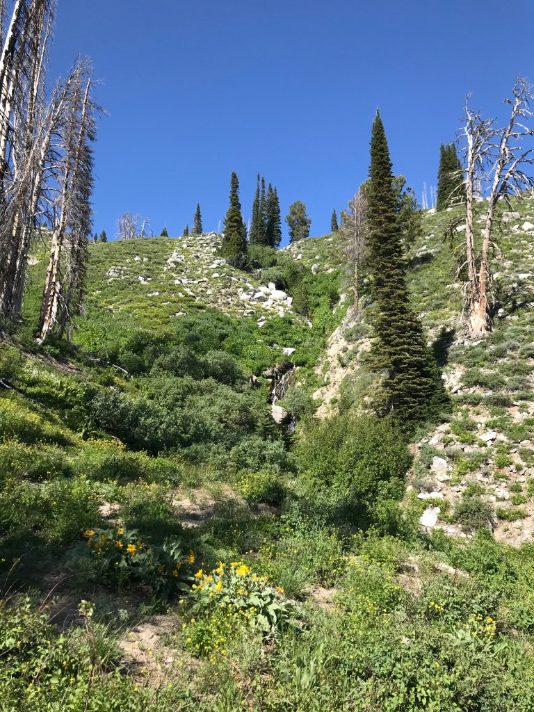
After cresting the saddle at 1.7 miles, the trail continues northwest down the other side through a lush pine forest with occasional burned sections. You’ll cross creek after creek, some of which tumble down small waterfalls as they converge on Smith Creek, the main tributary in the area. Several miles downstream, it tumbles 100 feet over Smith Creek Falls near its confluence with the South Fork of the Boise River.
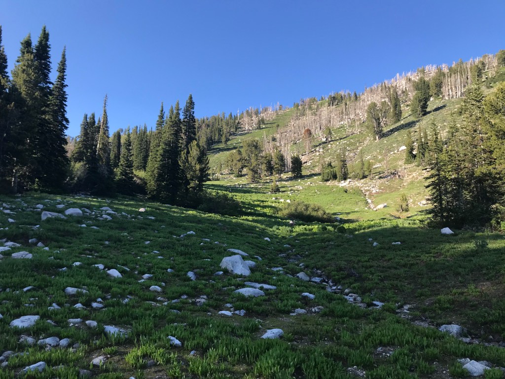
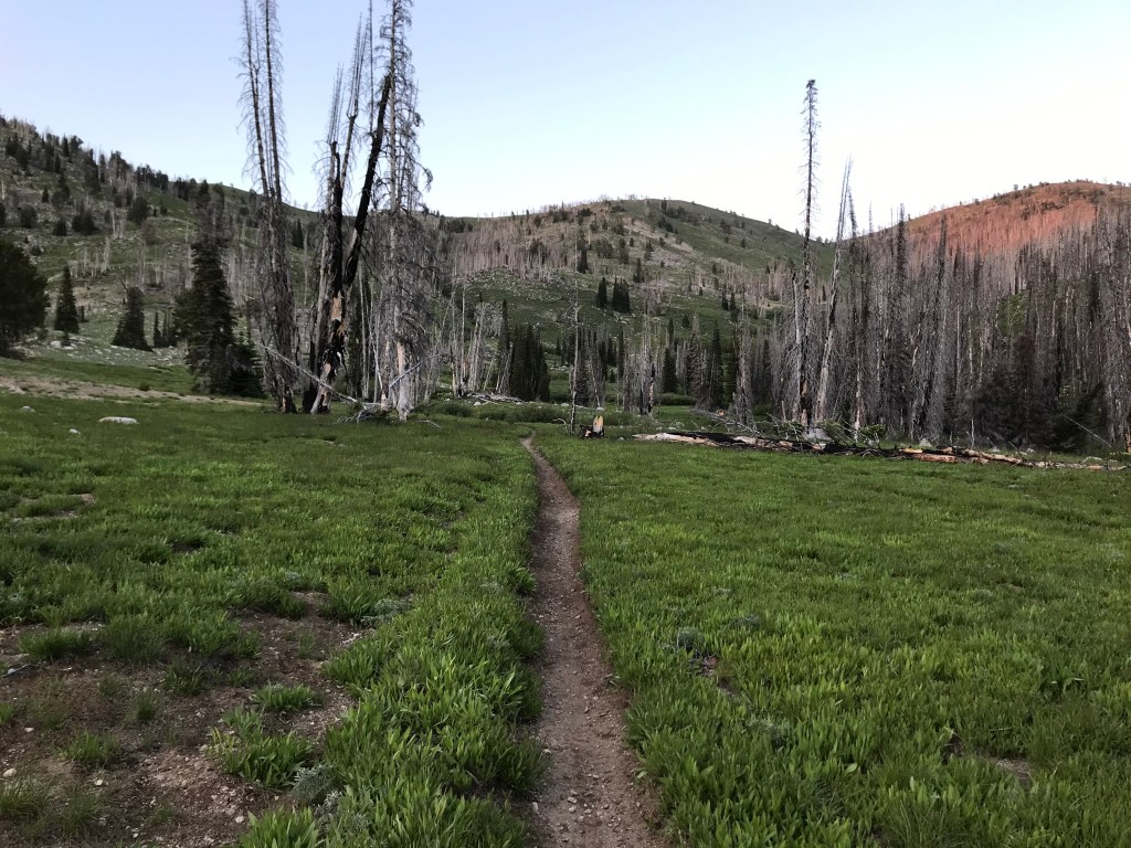
The descent levels out in a beautiful meadow with views down to Smith Prairie and the Danskin Mountains in the distance. At 2.7 miles, continue straight at a T-intersection with a fainter trail that meanders up to the right. This trail leads to Twin Sisters Lakes, which I’ll return to hike another time. EDIT: I hiked to Twin Sisters Lakes in 2022 and wrote about them in my 2022 Almost-Blogworthy Hikes. The possibilities for setting up a backpacking camp here are endless.
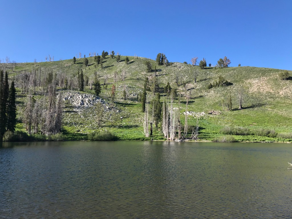
Towards the west end of the meadow, the trail begins to hug the north slope, ascending quickly up a rocky section, alternating between exposed and shady as the terrain undulates between flat and steep. After gaining 500 feet in just over a mile, you’ll arrive at Smith Creek Lake, sitting at 7,874 feet almost exactly 4.0 miles from the trailhead.
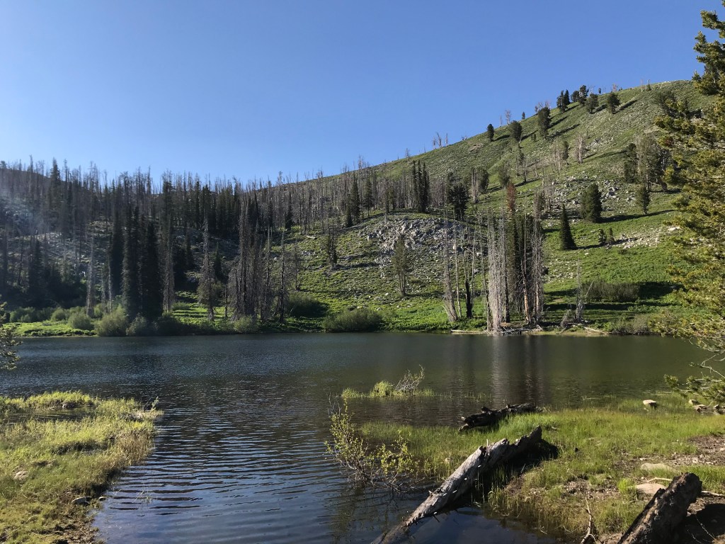
Smith Creek Lake is an excellent lunch destination, with plenty of flat places to set up a picnic (or a backpacking campsite) along the shore. Those hiking with young kids or old dogs will probably want to turn around here, as the more difficult sections of the hike begin after leaving the lake. This is the better lake of the two for swimming and fishing, as North Star Lake has a muddy bottom.
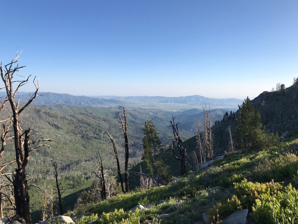
The next half-mile after the lake is relatively tame, crossing more small creeks in a severely burned area. The following ascent is the steepest and most difficult on the route, gaining another 500 feet quickly on an exposed ridge high above the Smith Creek drainage. At 8,363 feet, the trail levels out and turns west, losing most of the elevation just gained on the descent to North Star Lake.
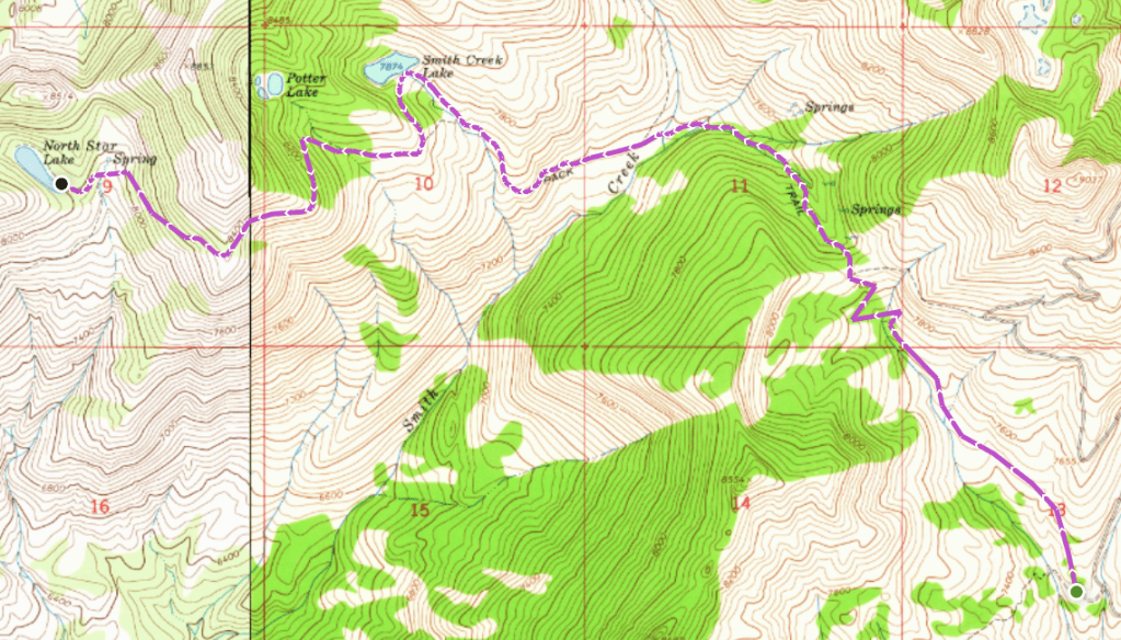
After descending to another small creek, continue west at the intersection with Lower Lava Mountain Trail to one final push uphill to the lake, 6.0 miles from the trailhead. The long, narrow lake is densely guarded by tall pines, a stark contrast from the grassy slopes framing Smith Creek Lake.
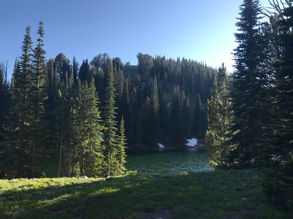
North Star Lake also has some incredible campsites along the shore. Unfortunately, I was only able to spend a few minutes here, as it was late in the day and I was already past my safe turnaround time to avoid hiking in the dark. I am planning on returning via the Lower Lava Mountain Trailhead soon, and will plan enough time to enjoy a full lunch (or possibly a night) here. EDIT: I returned to hike this trail in 2023 and wrote about it in my post, North Star Lake via Lower Lava Mountain Trail (link incoming).

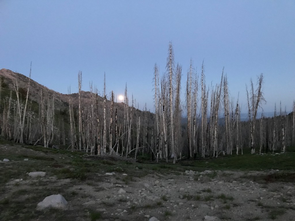
The return leg is not as difficult than the outbound, due to less steep inclines and more overall downhill – plus you’ll have the advantage of knowing what to expect. I started the hike so late in the day that it was dark by the time I returned to the saddle above the East Fork of Fall Creek; however, a full moon rose on the horizon in front of me, illuminating the lifeless pines in an eerie light. I now carry a headlamp on all treks to avoid this problem, and would recommend others to do the same. I made it back to the trailhead at 10pm after about 6.5 hours total on the trail at a pace just over 25 minutes per mile. Next time I’ll leave earlier and take my time enjoying the scenery.
Trail Stats
Split for Smith Creek Lake/North Star Lake
- Season: June to October
- Difficulty: Moderate to hard
- Type: Out-and-back
- Surface: Single track dirt
- Distance: 8.0 miles/12.2 miles
- Starting elevation: 7,277 feet
- Elevation gain: 1,329 feet/2,720 feet
My Rating
I haven’t been disappointed by any hike in the Trinity Range yet, and I don’t think I ever will be. This trail and Rainbow Basin on the other side of Trinity Peak are two of my favorites in Idaho.
How to Get There
Despite being only 35 miles from Boise in a straight line, the drive to the trailhead takes two and a half hours. The last few miles are rough in places, but most vehicles with average ground clearance should be able to make it. Here is the step-by-step navigation from Broadway Avenue and Interstate 84 in Boise, or use these steps:
- Proceed onto I-84 east and continue for 39.9 miles to Mountain Home
- Take exit 95 for US-20 North/Sun Valley Highway
- Turn left onto US-20 and proceed through Mountain Home
- Continue for 20.7 miles to a paved turnoff on the left (northwest)
- Turn left onto Anderson Dam Road
- Continue for 5.0 miles and bear left onto NF 134 to cross Anderson Ranch Dam
- Once across the dam, turn right onto NF 120/Anderson Dam Road, which snakes along the northwest shore of Anderson Ranch Reservoir
- Continue 8.7 miles, passing Fall Creek Resort and Marina, then proceed straight onto NF 123/Trinity Mountain Road
- Continue 4.6 miles to Ice Springs Campground, turning left to stay on Trinity Mountain Road
- Continue 1.7 miles and turn right to stay on NF 129/Trinity Mountain Road
- Continue 8.3 miles, gaining elevation quickly through switchbacks as the road gets rougher
- Turn left onto NF 129T, a small spur that leads to a dirt turnaround that serves as the parking area and trailhead
Preparation
Boise National Forest
Mountain Home Ranger District
(208) 587-7961
Interactive Map of Road, Trail, and Area Closures
Here are the need-to-know details for hiking the Lava Mountain Trail from the upper trailhead:
- This is black bear country – carry personal protection and know what to do in an encounter (here is a handy guide from the Humane Society of the United States)
- There is a second trailhead further up the road that eliminates one mile of hiking in each direction, but the road to it deteriorates quickly and isn’t recommended for most vehicles
- There are at least a dozen water crossings along the trail; however, most of them are shallow creeks less than three feet wide and can be easily hopped over or walked through
- As such, there are numerous sources to pump and filter water from along the trail
- Route-finding is not necessary at any point on this trail
- The trail is single-track dirt and rocks for the entire route and is suitable for dogs and children until Smith Creek Lake, after which it becomes considerably more steep and difficult
- About 25% of the trail is shaded, including some sections that burned badly in the Village Fire in 2013, increasing the sun exposure – protect yourself as needed
- Be respectful to other trail users and leave no trace!
Other Useful Resources
- Downloadable GPX track via AllTrails
- The Hiker’s Guide: Exploring Greater Boise by Scott Marchant
- Trails of Western Idaho by Margaret Fuller
- Topographical map via Natural Atlas

2 responses to “Smith Creek Lake and North Star Lake via Upper Lava Mountain Trail”
[…] like the Upper Lava Mountain Trailhead, the Big Trinity Lake Campground and Rainbow Basin trailhead are less than 40 miles from Boise in a […]
LikeLike
[…] to say about North Star Lake and Lava Mountain Trail is that I like them so much, this is my second blog post about them. Having hiked the entirety of Lava Mountain Trail, I can comfortably say it’s one of the best […]
LikeLike