Most Boiseans probably know Black’s Creek Road as the last interstate exit before entering Boise proper, or the route to historic Bonneville Point, where Captain Benjamin Bonneville and his expedition party first laid eyes on the Treasure Valley and the seam of green running through it, prompting exclamations of “Les Bois! Les Bois!” However, those who have ventured further into the mountains know the hidden treasures along the South Fork of the Boise River. From deep canyons to thundering waterfalls to perfect campsites nestled in the cottonwood and willows along the riverbank, this unofficial “scenic byway” provides an escape into nature just minutes from downtown Boise.

On the Road
The total distance of the byway is 38.0 miles, with about a dozen interesting places to stop and two side trip hikes along the way, which are presented in order when driving northwest to southeast. I’d recommend dedicating a half-day to see everything, and slightly longer if you want to hike both trails. With the exception of a few obviously marked private properties, most of the land along the byway is managed by the Boise National Forest and open to dispersed camping, in addition to a few established campsites near Anderson Ranch Reservoir.
How to Get There
Normally I’d place this section at the end of my post, but you’ll need the directions first since this is primarily a driving trip. Most of the byway is dirt and gravel road, but is suitable for all vehicles. Here is the step-by-step navigation from the intersection of Black’s Creek Road/Kuna-Mora Road and Interstate 84 southeast of Boise, or use these steps:
- Exit the interstate and turn left (northeast) onto Black’s Creek Road
- At 6.3 miles, turn left to stay on Black’s Creek Road, which turns to dirt shortly
- At 17.9 miles, arrive at Willow Creek Trailhead and the beginning of the “byway”
Points of Interest
Willow Creek Trail
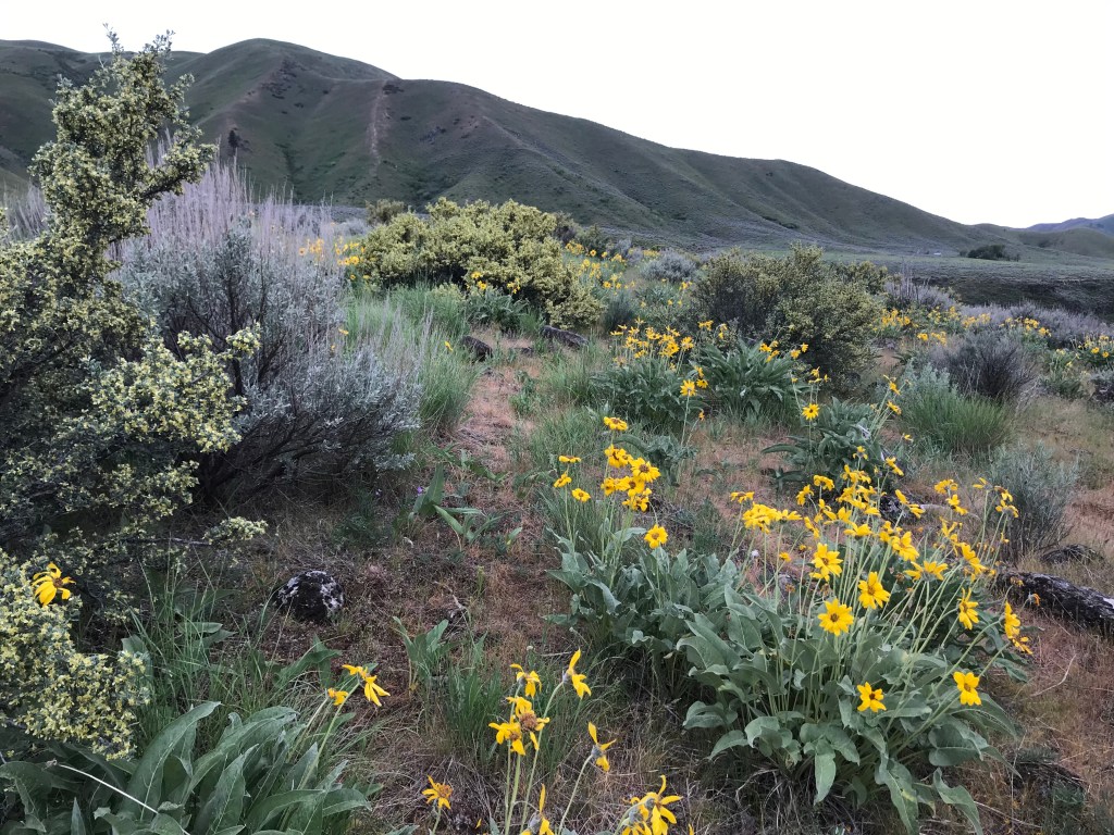
While the scenery along Black’s Creek Road/NF-189 improves steadily as you travel east, the beginning and first point of interest on the byway is at Willow Creek Trailhead, one of three portals to the Danksin Trails. Spanning 150 miles and 60,000 acres, these trails are more popular with dirt bikers, but are open to hikers too and provide some excellent early spring opportunities to get lost in the wilderness.

I’d highly recommend hiking up Willow Creek Trail for 1.5 miles to some interesting rock formations on the east side of the creek. You’ll cross it several times, so bring sandals or water shoes and be prepared for knee-depth water if you go early in the season. I hiked here with a friend in early May 2021, and large rainbow trout darted around us as we trudged through the deep crossings. We hiked a much longer eight mile loop that I’d recommend for experienced hikers seeking a challenge.

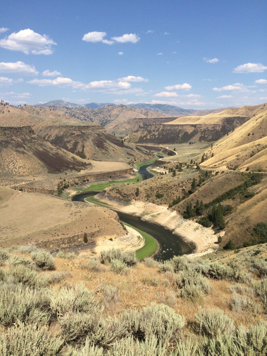
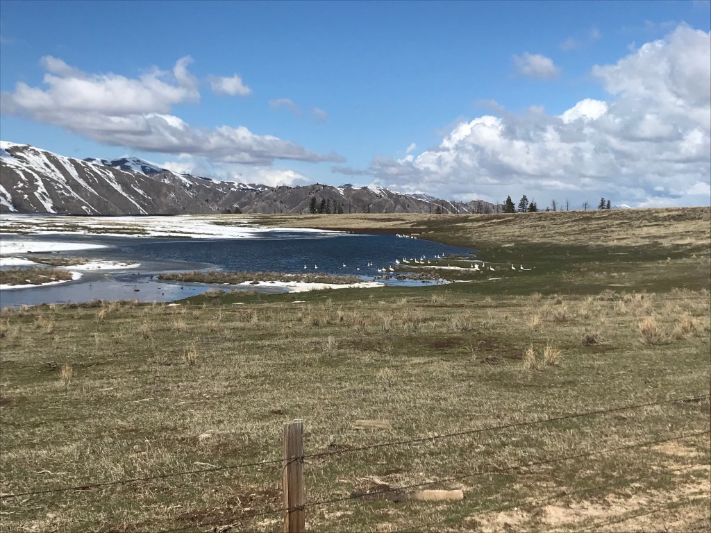
Arrowrock Reservoir
Departing from Willow Creek Trailhead, the byway curves up and around a steep slope to a high plateau, with expansive views of the South Fork Arm of Arrowrock Reservoir opening up at 1 mile. At 2 miles, there is a promontory point that offers a great photo op with the Trinity Range framing the South Fork as it flows into the reservoir from the east. The road then descends rapidly to near-river level again at 3.3 miles.
Waterfalls
The byway features one perennial and four seasonal waterfalls, three of which cascade 100 feet or more. The best time to view them is in late winter or early spring, when melting snow creates high runoff in the local creeks.
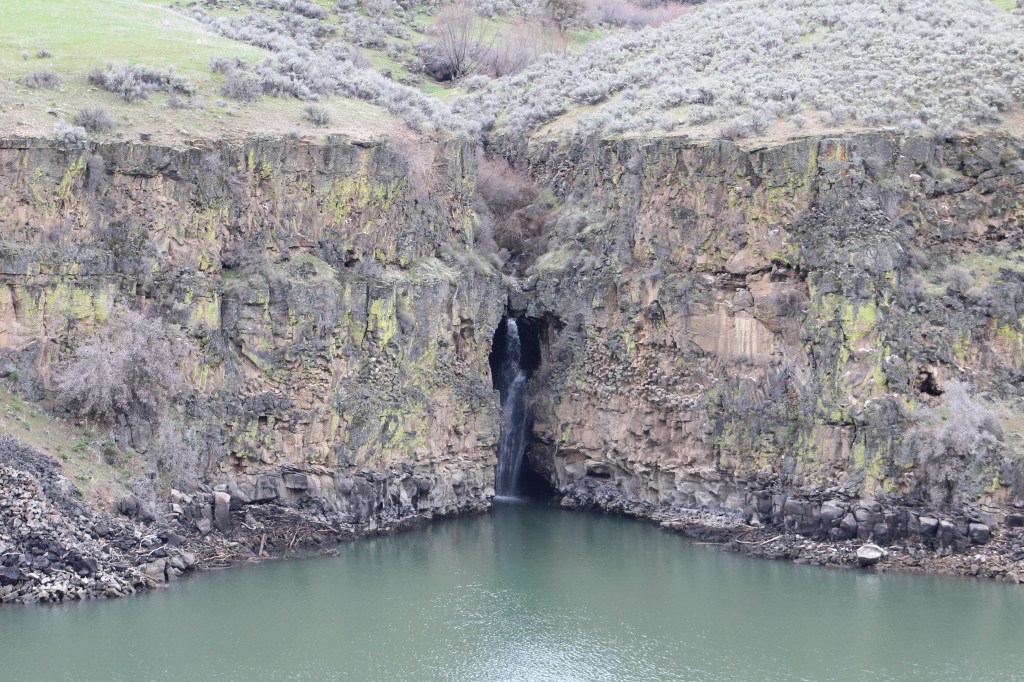
Camp Creek Falls
This minor chute cuts through a narrow gorge before falling directly into the South Fork Arm of Arrowrock Reservoir, making it an interesting destination for boaters too. It is on the opposite side of the canyon at 3.3 miles.
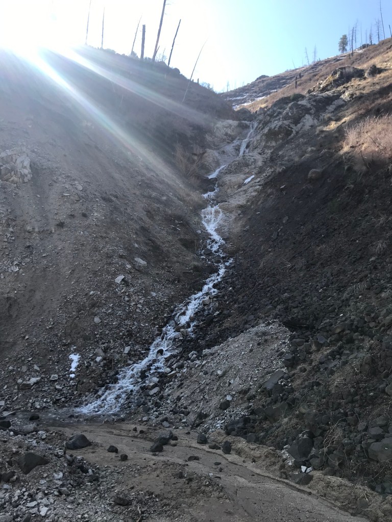
Crank Creek Falls
The smallest waterfall on the tour, this creek cascades down the hillside right next to the road before sinking into the sand and continuing underground to the canyon wall, where it re-emerges and flows into the South Fork Arm. Watch for it as you round a corner at 5.9 miles. After departing, you’ll descend to the riverbanks and cross Neal Bridge at 6.2 miles, where a small boat ramp offers access to the river. You’ll then ascend to another high plateau and turn south at 7.1 miles.
Long Gulch Falls
Blink and you’ll miss it! Tucked away in a tight corner, this creek flows through a culvert under the road before falling a total of 280 feet – much of it vertically – to the South Fork below. The best way to view it is to pull off to a parking area on the right at 8.4 miles, then backtrack to an outcrop to the north on foot. You can also stand next to the culvert directly above it. Be careful!

Big Fiddler Creek Falls
Divided into a 250-foot upper and 240-foot lower falls, Big Fiddler Creek Falls is the tallest cascade on the tour. Unfortunately, it’s across the canyon in a shady notch and can be difficult to see, especially when it’s not flowing at full strength.
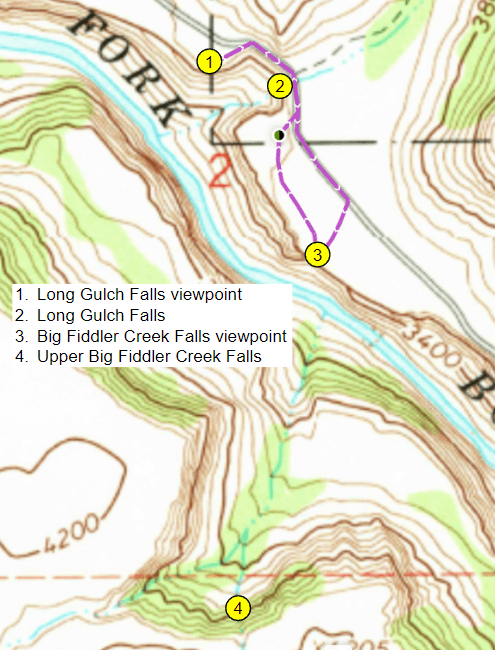
The best place to view it from is a short off-trail walk from mile marker 8.5, or walk to the canyon rim from where you parked for Long Gulch Falls. The upper falls is a vertical chute, while the lower falls is a long horsetail down the steep canyon side.
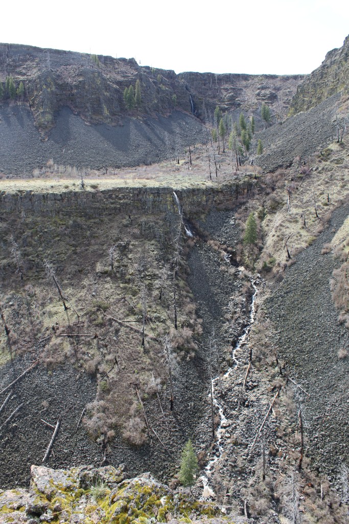
Smith Creek Falls
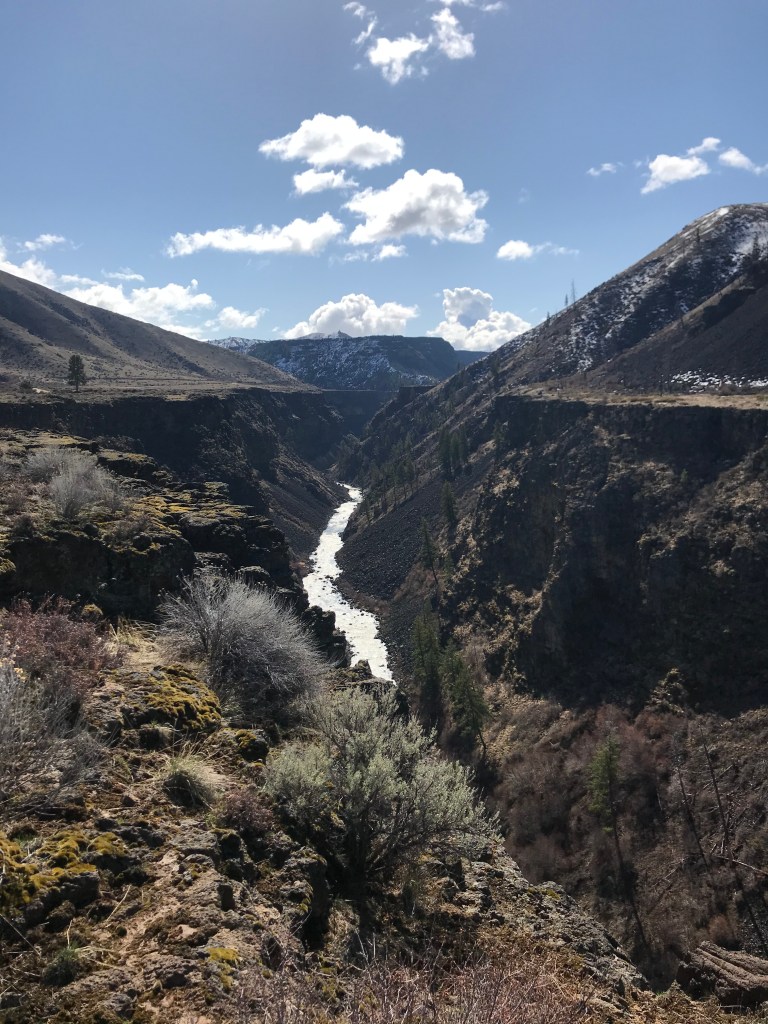
The largest waterfall by volume, Smith Creek flows from a lake high in the Trinity Range before crashing impressively down into the South Fork canyon 10.2 miles from the start of the byway. In Google searching it for more information, I’ve found that other adventurers have attempted to ice climb it in the winter (yikes!). You’ll have to walk off-trail to a sketchy overlook and peer into a deep gorge to see it. Be extra careful in this area. This spring I’ll be exploring an alternate hike to the other side of the gorge, from where it may be easier and safer to view it.

Smith Prairie
At Smith Creek Falls, the byway turns east and ascends through the national forest to the Smith Prairie, home of Prairie, Idaho, a small town with a one-stop where you can refuel or grab snacks and drinks. At 16.4 miles, turn right onto Prairie Road/NF-113. You’ll pass several cabins and ranches as you drive south, returning to the South Fork Canyon. At 24 miles, descend two huge hairpin turns to river level.
Danskin Bridge
At the end of the descent, a turnoff on the right backtracks to Danskin Bridge, the put-in for whitewater enthusiasts running the South Fork. The bridge also provides access to some of the more remote reaches of the Danskin Range. There is a camp toilet and small parking lot if you need to make a pit stop.

Granite Creek Trail
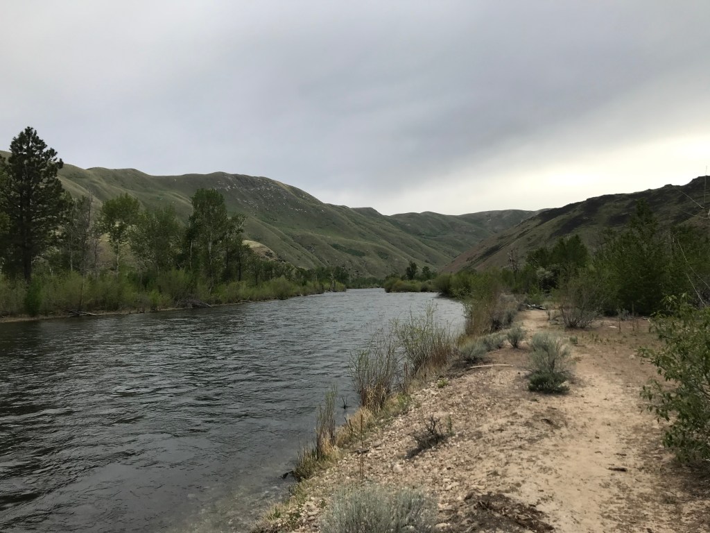
For the rest of the byway, you’ll parallel the river close to the water’s edge, where you’ll see anglers hoping to catch salmon, trout, whitefish, and more. If you plan on fishing, please adhere to local guidelines. At 28.3 miles, you’ll see a small turnoff on the right that serves as the parking lot for Granite Creek Trail, which ascends 1.5 miles to another seasonal waterfall that tumbles down among interesting rock formations.
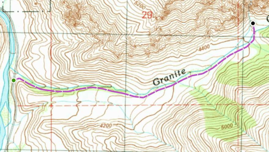
I didn’t have great expectations for this hike, but the destination blew me away. The trail surface is an old-two track, but to reach the waterfall, you’ll have to hike north off-trail and cross a few braids of the creek before walking up a rocky draw. I was able to scramble all the way to the bottom of the waterfall and would highly recommend you do the same! Rock pillars tower above the thin stream as it crashes down onto huge boulders below. I was here in mid-March, but it probably would’ve been more impressive about a month later.

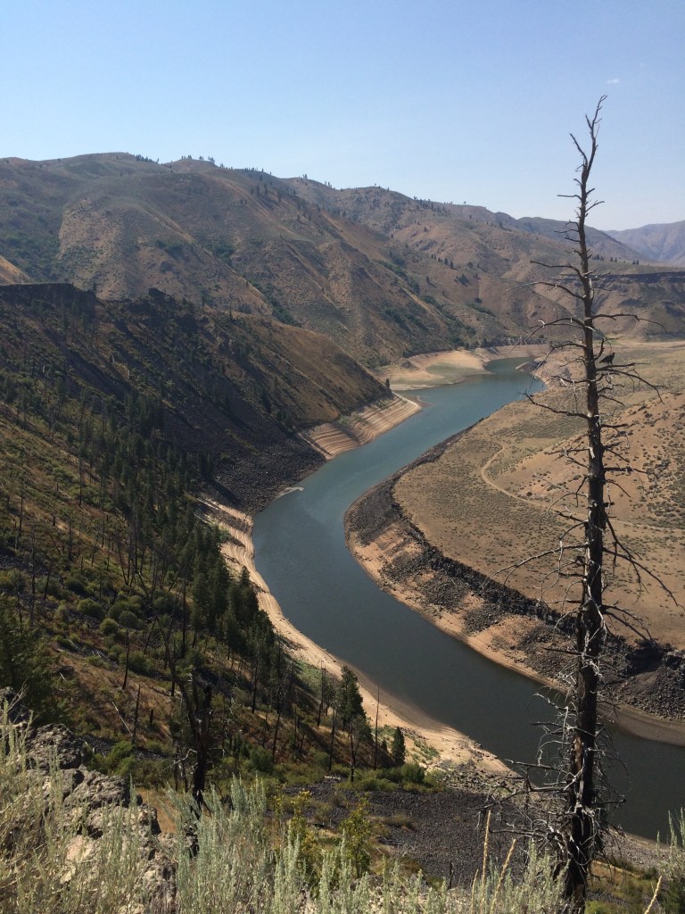
Camping Along the South Fork
The river widens after leaving the Granite Creek Trailhead, lined by a lush greenbelt that contrasts with the sparse hillsides. In the next ten miles, there are dozens of turnouts to secluded dispersed campsites, in addition to the two established ones, Cow Creek and Tailwaters. Some sites could accommodate parties of 20+ if you’re looking to go with a big group. This section of the river is calm and shallow and could probably be floated safely in a tube, as evidenced by several floatboat access ramps along the way.
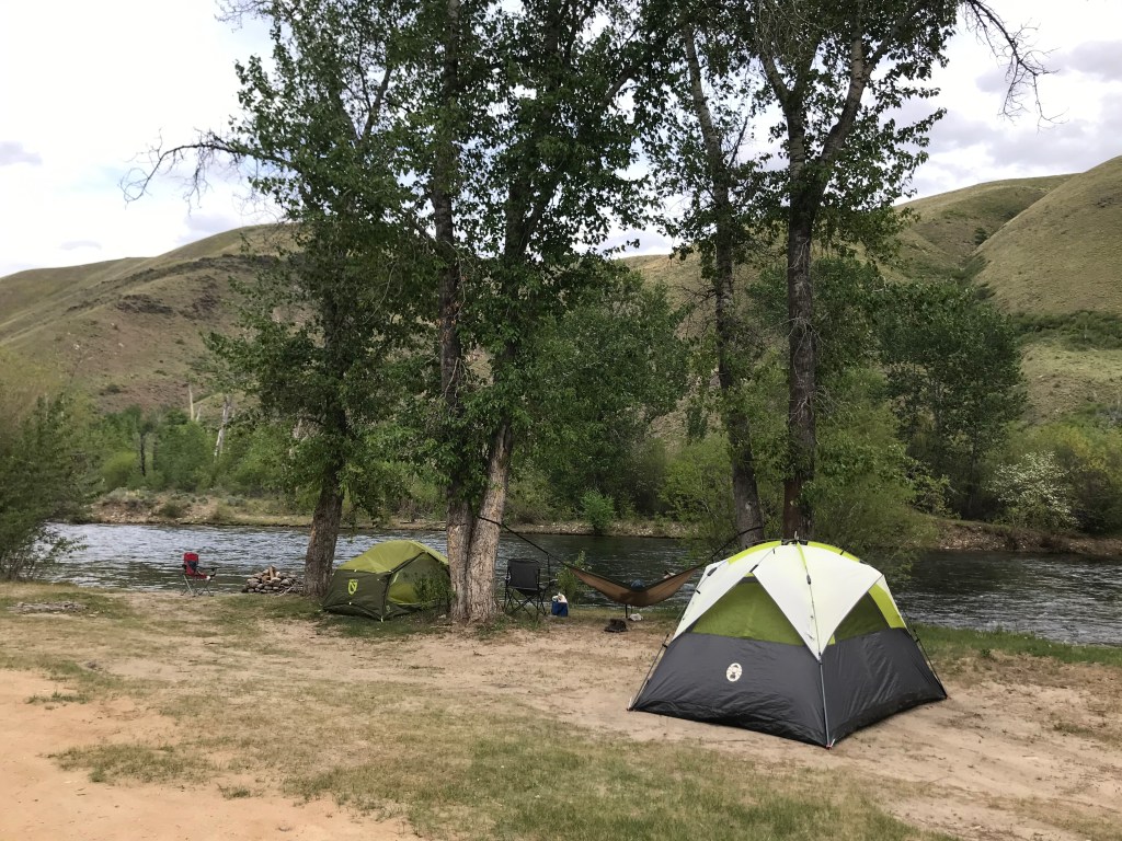
I camped here with a friend in mid-May 2021 and there was nobody near us. The weather was chilly at night but warm in the afternoon. If you’re seeking a good place to car camp early in the season when it’s still too cold to venture higher into the mountains, this is a great option! In the morning, we drove up past the dam and hiked Wilson Creek, another great trail in this area.
Reclamation Village
At 35.2 miles, you’ll pass the ruins of Reclamation Village, home of the workers who built Anderson Ranch Dam in the 1940s, including interned Japanese-Americans transferred from the Minidoka War Relocation Center near Jerome, Idaho.
End of the Byway
At 38 miles, ascend the 456-foot incline to Anderson Ranch Dam and reach the end of the byway. The return to Boise takes about an hour and fifteen minutes.

I recommend that anyone who drives the byway stop at least a few times and take in the scenery and fresh air. I keep going back and finding new things to explore further every time!
Byway Stats
- Season: March to November (depending on snowfall)
- Difficulty: Easy
- Type: Point-to-point
- Surface: Dirt road
- Distance: 38.0 miles
- Starting elevation: 3,354 feet
- Elevation gain: 3,392 feet

My Rating
I drive the “byway” just about every year, and I find new things to appreciate each time. I’m constantly surprised how few locals know about it, which is why I’m sharing it here. I hope all those that drive it enjoy it as much as I do!
How to Get Back
Since this is a point-to-point trip, here is the step-by-step navigation returning to the intersection of Highway 20 and Interstate 84 in Mountain Home, Idaho, or use these steps:
- Turn right onto NF-134 and cross Anderson Ranch Dam
- Turn right to continue on NF-134/Anderson Dam Road
- At 5.0 miles, turn right onto US-20 west
- At 20.5 miles, arrive in Mountain Home at the onramp for I-84
Preparation
Boise National Forest
Mountain Home Ranger District
(208) 587-7961
Interactive Map of Road, Trail, and Area Closures
Here are the need-to-know details for driving the South Fork Boise River Scenic Byway:
- This is black bear country – carry personal protection and know what to do in an encounter (here is a handy guide from the Humane Society of the United States)
- Ensure you have enough fuel for the 38-mile trip
- Bring water and snacks in the car as necessary, or bring a full picnic – there are endless places to stop and enjoy a meal along the way
- If you do need to filter water, there are many opportunities
- Route-finding is not necessary at any point on the byway
- Be cautious around the steep drops at the canyon edges
- This is a great trip for kids and dogs!
- Most of the byway is not shaded – protect yourself from the sun as needed
- Be respectful to other trail users and leave no trace!
Other Useful Resources
- Downloadable GPX track via AllTrails
- Full byway route via Google Maps
- The Hiker’s Guide: Exploring Greater Boise by Scott Marchant
- Topographical map of Willow Creek via Natural Atlas
- Topographical map of Granite Creek via Natural Atlas

One response to “South Fork Boise River Scenic Byway”
[…] designated “South Fork Boise River Scenic Byway,” which I’ve written about at length. It’s one of my favorite drives in southern Idaho, especially in the early spring when runoff […]
LikeLike