Up to this point, I’ve only written about hiking destinations within three hours of Boise (hence the blog name), but last weekend, I found myself in Coeur d’Alene for a wedding and seeking a hike to do the following day. My search parameters were simple: I was looking for something around 7 miles long with reasonable elevation gain and a scenic destination that was not more than an hour and a half’s drive. I was surprised while scrolling through AllTrails and other sources at the relatively slim pickings. Perhaps I’m simply undereducated about the hikes of North Idaho, because I thought I’d have dozens of options. While the search results were underwhelming, the final selection was quite the opposite. If, like me, you’re spending time in North Idaho and searching for a perfect day hike, Lone Lake is the one.
On the Trail
The Stevens Lake Trailhead serves two trails, each of which travels up a fork of Willow Creek. When facing towards the mountains in the parking lot, you’ll walk to the right for Lone Lake Trail – the left side ascends higher and farther to the Stevens Lakes. Both are steep and relatively short, with Lone Lake Trail coming in at 5.2 miles and 1,720 feet of elevation gain. Luckily, the most strenuous sections are well-shaded and offer intermittent flat spots to rest. Backpackers and day picnickers will find a few excellent places to set up camp along the lakeshore. Beyond the lake, a short bushwhack along the creek leads to a mystical pond in a high cirque.

The trail starts off as a full-width dirt road and ascends steeply through a few switchbacks in a mix of sun and shade. Jeep or UTV drivers could easily speed through this section to the intersection at 0.4 miles where the single track trail splits off. When the road curves up and to the right, look straight ahead to the narrow opening in the trees where Lone Lake Trail officially starts. You’ll skirt along a fairly steep hillside that is still exposed to the sun. When we visited in early September 2022, it was still very hot here. There are a few exposed steps where you’ll want to tread carefully to avoid slipping – the slope down to the creek is long and sheer.
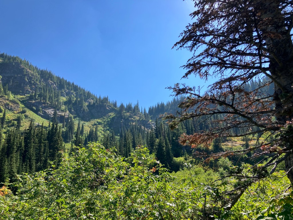
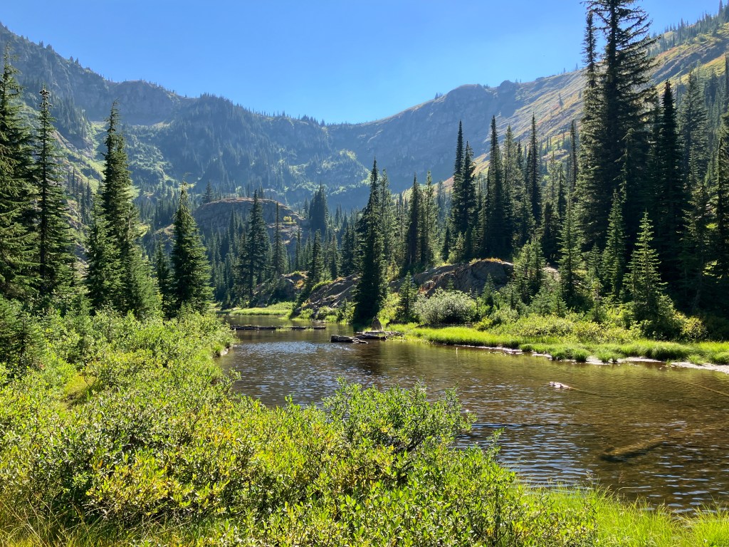
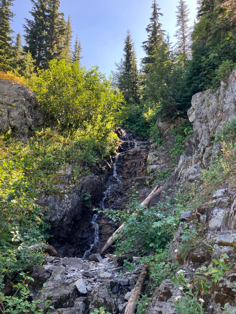
About a mile in, you’ll enter the forest. Don’t be fooled by the relief the shade offers – the most arduous stretch is ahead. Stay hydrated and take as many breaks as you need – we spent over an hour ascending to the lake. At 1.3 miles and approximately 1,000 feet gained, you’ll enter a magnificent meadow with a clear view of the remaining ascent. We missed the wildflower bloom, but I bet it’s stellar. Look for several types of berries and brambles here, too. In another tenth of a mile, watch for a small spur off to the left, and take it about 100 yards to a delightful waterfall. It was somewhere between a trickle and a stream, but I’d wager that it’s impressive at full strength in the late spring.
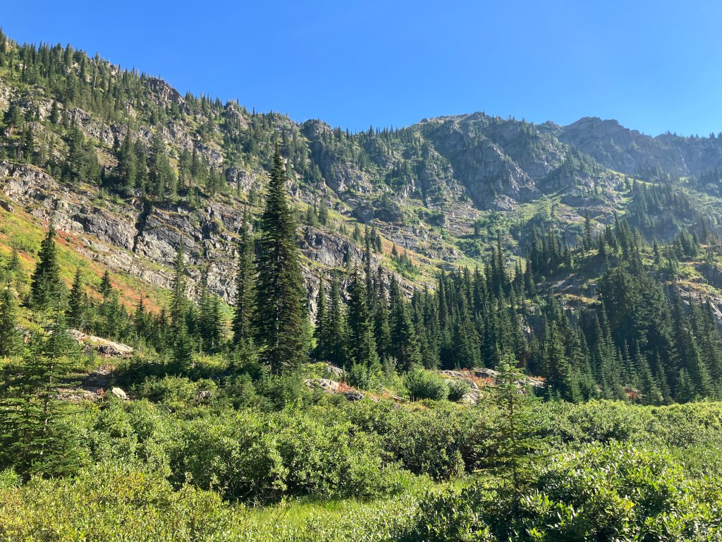
Back on the main trail, you’ll ascend a few large switchbacks in rocky terrain blanketed by Greene’s mountain ash, red baneberry, and bog bilberry. Watch your stride on the rocky surface – there are some places where you’ll have to step up 12 inches or more at a time. The view opens up in all directions as you climb the uncluttered hillside. There is an obvious chute in the granite notch flowing down from the lake outlet where another spring waterfall would roar, but we saw only a small strand of silver gracefully plummeting down. At two miles, you’ll enter a denser, shadier forest than before as you make the final push to the lake.
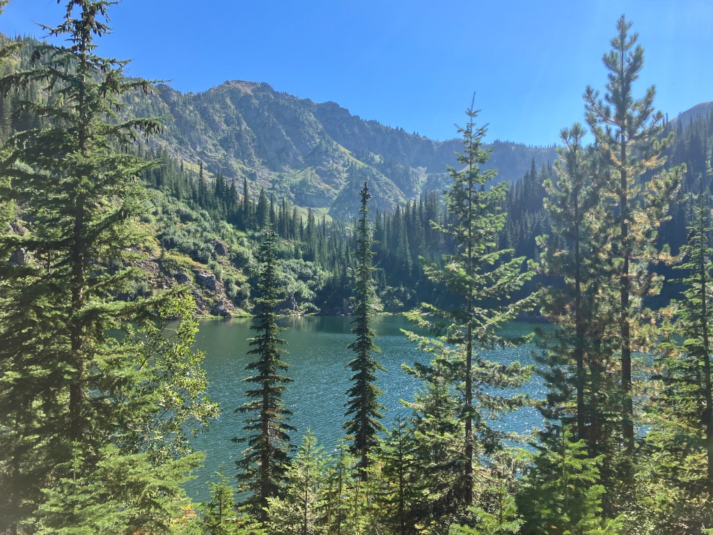
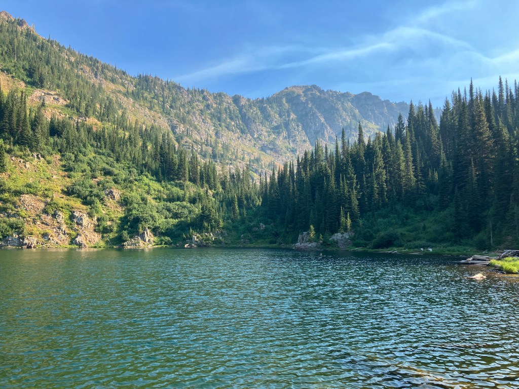
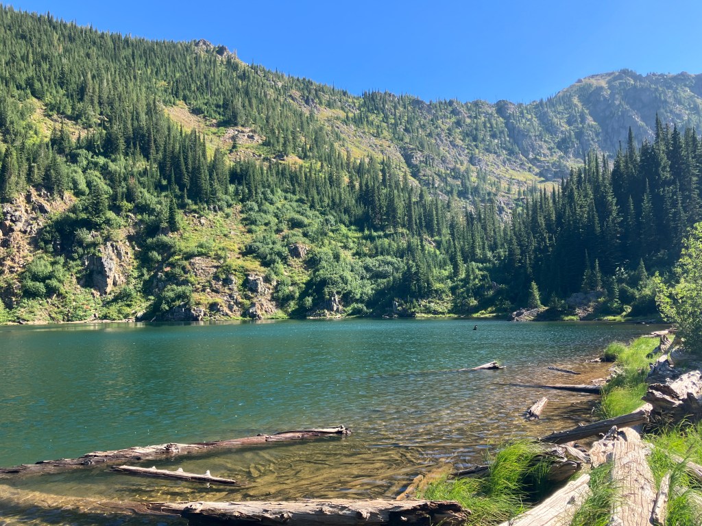
The view of Lone Lake unfolds as you descend a small hill to the rocky edge. An overgrown use trail to the left leads to an excellent backpacking spot. To continue around the lake, follow a more obvious trail down and to the right. The best photo opportunities are here along the shore. A quarter of the way around, on the west bank, there is another nice campsite with great sitting logs. You’ll have to navigate some rocky outcrops to keep moving towards the inlet – my advice is to stay close to the water’s edge after you go up and over a large boulder. On the south side of the lake, another small waterfall crashes down onto smooth river rocks. The trail becomes less obvious here, but if you follow the steep section left of the falls and then immediately cross the creek, it continues up another tenth of a mile to a stunningly beautiful unnamed pond in the cirque between Stevens Peak and West Willow Peak.
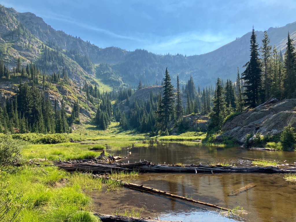
We struggled a bit to find the right route up the creek, but we’re glad we did. I’ve seen so many incredible views in the last few years, but I can’t think of the last one that left me as awestruck as this. Pictures don’t do it justice. As seen above, it was still remarkably green in late summer, and I can only imagine how it looks in the springtime. There was one campsite along the pond, which is marshy and full of frogs. I saw a snake in the tall grass too, but it slithered away before I could identify it. I half-expected to see a moose to emerge from the trees to sip water from the pool. We spent much more time here than we typically do at the turnaround point of a hike, but I bet you will too. The trail continues up the meadow for a while, eventually disappearing on a rocky bluff overlook. If you’re looking for a picnic spot, this is it.
When you’re ready to return, hike back the way you came. Be cautious while descending the muddy slope between the pond and lake, and remember that your knees will take a beating on the steep downhill. Take your time and enjoy the views on your return trip too! We spent almost four and a half hours on the trail – a terrible clip if we had just been here for the workout, but a perfect pace for a post-wedding excursion.
Trail Stats
- Season: May to October
- Difficulty: Hard
- Type: Out-and-back
- Surface: Single track dirt, rock
- Distance: 5.2 miles
- Starting elevation: 3,970 feet
- Elevation gain: 1,720 feet
My Rating
Am I biased because this is only one of two hikes I’ve done in North Idaho? Yes. Will this be the hike that I recommend to anyone looking for a day trip from Coeur d’Alene. Still yes. No regrets, if I could give this six stars, I would, but WordPress won’t let me.
How to Get There
It takes one hour to drive from Coeur d’Alene to the Stevens Lake Trailhead just outside the town of Mullan, Idaho. If you proceed east on Interstate 90, you’ll cross into Montana at Lookout Pass Ski Area, where you can buy trail passes and rent bikes for the nearby Route of the Hiawatha Trail, a rails-to-trails ride through the tunnels and across the trestles of the defunct Milwaukee Railroad. I’d highly recommend it if you’re spending a couple days in the area. Most of the driving journey takes place on the interstate, but the last few miles are a rough dirt road, and I’d recommend a vehicle with at least medium ground clearance to navigate the bigger potholes and ruts. Here is the step-by-step navigation from the intersection of Highway 95 and Interstate 90 in Coeur d’Alene, or use these steps:
- Merge onto I-90 east and proceed 55.9 miles
- Exit onto I-90 BL W, the second exit in Mullan
- Turn left at the intersection onto Atlas Road
- Cross over the interstate and proceed to the next intersection
- Turn right onto Friday Avenue
- Proceed 2.5 miles – after crossing over the interstate, the surface turns to dirt and gravel
- Arrive at the trailhead, which sits on the old grade of the Northern Pacific Railroad, now the Northern Pacific Trail – there is parking for 10+, a pit toilet, and an interpretive sign
If you’re driving from the Montana side, use the same exit and turn right at the off-ramp, or drive west down the Northern Pacific Trail from Lookout Pass Ski Area. This road surface may be better for low-clearance sedans.
Preparation
Idaho Panhandle National Forest
Coeur d’Alene River Ranger District – Silver Valley Office
(208) 783-2363
Here are the need-to-know details for hiking to Lone Lake:
- This is black bear AND grizzly bear country – carry personal protection and know what to do in an encounter (here is a handy guide from the Humane Society of the United States for black bears, and here is one from the National Parks Service for all types of bear encounters)
- While this trail is short mileage, the elevation gain is fairly intense – know your own ability and plan accordingly
- Despite the strenuous elevation gain, I’d still recommend this trail for inexperienced hikers, including kids, and athletic dog breeds
- There are a few minor creek crossings that were dried up when we hiked here in September 2022 – in spring runoff, they may pose a small obstacle
- There are numerous sources to pump and filter water from (I took some from Lone Lake and it was delicious!)
- There is some route-finding necessary on the final ascent between Lone Lake and the unnamed pond, but a GPS device isn’t necessary
- Be respectful to other trail users and Leave No Trace!
Other Useful Resources
- Downloadable GPX track via AllTrails
- Topographical map via CalTopo

One response to “Lone Lake (North Idaho)”
Another wonderfully descriptive blog, Greg … it made me want to get out there & do it!
LikeLike