The oft-forgotten Danskin Trail System is located just one hour from Boise and provides excellent spring and fall hiking in a pocket of the Boise National Forest that is remote, scenic, and full of surprises. If you’re looking for an adventurous hike that exemplifies these three qualities, a trek down Danskin Trail #340 will exceed your expectations – but be warned, you’ll need an AWD/4WD vehicle with high ground clearance to access the trailhead until the storm-beaten dirt road to Danskin Peak Lookout Tower is resurfaced. If you’re willing to make the white-knuckle drive, the stunning overlook of the South Fork Boise River Canyon is worth the trip!
On the Trail
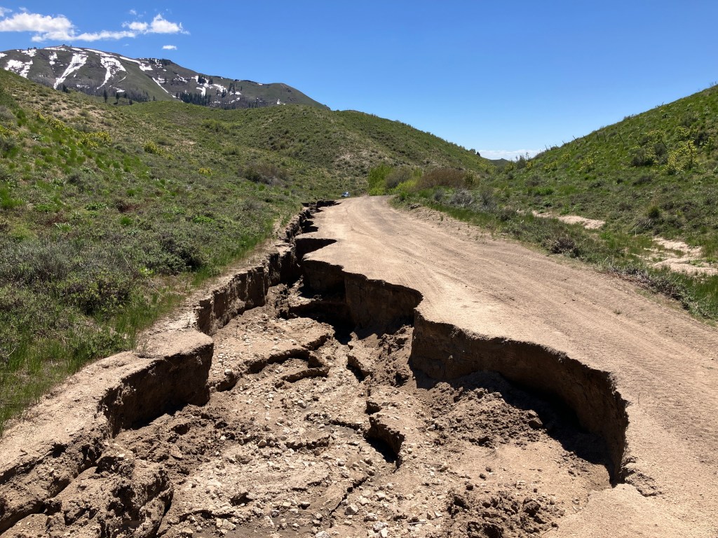
Friends Nate and Robby joined me on this venture into the Danskins on an early May day when temperatures were expected to level out in the mid-70s. I wouldn’t recommend hiking here in anything hotter due to the near-constant sun exposure and lack of safe water sources to filter from. Our hike started a little sooner than expected due to the extreme erosion of Danskin Peak Lookout Road, which is impassable by anything less than a high clearance Jeep or pickup truck about four-tenths of a mile from the trailhead. I am not exaggerating when I say that runoff has scoured ruts six feet deep into and across the road.
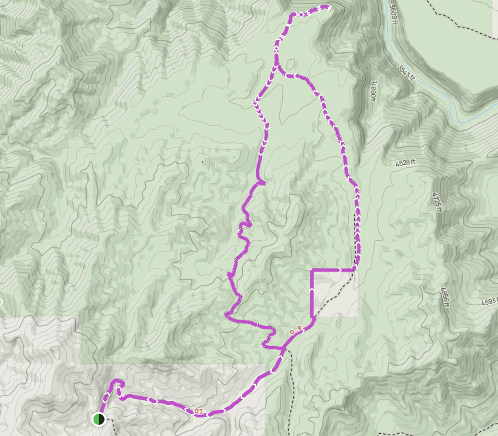
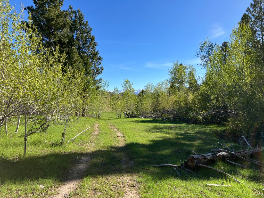
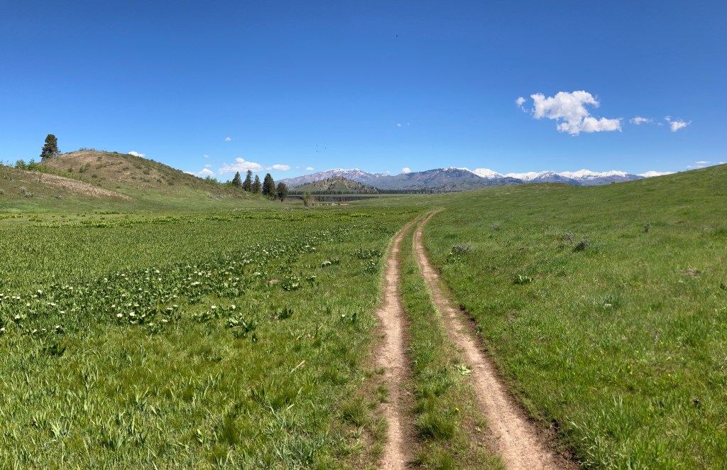
Once you reach the trailhead, the wide tread, which is the remnant of the original Danskin Lookout Road, begins a long, sweeping descent into an unnamed drainage. Within a mile, the trail enters a pine forest and parallels a creek. Those interested in backpacking will find some nice potential spots along this stretch. At 1.5 miles from the proper trailhead, a four-way intersection unfolds in front of you: to the right is the continuation of the former lookout road, which descends to private property just shy of the South Fork Boise River. To the left is the continuation of Trail #340. Straight ahead is a non-motorized trail that passes through a small parcel of private property.
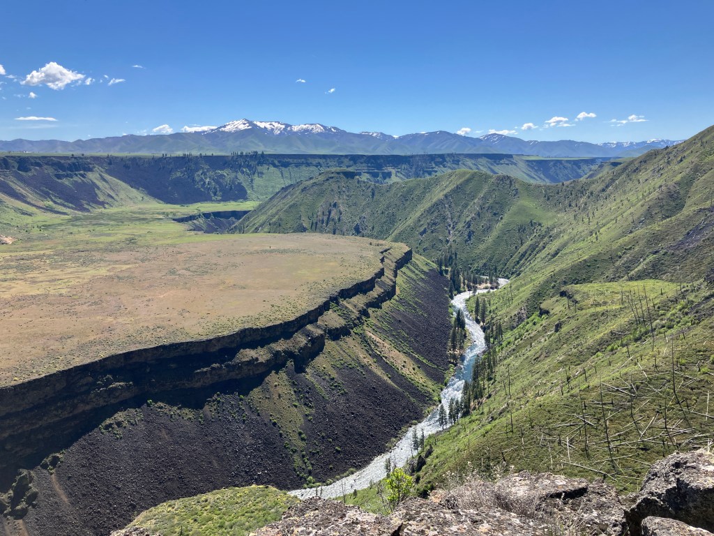
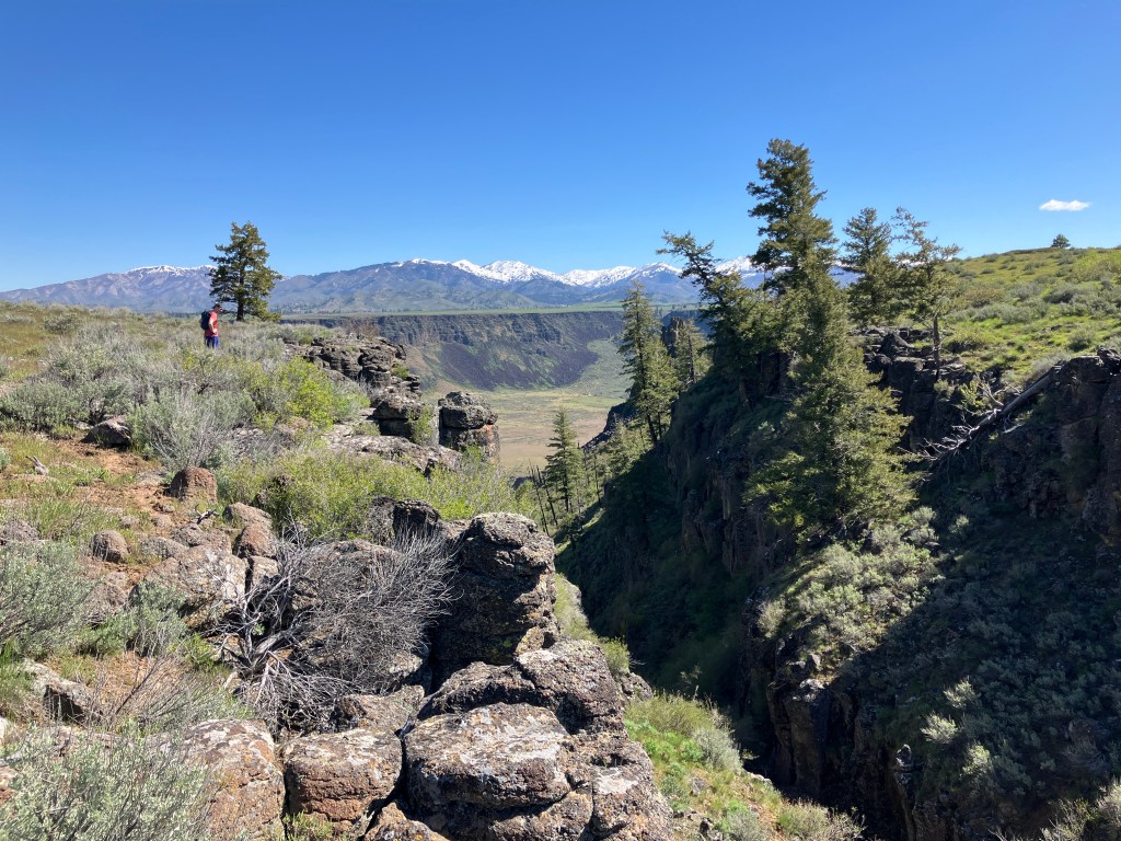
We opted to continue straight and hiked off-trail around the private property boundary, which was not fenced but was documented on AllTrails and marked with multiple No Trespassing signs. The property is an enclave surrounded completely by National Forest land and we felt comfortable walking around it. If you don’t, simply turn left to remain on Trail #340 and skip to the end of the next paragraph. Once we skirted the property, we quickly found the trail again and continued downhill along the creek to an immense draw into the South Fork Canyon. At 3.0 miles, we left the trail again, opting to hike cross-country along the gorge, where tremendous views opened up towards from the distant Trinity Mountains down to the blue vein of the river.
Once the terrain became less edge and more cliff, we returned to the trail, now diminished to a faint two-track that rambles northwest along a rolling bluff. At 3.8 miles, we crossed a series of muddy marshes that impede the flow of Bounds Creek, the only named creek in the area. After a short ascent, the trail dwindles again to a game path – however, Trail #340 will be directly ahead, running perpendicular to your heading. At about 4.0 miles, turn right onto it and continue to its end, just shy of the vertical drop into the South Fork Canyon.
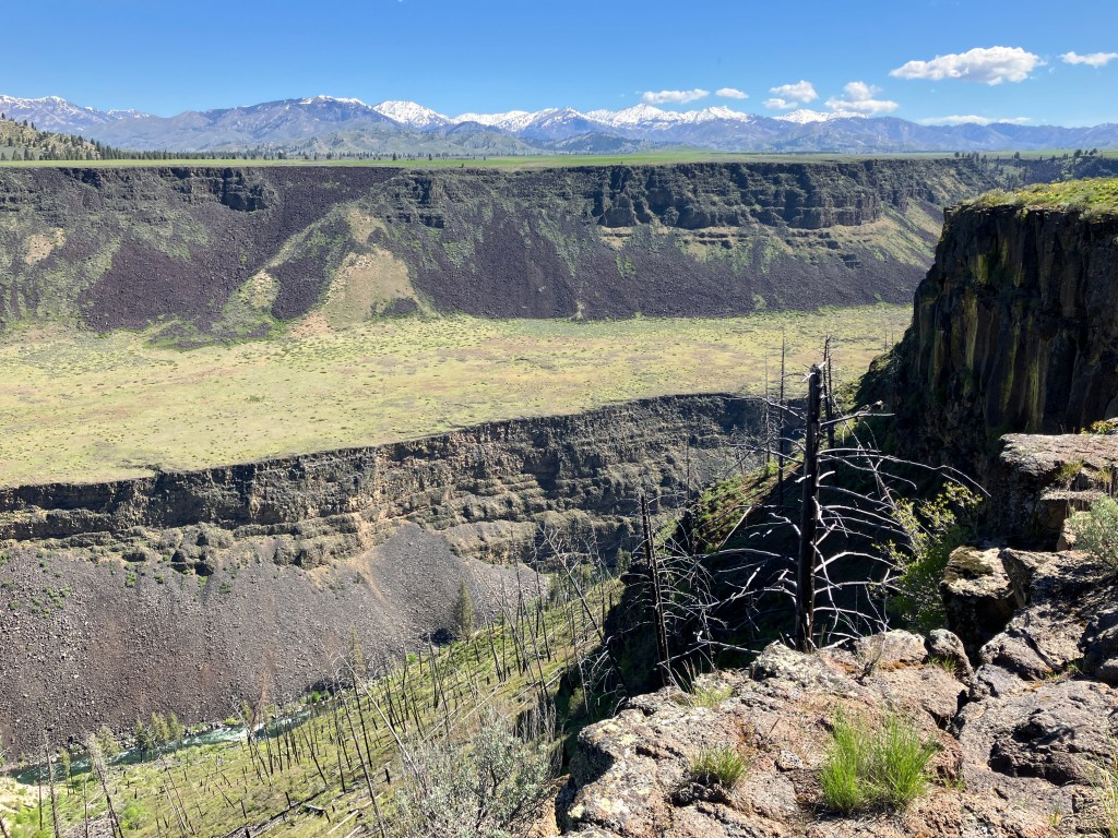
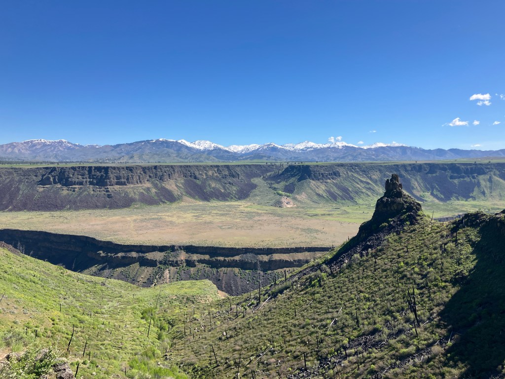
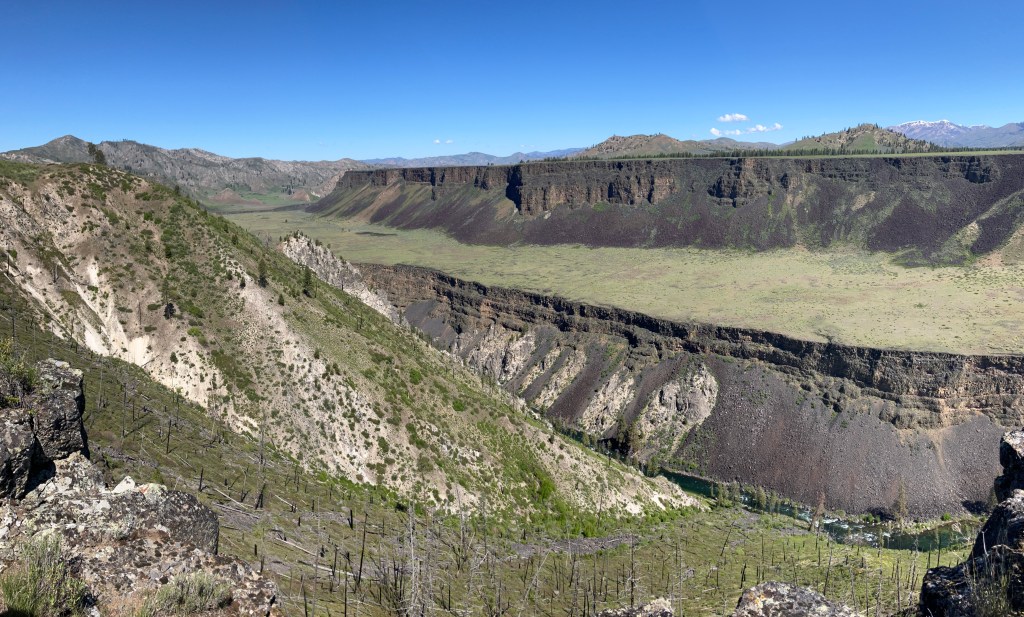
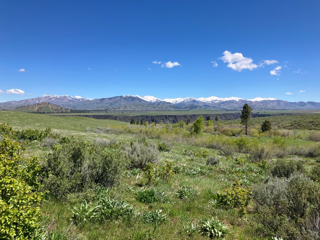
I’d highly recommend following a series of use trails to the promontory point 0.3 miles east, where astonishing panoramic views unravel. From left to right, the major peaks visible are Grape Mountain, Lava Mountain, Trinity Peak, and House Mountain. In front of you, the impossibly flat Smith Prairie sprawls, oxymoronic to the otherwise rugged, mountainous topography. 875 feet below you, the Boise River tumbles through the spectacularly carved canyon.
To complete the loop, return to Trail #340, avoiding minor side trails as it ascends an undulant drainage. In springtime, runoff creates a wetland teeming with red-winged blackbirds, whose signature trills serenaded us as we walked. At 5.4 miles, turn left to remain on Trail #340. Then, at 5.8 miles, you’ll leave the creek and begin ascending a series of switchbacks. Be wary of dirt bikers, who may not be looking for hikers, as these trails are much more popular with motorized users. We were stopped by one who perplexedly asked us, “Where are we?”
At 6.9 miles, you’ll reach a saddle and begin descending into the first drainage towards the four-way intersection. This shady section is a nice respite from the unrelenting exposure of the last few miles. At 7.7 miles, turn right to remain on Trail #340 again and return to the trailhead, 1.6 miles and 660 feet of elevation gain ahead.
Trail Stats
- Season: Late April to May, late September to early November
- Difficulty: Moderate
- Type: Loop
- Surface: Dirt road, two track, single track dirt, off trail
- Distance: 9.3 miles
- Starting elevation: 5,361 feet
- Elevation gain: 1,500 feet
My Rating
The trail itself leaves a little to be desired, especially in terms of the lack of shade and short season it’s feasible to hike. It’s also a bummer that private property requires that you either skip part of the loop and hike out and back, or hike off-trail to avoid it. However, the views at the end more than make up for it, and I’d do it again in a heartbeat on a cool day.
How to Get There
As I warned from the beginning, I wouldn’t recommend trying to drive to this trail in less than a high clearance vehicle with AWD or 4WD. Expect about an hour and a half of drive time from Boise. If you’re interested in car camping, there are a few places along Danskin Lookout Road that would make for nice spots, especially near the pond on Case Creek, roughly four and a half miles before the trailhead.
Here is the step-by-step navigation from the intersection of Highway 21 and Interstate 84 in southeast Boise, or use these steps:
- Proceed east on Interstate 84 for 18.2 miles
- Take exit 74 for Simco Road
- Turn left onto Simco Road and cross the interstate bridge
- Turn right onto Desert Wind Road and proceed for 5.3 miles
- Continue slight left onto Tilli Road and proceed for 2.3 miles
- Continue right onto Ditto Creek Road and proceed for 0.9 miles
- Turn left onto Martha Avenue and proceed for 6.2 miles
- Turn sharp left onto Canyon Creek Road/Foothill Road/Danskin Lookout Road – as you ascend into the Danskin Range, the quality and width of the road decreases steadily
- Proceed 18.0 miles to a hairpin turn with an unsigned trailhead on the left
As previously mentioned, if the deteriorating road surface (evidence below) prevents you from making it to the trailhead, find a place to park along the side and hoof it. There isn’t much room to park at the trailhead anyway, so it may actually be easier to park lower and add mileage to your hike.
Preparation
Boise National Forest
Mountain Home Ranger District
(208) 587-7961
Boise National Forest Interactive Map of Road, Trail & Area Closures
Here are the need-to-know details for hiking to the South Fork overlook via Danskin Trail #340:
- This is black bear country – carry personal protection and know what to do in an encounter (here is a handy guide from the Humane Society of the United States)
- There are no reliable water sources along the trail
- Route-finding is necessary to navigate around the private property and find the trail again
- Shade is sparse – expect prolonged sun exposure and protect yourself as necessary
- The South Fork canyon rim is composed of vertical cliffs hundreds of feet high – if hiking with children or dogs, be extra cautious while enjoying the views
- Be respectful to other trail users and Leave No Trace!
Other Useful Resources
- Downloadable GPX track via AllTrails
- Topographical map via NaturalAtlas
